Elevation: 5,580 ft
Prominence: 680

This peak is not in the book. Additional Danskin Mountains access information is in the book [(D)(1) on Pages 154-155 and (G)(1) on Page 156]. Also see the following website page: Danskin Mountains OHV Trails. Published April 2017
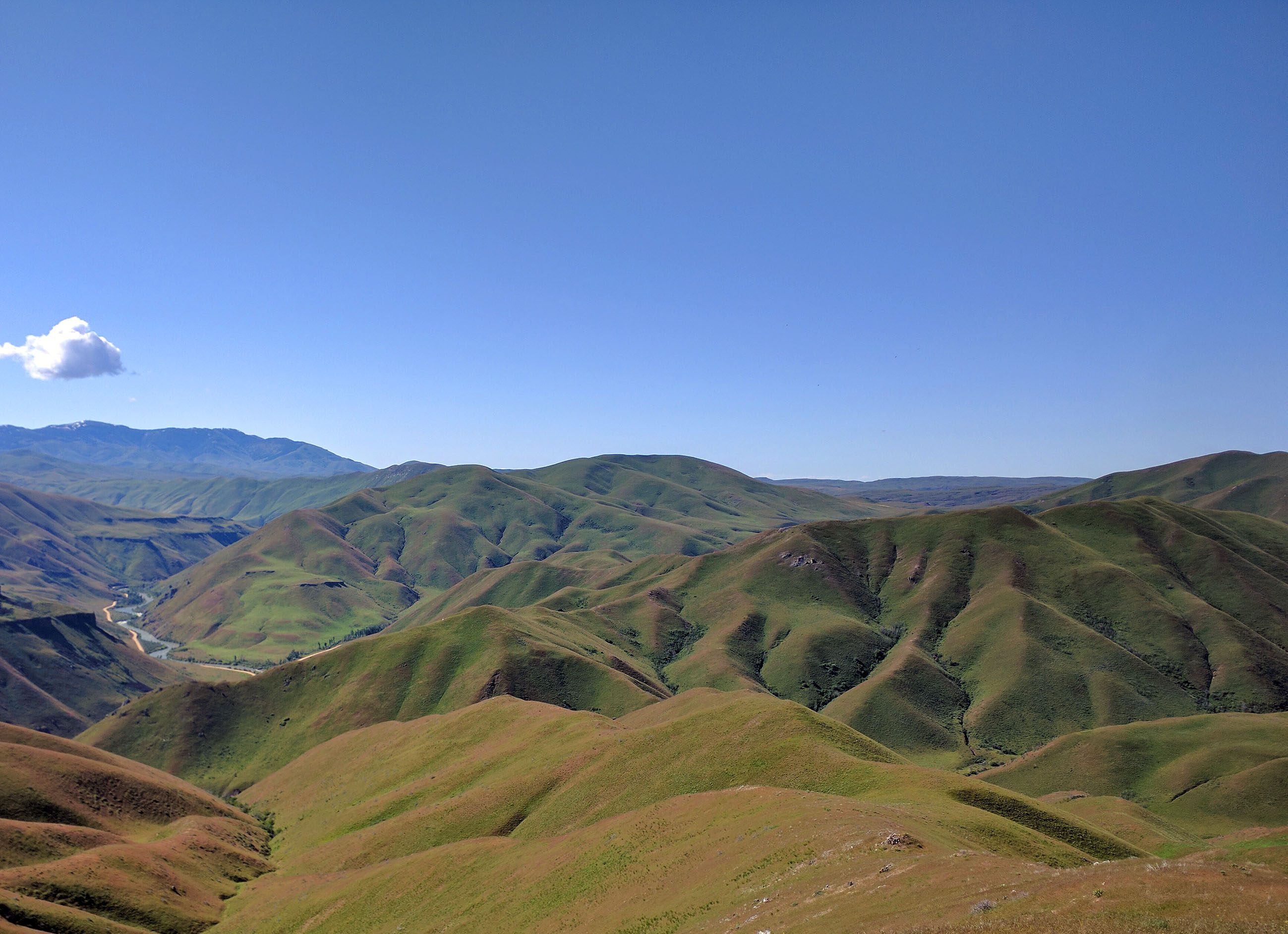
The summit of Peak 5580 offers a lot of viewing enjoyment which can be quickly reached by a short, steep walk. The peak is a grass-covered mountain which drops away significantly on all sides. You can observe a huge swath of the eastern Danskin Mountains as well as the South Fork Boise River Canyon and the Trinity Mountains from the summit. USGS Long Tom Reservoir
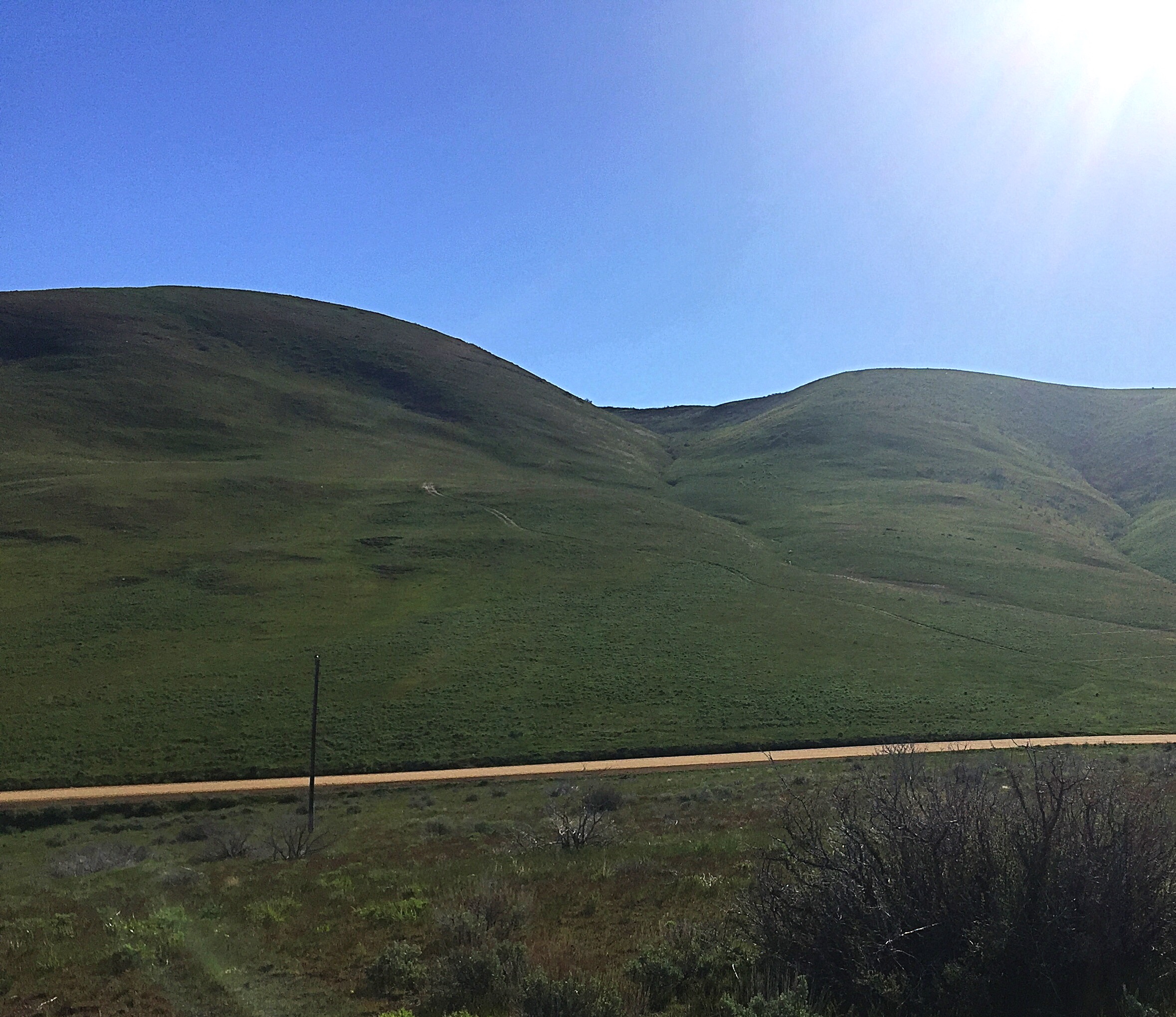
Peak 5580 as viewed from the west.
Peak 5580 is easily accessible from FS-131/Pony Creek Road/Prairie Road [(E)(1) on Page 155]. Follow the road north from ID-20 for 7.6 miles to a broad saddle. Peak 5580 is located due east of the saddle. A two-track road leads up toward the peak. The summit is roughly 0.8 miles and 700 feet above this junction. The two-track road is passable when dry to 4WDs for 0.3 miles.
Follow the two-track road uphill from the main road to a flat spot where there is good parking. From this point the peak’s broad West Ridge is to the north. The least steep route contours over and up to the ridge and then follows it to the summit. Class 2. USGS Long Tom Reservoir
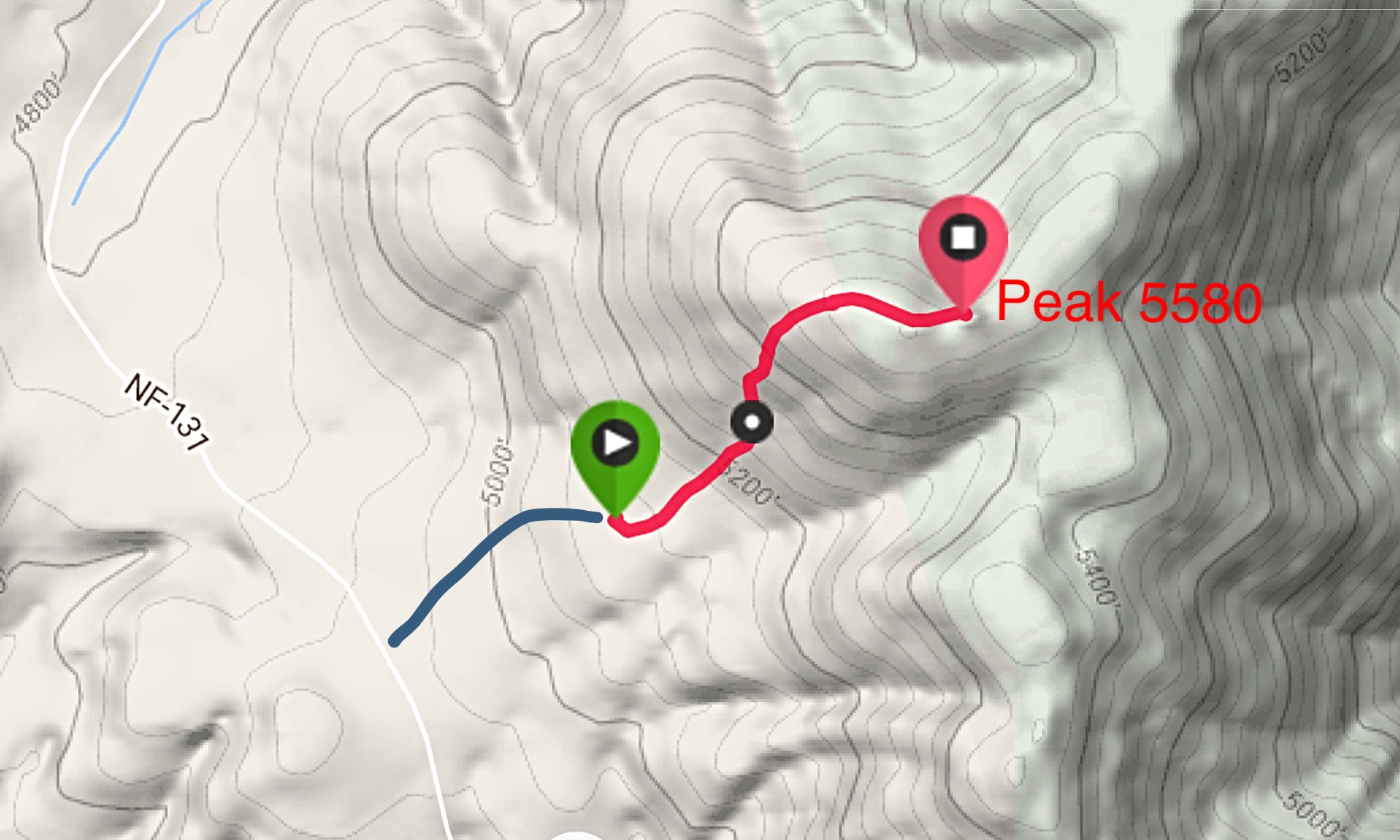
My GPS track (red) and the road approach (blue).
Cow Peak is in the middle as viewed from Bridge Peak to the north. Erik Pohlmann Photo
Additional Resources
Regions: Boise Mountains->Danskin Mountains->WESTERN IDAHO
Mountain Range: Boise Mountains
Year Climbed: 2017
Longitude: -115.55579 Latitude: 43.33749