Elevation: 5,690 ft
Prominence: 350
This peak is not in the book. Published November 2023
Peak 5690 is a seldom-climbed scrub hump that separates Bills Canyon from Carl Gulch. It towers above the east side of the North Fork Salmon River. This area is a mix of private and public land, so be careful. This climb is entirely on National Forest land. USGS North Fork
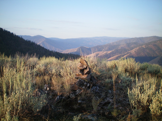
The summit of Peak 5690 with its newly-built summit cairn. Livingston Douglas Photo
Access
Park at a roadside pullout for “Historical Monument” (signed) on the east side of US-93 north of North Fork just across from the road junction with [signed] Hull Creek Road/FSR-005. This pullout is 4.2 miles north of North Fork and 1.1 miles south of Hughes Creek Road. The parking pullout next to the large spherical rock is at the mouth of Bills Canyon. It is at 3,915 feet and 45⁰28’07”N, 113⁰59’27”W. This is the first leg of a 2-peak adventure that includes Peak 5690 and Peak 6612. It covers 6.8 miles with 3,250 feet of elevation gain round trip.
South Spur/West Ridge, Class 2
The Climb
From the roadside pullout, follow an old 2-track road briefly as it heads south then east to the mouth of Bills Canyon then abruptly ends. Pick up a good use trail on the right/south side of Bills Canyon here. This trail eventually weakens and then disappears at about 4,200 feet in the center of the dry canyon. Thankfully, the dense trees and brush in the canyon are gone at this point so it is easy to access the south side of Peak 5690 from here.
Leave the canyon and scramble northeast then north up a steep face (then shoulder) of gravel and short grass/scrub. After a steady, steep grind upward, reach a flatter section of the shoulder (south spur). Continue heading up toward the west ridge in open, easy grass. Once on the west ridge, follow it northeast then east up easy grass/scrub to the open summit of Peak 5690. The summit hump is open and obvious. There was no summit cairn so I built one.
East Ridge, Class 2
The Descent
From the summit, descend northeast then east then southeast in open terrain then in semi-open forest (mostly grass) to intercept Carl Gulch Trail/FST-133 in a saddle at 5,340 feet. Follow FST-133 east then south across the top of two gulches to reach the base of the northeast side of Peak 6612. Leave the trail and drop slightly into a meadow at about 5,200 feet. This is the low point in the traverse from Peak 5690 to Peak 6612. It concludes the first leg of today’s 2-peak adventure. Peak 6612 is up next.
Additional Resources
Regions: Beaverhead Range->EASTERN IDAHO
Mountain Range: Beaverhead Range
Longitude: -113.9725 Latitude: 45.4736