Elevation: 6,612 ft
Prominence: 672
This peak is not in the book. Published November 2023
Peak 6612 is a ridgeline summit that sits above the south side of Bills Canyon. It towers over the east side of the North Fork Salmon River. This area is a mix of private and public land, so be careful. This climb is entirely on National Forest land. USGS North Fork
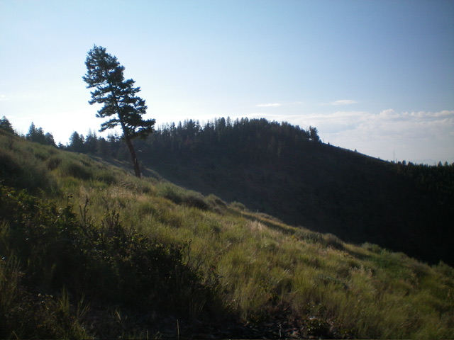
The summit hump of Peak 6612 (forested in dead center) as viewed from the northwest. Livingston Douglas Photo
Access
Same as for Peak 5690. This is the second leg of a 2-peak adventure that includes Peak 5690 and Peak 6612. It covers 6.8miles with 3,250 feet of elevation gain round trip.
North Ridge, Class 2
The Climb
From the meadow on the northeast side of Peak 6612 (at about 5,200 feet), pick up a game trail that heads diagonally right/west up toward the crest of the north ridge. Follow a series of game trails to complete the push to the north ridge in the aforementioned diagonal fashion. Once on the north ridge, follow the rounded ridge south up through an open pine forest with some deadfall and an easy grassy base. The north ridge leads up to a junction with the northwest ridge at Point 6520+. From Point 6520+, traverse the ridge crest southeast then south to the summit of Peak 6612.
The ridge traverse begins in easy, open field grass. However, it gets very thick with deadfall and awful brush as the ridge narrows and climbs to the narrow summit area. The summit is about ½ mile from Point 6520+. It has a gold USGS benchmark (surprising) and a nearby fire ring. I built a summit cairn using the rocks from the fire ring.
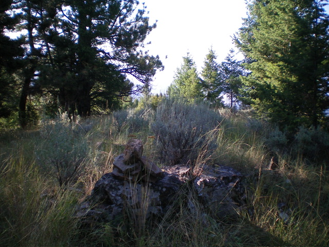
The summit of Peak 6612. Livingston Douglas Photo
Northwest Ridge, Class 2+
The Descent
From the summit, return north then northwest to Point 6520+. Descend west then northwest on the long, steep (in sections), open northwest ridge, staying in open grass/scrub on the left/south edge of the thick pine forest. Lower down, the ridge definition weakens and it becomes a series of shoulders and dry gullies. Angle right/north to finish near the parking pullout along US-93. The final 600 vertical feet of descent is steep and challenging. Cross a dry gully then descend west on a steep shoulder. From there, head northwest down a very steep, loose face of scrub and loose scree/gravel (Class 2+). Reach US-93 about 0.1 miles south of the parking pullout. Walk briefly north on US-93 to return to the parking pullout.
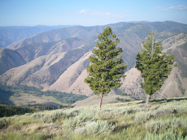
Looking down the magnificent northwest ridge, my descent route. Livingston Douglas Photo
Additional Resources
Regions: Beaverhead Range->EASTERN IDAHO
Mountain Range: Beaverhead Range
Longitude: -113.9618 Latitude: 45.4567