Elevation: 5,744 ft
Prominence: 414
This peak is not in the book. Published January 2023
Raft Narrows Peak East is one of two peaks of identical height that are located just south of The Narrows of the Raft River at the south end of the Jim Sage Mountains. This is the first leg of a 2-peak adventure that includes Raft Narrows Peak East (5,744 feet) and Raft Narrows Peak West (5,744 feet). The easiest public access is from Standrod Road (1775 East Road) to the east. USGS Chokecherry Canyon
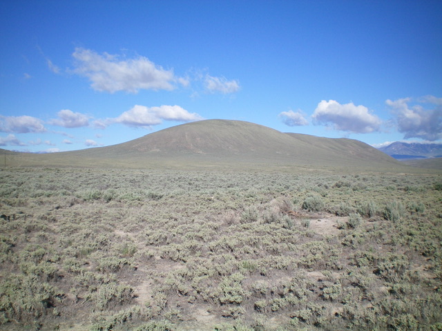
Raft Narrows Peak East as viewed from Standrod Road to its east. Livingston Douglas Photo
Access
From the City of Rocks Visitor Center at the south end of Almo on ID-77, drive south on ID-77 for 0.6 miles to a well-signed junction with Ey Road (3100S Road). Turn left/east onto Ey Road and drive 6.7 miles to a “T” junction with [signed] Narrows Road. Turn right/east onto Narrows Road and drive 3.2 miles to a junction with [signed] Standrod Road (1775E Road). Turn right/south onto Standrod Road and drive 1.4 miles to reach a set of power lines that cross the road and a power lines service road. Park at this junction (5,125 feet).
Map Errors
The USGS map mislabels Ey Road as Narrows Road and Narrows Road as Ey Road. It also shows Standrod Road as a 4WD road when, in fact, it is a wide, well-maintained, 45MPH dirt road. The USGS map shows a jeep road heading east off of Narrows Road to a gaging station and then heading south up toward Raft Narrows Peak East. However, no such road exists to the gaging station anymore. It does still exist (as a weak 2-track) above the gaging station and higher up on the east face of Raft Narrows Peak East.
The USGS map fails to show the power lines nor the service road underneath the power lines (which is used for hiking purposes for the climb up Raft Narrows Peak East). The Sawtooth National Forest/Minidoka District Map shows Ey Road, Narrows Road, and Standrod Road as 4WD roads when, in fact, they are all smooth, well-maintained dirt roads very suitable for passenger vehicles.
Southeast Face, Class 2
The Climb
From Standrod Road at the power lines crossing, hike southwest up the power lines service road for about 0.8 miles. Leave the road and scramble northwest directly at the summit of Raft Narrows Peak East on easy scrub. The summit has a summit cairn about 100 feet southeast of the actual high point, which is about five vertical feet higher.
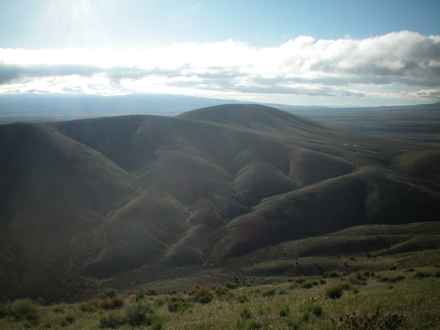
Raft Narrows Peak East (dead center in distance) as viewed from Raft Narrows Peak West. Livingston Douglas Photo
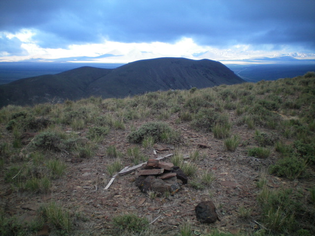
The summit area of Raft Narrows Peak East, looking across at Raft Narrows Peak West. Livingston Douglas Photo
Southwest Shoulder, Class 2
The Descent
From the summit, descend southwest on an easy scrub shoulder to reach a sand/dirt saddle that is obvious (Saddle #1) at 5,390 feet. From Saddle #1, scramble southwest then south to reach the top of a ridge. Descend west from the south end of this ridge through sagebrush to reach Saddle #2 at 5,350 feet. This is the low point and is the connecting saddle between Raft Narrows Peak East and Raft Narrows Peak West. This concludes the first leg of today’s 2-peak adventure. Raft Narrows Peak West is up next.
Additional Resources
Regions: Albion Range->Jim Sage Mountains->SOUTHERN IDAHO
Mountain Range: Albion Range
Longitude: -113.45921 Latitude: 42.0522