Elevation: 5,761 ft
Prominence: 541
This peak is not in the book. The original entry was provided by Erik Pohlmann. His route starts in the north side of the mountain. Livingston Douglas added a route approaching from the south. Additional Danskin Mountains access information can be found in the book [(D)(1) on Pages 154-155 and (G)(1) on Page 156]. Also see the following website page: Danskin Mountains OHV Trails. Updated October 2023
Peak 5761 is located at the southeastern end of the Danskin Mountains Crest and roughly 1.0 mile north of US-20. This summit is located on private property. Secure permission first! People have climbed East Fork Peak from multiple directions. USGS Anderson Ranch Dam
East Fork Peak as viewed from the power lines road to its southwest. Livingston Douglas Photo
Southwest Shoulder by Livingston Douglas
Access
Park in a large, paved pullout on the south side of US-20 about 100 feet east of a junction with an unsigned dirt road that heads north. This pullout is at 4,880 feet and 43⁰16’37”N, 115⁰30’07”W. The pullout is 0.9 miles east of Prairie Road and is at virtual MM 111.7, about 16 miles up US-20 from Mountain Home.
This route is on a mix of unsigned private land and BLM land (mostly BLM land). The summit is on private land but is unfenced high up and is unposted. There is a small corner of private land early on under the power lines in a meadow area with marshes and multiple cattle fences (none posted). This route also provides the easiest BLM access to nearby Don Benchmark (5,691 feet).
The easiest ascent route for East Fork Peak is via the southeast ridge from Dixie Summit on US-20 but that route is entirely on private land and is not open to the public.
Southwest Shoulder, Class 2
The Climb
From the pullout, walk about 100 feet west on US-20 to the junction with the dirt road. Hike north up the dirt road for just over ½ mile to get past the private land on the right/east side of the road (which is not fenced or posted). There is no obvious fence row crossing to mark the private/public land boundary. Bushwhack east toward the powerlines and follow them northeast to soon pick up a service road under them.
Follow the muddy 2-track road to avoid the thick sagebrush nearby. This road is shown on the USGS topo map as a “jeep trail.” Leave the 2-track road at about 5,000 feet as it bends left-ish/north-northeast away from the obvious summit of East Fork Peak. The road eventually crosses the northwest ridge of East Fork Peak on private land. The BLM land continues up to about 5,370 feet on the southwest shoulder. There is a more prominent south ridge to the right/east of the southwest shoulder but the south ridge is almost entirely on private land and is readily visible from US-20.
After leaving the 2-track service road, follow a somewhat-wide gulch of sagebrush that heads northeast then east. After the gulch ends rather unceremoniously, follow a small, marshy stream to avoid the thick, angled sagebrush on its sides. Bushwhack straight for the [obvious] southwest shoulder, crossing two minor gullies and ridges to reach the base of the sagebrush-covered shoulder. The shoulder is steep in spots but the sagebrush isn’t too bad. Thankfully, the shoulder is dry (no streams or marshes).
The summit of East Fork Peak is a small area of sagebrush with remnants of an old 2-track coming up over it (east to west). The summit has no summit cairn nor any loose talus with which to build one. When descending this route, aim directly at Don Benchmark in the distance and intercept the powerlines service road. Follow the service road until it turns hard right/east to go to God-Knows-Where. Continue to follow the powerlines as they approach the main dirt road. Leave the powerlines in the meadow and scramble right/southwest then west to intercept the dirt road. Follow the dirt road south to US-20 then walk along the busy highway 100 feet east to the paved pullout.
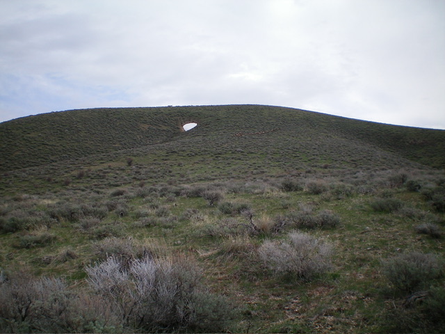
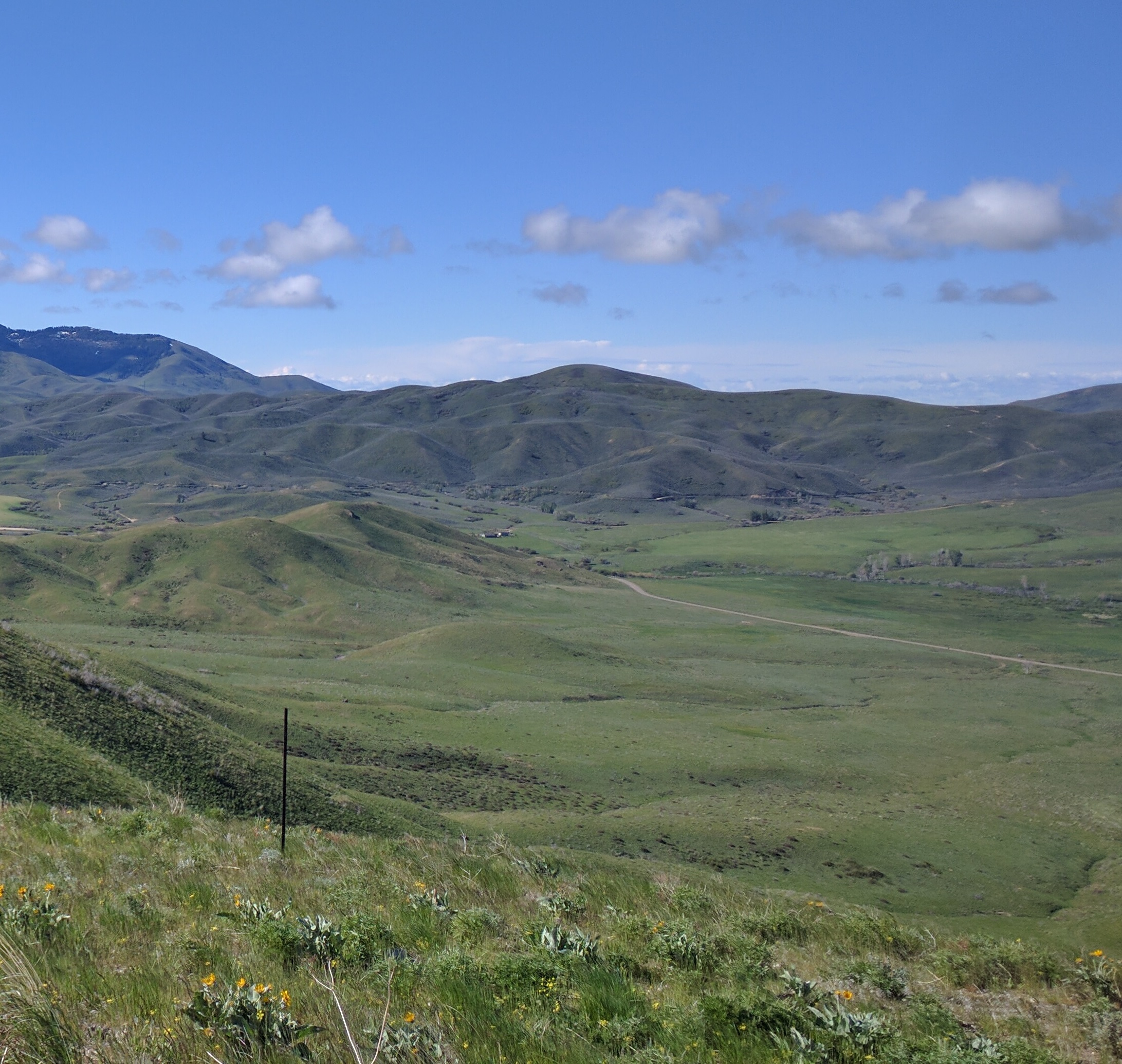
The final push up the southwest shoulder to the summit. Notice the large herd of elk. Livingston Douglas Photo
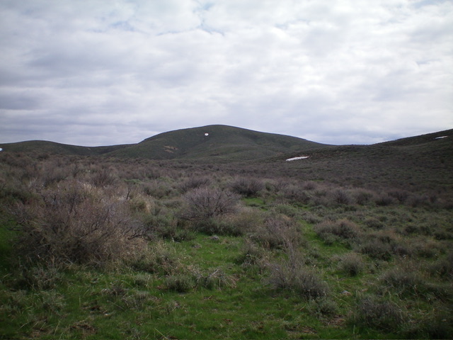
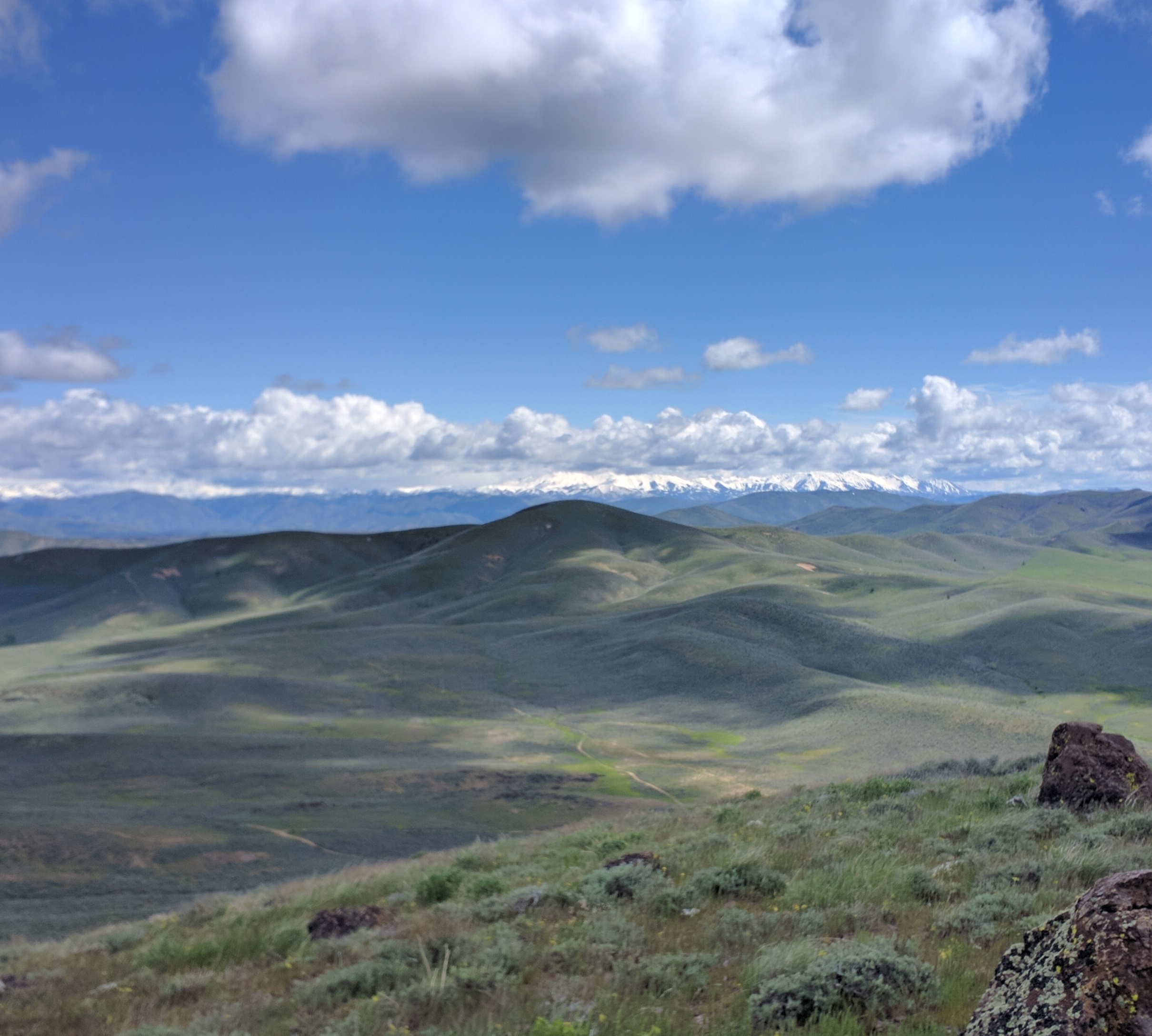
View of Mount Bennett (center) from the sagebrush summit of East Fork Peak. Livingston Douglas Photo
Power Line Road By Eric Pohlmann
Access
The route to the power line road from the south is a more difficult route which leads from US-20. This route requires opening a couple of unlocked gates (not on private property). A high-clearance vehicle is recommended.
Power Line Road, Class 1+
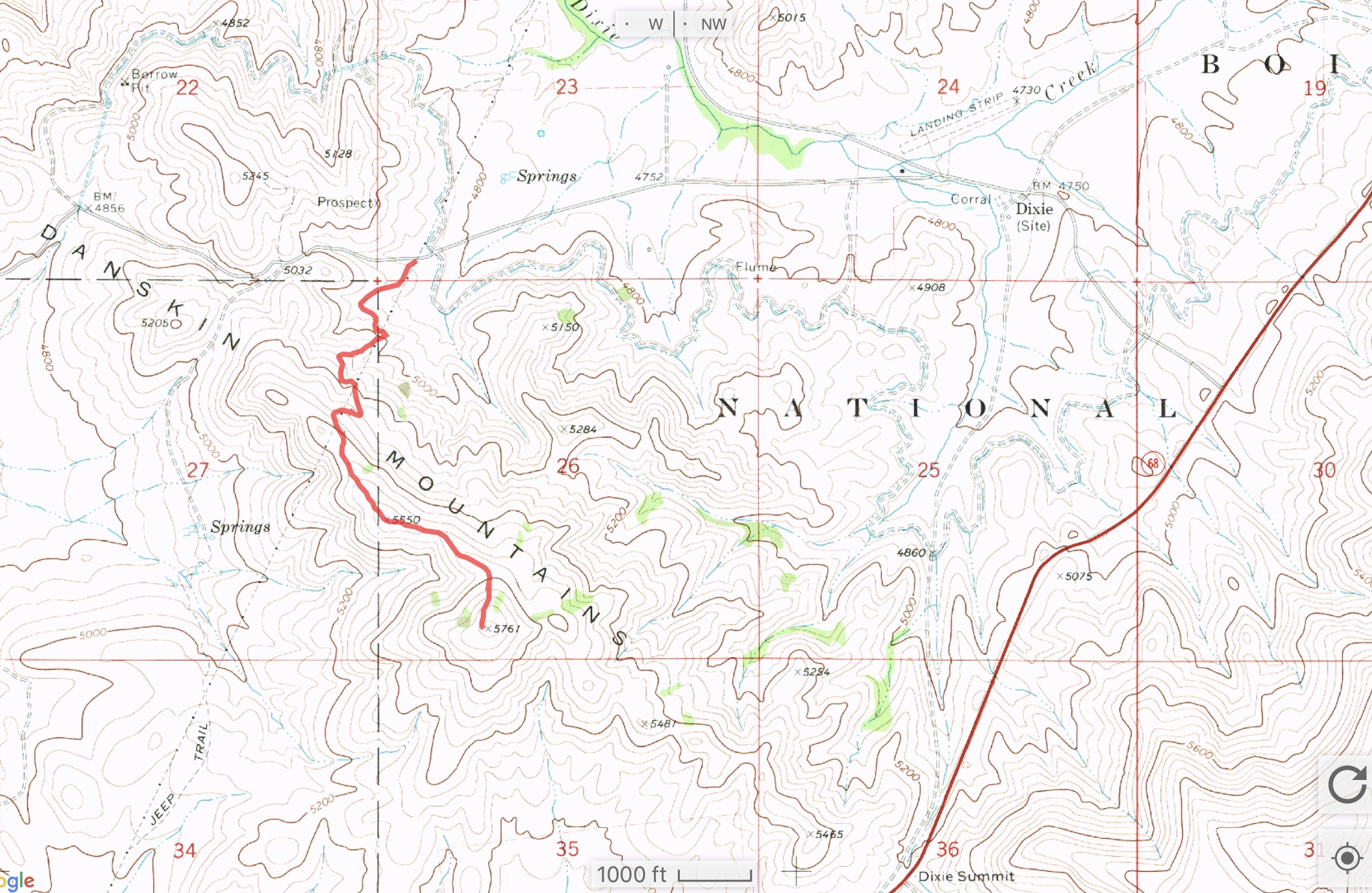
GPS track for the Northern Route.
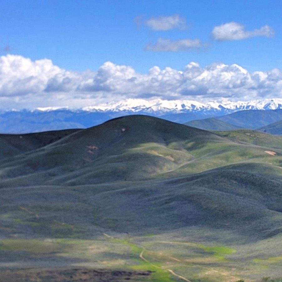
East Fork Peak as viewed from Dixie Creek Peak.
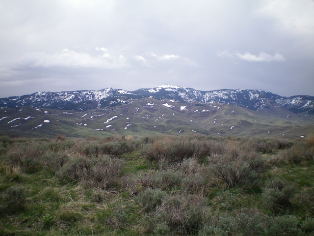
East Fork Peak as viewed from Don Benchmark.
Additional Resources
Regions: Boise Mountains->Danskin Mountains->WESTERN IDAHO
Mountain Range: Boise Mountains
Longitude: -115.47539 Latitude: 43.30059