Elevation: 5,928 ft
Prominence: 428
This peak is not in the book. Margo Mandella prepared the initial page for this peak. Livingston Douglas provided the updated access information. Updated January 2020
Peak 5928, also known as Snaky Peak, is the southernmost peak in the Beaverhead Mountains. Snaky Peak and its neighbor, Rattlesnake Point, are named for the likelihood of encountering snakes on their slopes. USGS Snaky Canyon
Access by Livingston Douglas
From the junction of ID-28/ID-22, drive east on ID-22 for 3.0 miles to [signed] Reno Cutoff Road. Turn left/west onto Reno Cutoff Road and drive 0.1 miles, crossing a bridge over a canal on the way. Immediately after crossing the bridge, turn right/east onto an unsigned 2-track jeep road. Follow this road for 0.4 mile to a road junction—a side road goes left to a corral that sits at the base of the east face of Peak 5928.
On the way, go right at an unsigned road junction and cross under two sets of power lines. Park either at the corral or near the final road junction in a large pullout/turnaround area. The elevation here is 5,160 feet. This parking spot offers outstanding views of the southeast ridge of Peak 5928 and the south aspects of Rattlesnake Point.
Routes by Margo Mandella
Southeast Ridge, Class 2+
The southeast ridge is short and steep and a little loose in just a couple of places. Numerous interesting rock outcrops require navigating as you ascend, which makes the climb fun. Small wildflowers were all over the peak in May. Overall, it was a surprisingly fun, pretty, and fast climb.
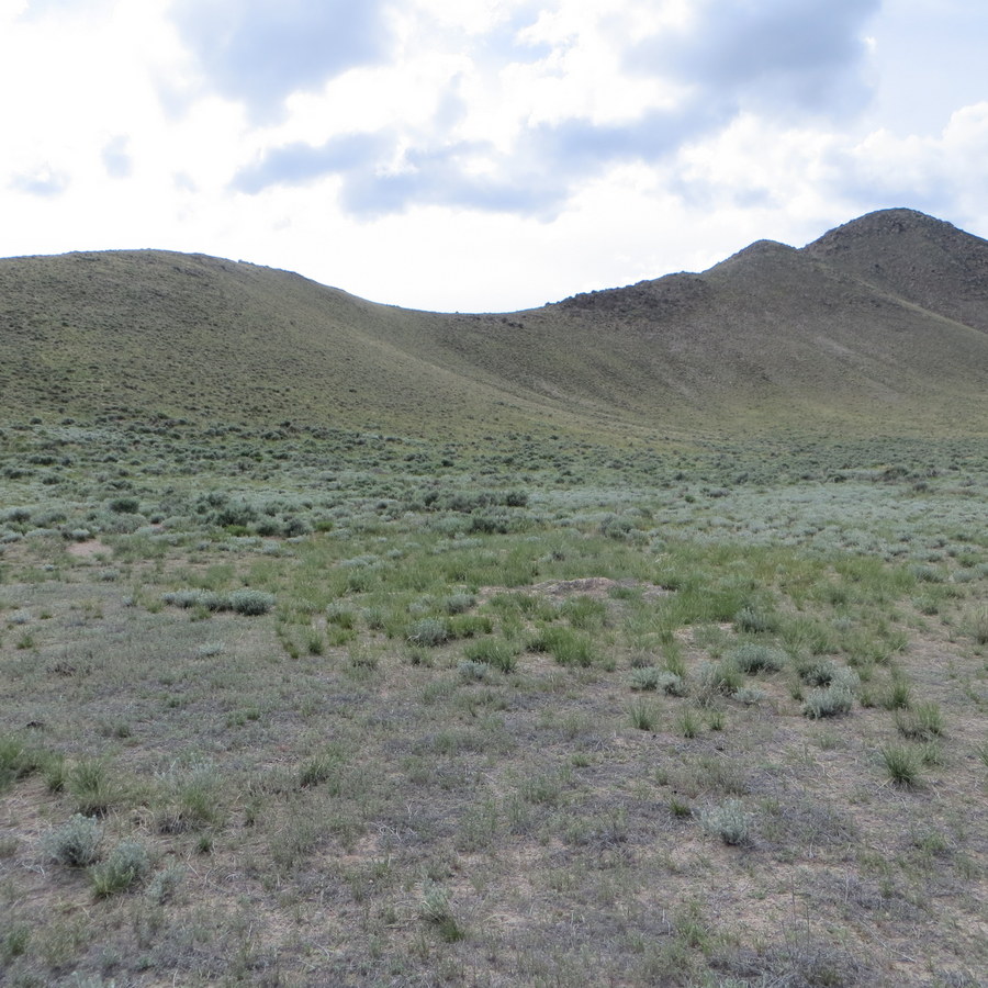
Snaky Peak’s southeast ridge. Steve Mandella Photo
Northeast Ridge, Class 2
The northeast ridge approach is a little more than twice as long as the southeast ridge. However, there are no rocky outcrops or loose footing on this route.
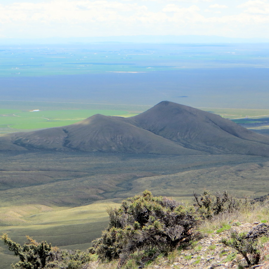
There is no summit marker, just a rocky high point. From the summit, you’ll have good views of the Southern Lemhis, South Beaverheads, and the Idaho National Laboratory. If you have the time/desire, you can use both ridges for a loop route.
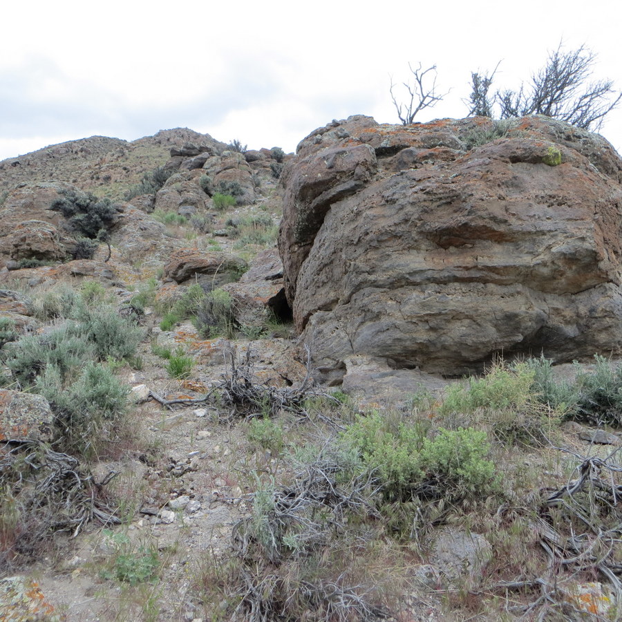
Rocky outcrops on the southeast ridge. Steve Mandella Photo
Summit boulder atop Peak 5928. The LONG ridge of Rattlesnake Point (6,648 feet) is in the distance. Its high point is the hump in dead center. Livingston Douglas Photo
Additional Resources
Regions: Beaverhead Range->EASTERN IDAHO
Mountain Range: Beaverhead Range
Longitude: -112.72969 Latitude: 44.04069