Elevation: 5,940 ft
Prominence: 360
This peak is not in the book. Published January 2023
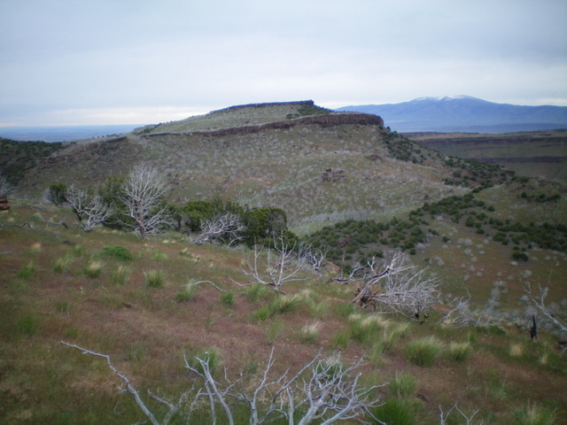
Peak 5940 is a ridgeline hump that separates Big Cottonwood Creek from Big Cedar Canyon in the South Hills. It has a very steep east face. Peak 5940 is most easily climbed from Big Cedar Canyon Road/FSR-528 and its north ridge. USGS Buckhorn Canyon
Peak 5940 as viewed from the west. Livingston Douglas Photo
Access
From ID-27 north of Oakley, drive west on [signed] 1600S for 6.9 miles to the [unsigned] Cottonwood Creek Road turnoff (to the left/south). Continue west for another mile to a cattle guard crossing at the Sawtooth National Forest boundary. Park in a pullout just before the cattle guard (4,885 feet).
Northwest Shoulder/North Ridge, Class 2
The Climb
From the Sawtooth National Forest boundary, you have two options. First, you can follow the fence row southeast up a shoulder to reach the north ridge. Second, you can hike about ¼ mile southwest on FSR-528 and climb an easier shoulder from there (it also heads southeast to the ridge). I did the former but I recommend the latter in retrospect, having gotten a good look at the second shoulder from my vantage point high up.
From the parking pullout, scramble left/southeast up the stiff fence row to a flattish area just below the ridge cliffs and the end of the fence row. Crawl under the fence (too high and stiff to straddle) and scramble diagonally right/south to reach the ridge crest just past (and south of) the ridge cliff bands. Once on the wide, open ridge, head south in open grass with scattered junipers (some dead, some live) with two ups and downs to finally reach the flat, elongated summit area. A decent cairn marks the high point (based on my altimeter). This point is at least halfway along the flat summit plateau.
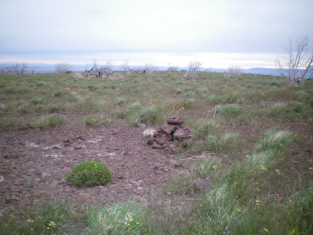
The summit area of Peak 5940. Livingston Douglas Photo
Southwest Face, Class 2
The Descent
From the summit, descend southwest (to avoid a ridge cliff band directly south of the summit) then bend left-ish/south then right/west through a forest of dead, standing junipers (an amazing sight). Do a final descent through some live junipers to reach the broad, grassy saddle that connects Peak 5940 and Peak 6006. This concludes the first leg of this 2-peak adventure. Peak 6006 is up next.
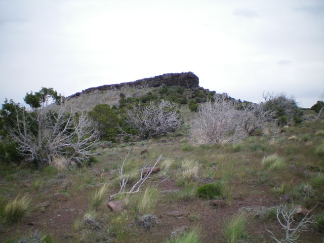
The imposing summit block of Peak 5940 as viewed from high on the southwest face (my descent route). Livingston Douglas Photo
Additional Resources
Regions: South Hills->SOUTHERN IDAHO
Mountain Range: South Hills
Longitude: -114.03869 Latitude: 42.2841