Elevation: 6,006 ft
Prominence: 346
This peak is not in the book. Published January 2023
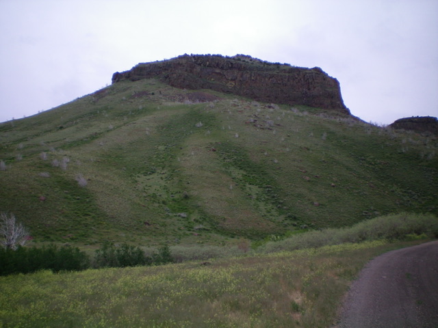
Peak 6006 is a rugged, rocky outcrop that towers over Big Cedar Canyon in the South Hills. It can be climbed in combination with nearby Peak 5940 or by itself directly from Big Cedar Canyon Road/FSR-528. The north face of Peak 6006 is a sheer, 250-foot cliff. USGS Buckhorn Canyon
Peak 6006 and its rugged north face. Livingston Douglas Photo
Access
Same as for Peak 5940. This is the final leg of a 2-peak adventure that includes Peak 5940 and Peak 6006.
East Face, Class 3
The Climb
From the 5,580-foot connecting saddle with Peak 5940, scramble west up steep, short grass (with underlying embedded talus) and skirt the left/south side of a mid-level cliff band. Once past the cliff band, move right/north to approach the summit blocks. Head directly up to the summit blocks then move to their right/north side to scramble to the top of the east block and middle blocks (Class 3). The middle block has a summit cairn atop it. The east summit block is very close in height but is probably 1-2 feet lower than the [cairned] middle block. The west summit block (a pinnacle) appears to be a bit lower than the middle block.
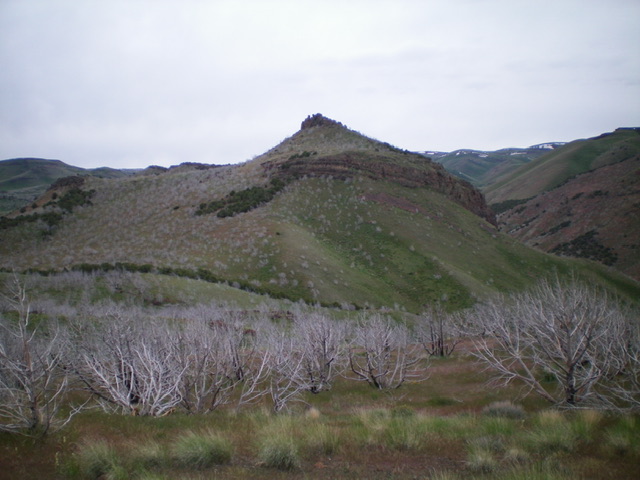
Peak 6006 as viewed from the east. Livingston Douglas Photo
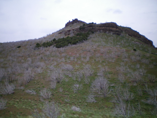
The steep east face of Peak 6006 (my ascent route). Stay left/south of a cliff band midway up the face. Livingston Douglas Photo
East Face/North Gully, Class 3
The Descent
From the summit, return down the east face to the 5,580-foot connecting saddle at the head of the north gully. Descend north then northwest down the narrow gully, using a cattle trail to reach the thick field grass at the base of the gully in the Big Cedar Canyon Creek drainage. Bushwhack through the thick grass upstream about 50 yards to find a plausible crossing of modest-sized Big Cedar Canyon Creek (a cattle crossing). Once across the creek, follow Big Cedar Canyon Road north then northeast for 1.5 miles to return to the Sawtooth National Forest boundary and your parked vehicle.
Additional Resources
Regions: South Hills->SOUTHERN IDAHO
Mountain Range: South Hills
Longitude: -114.05249 Latitude: 42.27979