Elevation: 5,954 ft
Prominence: 334
This peak is not in the book. Published November 2023
Peak 5954 is located on a ridgeline that separates Silverlead Creek from Little Silverlead Creek in the Beaverhead Mountains. It is most easily reached (on public land) from FST-130/The Lewis and Clark National Recreation Trail and its southwest ridge. This area is a mix of private and public land, so be careful. USGS North Fork
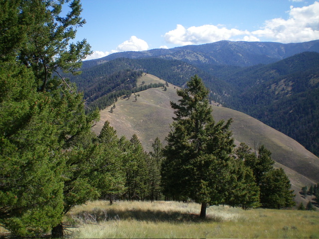
Peak 5954 (mid-ground in center) as viewed from Peak 5812 to its southwest. Livingston Douglas Photo
Access
Same as for Peak 5812. This is the second leg of a 2-peak adventure that includes Peak 5812 and Peak 5954. It covers 7.3 miles with 3,500 feet of elevation gain round trip.
Southwest Ridge, Class 2
The Climb
From 5,220-foot connecting saddle with Peak 5812, scramble east-northeast up a ridge of mostly field grass to a bend in the ridge on a ridge hump. Head left/northeast and descend 85 vertical feet to a minor saddle. From the saddle, continue northeast then north in open field grass (easy) to reach the elusive summit hump of Peak 5954. I rebuilt the small, old summit cairn into a much larger one. Return back to the 5,220-foot connecting saddle then follow FST-130 north and then west back to the Trail Gulch Trailhead and your parked vehicle.
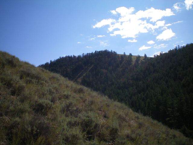
The southwest ridge of Peak 5954 as viewed from just above the saddle at its base. The summit hump is not yet visible. Livingston Douglas Photo
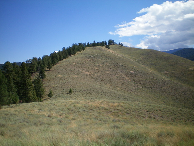
Peak 5954 (center) as viewed from the west. Livingston Douglas Photo
Additional Resources
Regions: Beaverhead Range->EASTERN IDAHO
Mountain Range: Beaverhead Range
Longitude: -123.9533 Latitude: 45.4437