Elevation: 6,300 ft
Prominence: 280
This peak is not in the book. Published January 2023
Peak 6300 is a hidden hump and is one of two peaks at the north end of the Jim Sage Mountains. This hike is entirely on BLM land. It is the second leg of a 2-peak adventure that includes Peak 6635 and Peak 6300. Round-trip stats: 7.0 miles with 2,900 feet of elevation gain. USGS Nibbs Creek
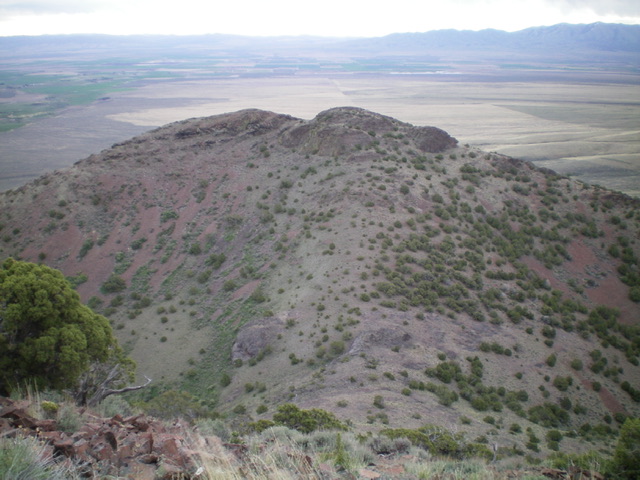
Peak 6300 is a double-humped peak when viewed from the final saddle at the base of its west ridge. Livingston Douglas Photo
Access
Same as for Peak 6635. This is the final leg of a 2-peak journey.
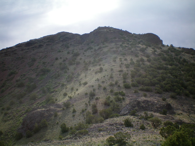
Gentle Peak 6300 as viewed from the northwest on the connecting ridge with Peak 6635. Livingston Douglas Photo
West Ridge, Class 2
The Climb
From the 6,020-foot connecting saddle, scramble east up loose shale and rocky shelves/outcrops in a forest of scattered junipers to reach the south summit hump of Peak 6300. This is the official high point. It has no summit cairn. However, there is another hump to the north that appears to be of equal height. Upon investigation, the north summit has a summit cairn and a triangulation post on the ground nearby. Could this be the true summit? Perhaps. But, in my opinion, the south summit appears to be slightly higher. I believe that the south summit IS the high point of Peak 6300.
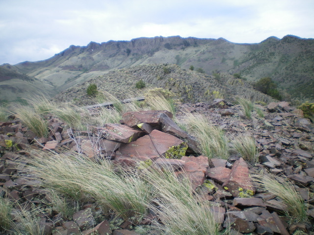
The [unofficial] north summit hump has a cairn. This view is from the north summit hump to the nearby, official south summit high point. The altimeter shows them of equal height. Livingston Douglas Photo
Additional Resources
Regions: Albion Range->Jim Sage Mountains->SOUTHERN IDAHO
Mountain Range: Albion Range
Longitude: -113.49509 Latitude: 42.2551