Elevation: 6,635 ft
Prominence: 295
This peak is not in the book. Published January 2023
Peak 6635 is one of two peaks at the north end of the Jim Sage Mountains. The only public access to Peak 6635 is via ID-77 at a gravel pit. This hike is entirely on BLM land. It is part of a 2-peak adventure that includes Peak 6635 and Peak 6300. Round-trip stats: 7.0 miles with 2,900 feet of elevation gain. USGS Connor Ridge
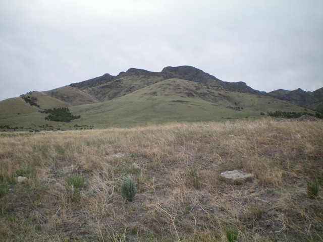
Rugged Peak 6635 (summit is left of center) as viewed from the gravel pit along ID-77 (start of hike). The west ridge ascent route is in dead center with a noticeable hump to climb over. Livingston Douglas Photo
Access
From the “T” junction of ID-77 in Connor, drive southwest on ID-77 (toward Elba) for 1.9 miles to an unsigned junction with a 2-track road heading left/southeast up Jones Hollow. Park in a gravel pit area about 75 yards south of this 2-track road along ID-77. The elevation at this gravel pit is 5,095 feet.
West Ridge, Class 2
The Ascent (then Descent)
From the gravel pit, scramble east across easy scrub and a dry gully to reach the 2-track Jones Hollow Road. Hike briefly up the road to a cattle fence/gate. Jump the fence then leave the road to scramble left/northeast to get on the broad, grass-and-shale west ridge of Peak 6635. Follow the ridge east to the large cairn atop Point 5750. Drop 45 feet to a minor saddle then grind your way up the ridge on a mix of shale, scrub, and rocky ridge outcrops to reach a minor ridge point.
The ridge turns right/southeast here and heads up to an imposing headwall at 6,400 feet. Skirt the left/north side of this headwall by following a game trail below the wall that leads diagonally left up to a saddle. From the saddle, scramble east up the ridge through a forest of scattered junipers with rock bands and loose shale to reach the cairned, open summit of Peak 6635. Be aware that when you descend the west ridge, the talus/scree is very loose and slippery.
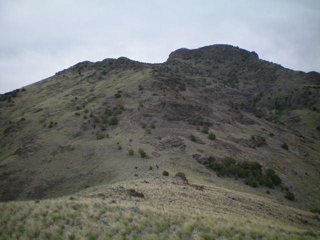
Looking up the upper west ridge ridge of Peak 6635. The climbing now becomes more difficult. Livingston Douglas Photo
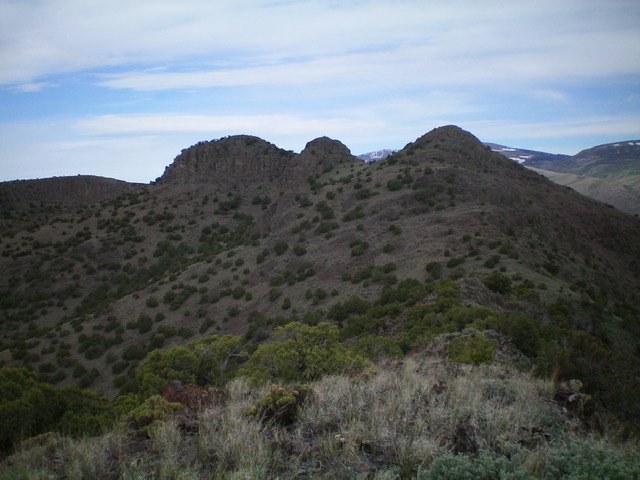
The final approach to the summit of Peak 6635. The summit hump is in dead center. The rugged, narrow peak to the left is NOT the summit. It appears higher but that is merely an optical illusion. Livingston Douglas Photo
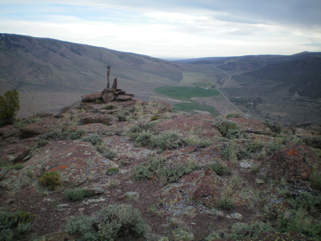
The summit of Peak 6635. Livingston Douglas Photo
East Ridge, Class 3+
The Descent (then Ascent)
From the summit, descend northeast and quickly reach a ridge notch. Skirt the right/southeast side of a rocky ridge tower on ledges that are just above the notch. Work around left/north to the back side of the rocky point and find a Class 3+ chute to descend off an otherwise impassable headwall, a hidden and rather unpleasant surprise not shown on maps. Once below the headwall, descend east on steep, loose shale with scattered junipers to reach a minor saddle. Contour east then southeast diagonally down to reach Saddle #1 (6,340 feet), which is northwest of Point 6455.
From Saddle #1, scramble southeast along the ridge crest to the top of Point 6455. There is much loose talus/scree in this section of the ridge. From Point 6455, descend east in steep, loose talus to reach the top of a hidden headwall. Find a Class 3+ chute with a large dead tree in it (with its trunk uphill and its top downhill). Descend this chute to the base of the headwall. Continue east down more loose talus/scree with scattered junipers to reach flatter terrain and Saddle #2 (6,020 feet). This is the connecting saddle with Peak 6300 and concludes the first leg of today’s 2-peak journey. Peak 6300 is up next.
Additional Resources
Regions: Jim Sage Mountains->SOUTHERN IDAHO
Mountain Range: Albion Range
Longitude: -113.5091 Latitude: 42.2567