Elevation: 6,390 ft
Prominence: 450

This peak is not in the book. Published December 2019
Peak 6390 is the highest and most rugged of a trio of ranked summits that form a horseshoe around an unnamed drainage/meadow just north of Fish Creek Reservoir. The ridge traverse between these three peaks (Peak 6331, Peak 6326, and Peak 6390) is my favorite ridge traverse in the Fish Creek Reservoir area. It is magnificent and offers stunning views of the reservoir and the surrounding peaks and valleys. You are likely to see black-tailed deer in this area. USGS Fish Creek Reservoir
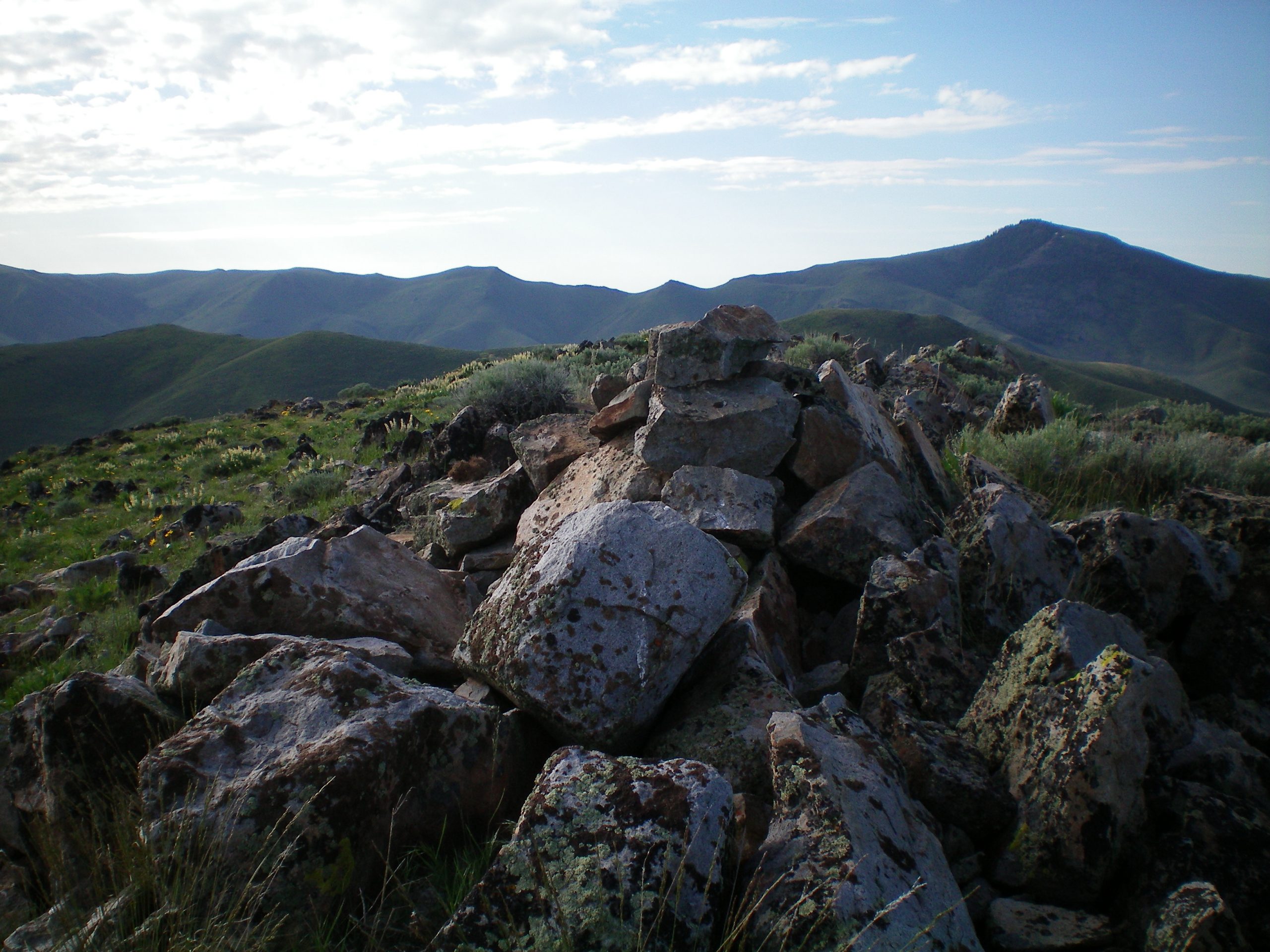
The summit cairn atop rocky Peak 6390 with Pine Mountain in the background (right of center). Livingston Douglas Photo
East Spur/North Ridge, Class 2
Access
Same as for the west ridge of Peak 6331. This is the next leg of a ridge traverse from Peak 6331 to Peak 6326 to Peak 6390.
The Climb
From the connecting saddle with Peak 6326, follow the left/south side of a fence row up to the top of Point 6108 in easy scrub/sagebrush. From Point 6108, descend west to a minor saddle. Continue to follow the left/west side of the fence row to bend southwest to reach the north ridge of Peak 6390. Leave the fence here and follow the rocky ridge south up to the very rocky summit area. The summit of Peak 6390 is a narrow ridge crest of boulders, talus, and brush. The high point and summit cairn is at the northwest end of the elongated summit crest.
South Ridge, Class 2
Access
Same as for the east spur/north ridge. This is the final leg of a loop route that begins and ends on West Fork Fish Creek Road.
The Descent
From the summit, descend the rocky, narrow, tedious ridge southeast then south. Eventually, the troublesome boulders and talus disappear. The descent becomes a bushwhack through easy then thicker scrub/sagebrush. The toe of the south ridge is in a meadow just east of West Fork Fish Creek Road. Bash your way west through a final section of sagebrush to reach the road and your parked vehicle.
Additional Resources
Regions: EASTERN IDAHO->Pioneer Mountains
Mountain Range: Pioneer Mountains
Longitude: -113.82889 Latitude: 43.45829