Elevation: 6,394 ft
Prominence: 334
This peak is not in the book. Livingston Douglas added two additional routes to this entry. Updated November 2022
Peak 6394 is located in the center of the southern section of the Soldier Mountains on a north/south trending ridge that separates Thompson Creek from Maxfield Creek. USGS Deer Mountain
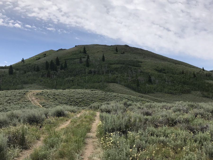
Peak 6394 as viewed from the north
Access
FS-069 climbs up Hawks Gulch and then drops into Maxfield Creek. The road fords Maxfield creek at a point where it forms a broad puddle. While the bottom of the puddle is rocky, a 4WD and caution are recommended. After the creek crossing, the road quickly reaches the northern slopes of the peak. Find a place to park. See the Southern Soldier Mountains Access page for details on reaching FS-069.
Northwest Slopes, Class 2
The northern slopes are steep and covered with sagebrush but there are no obstacles. Pick a line and climb to the summit.
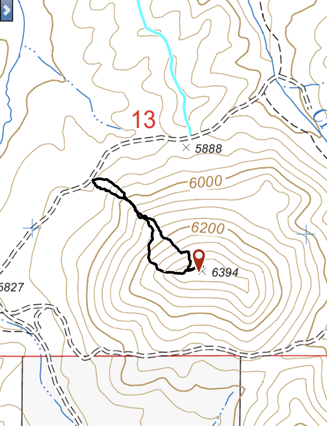
My GPS track for the peak. I recorded 0.8 miles round trip with 495 feet of elevation gain.
North Face and West Ridge/West Face Routes by Livingston Douglas
North Face, Class 2
The Ascent
From the unsigned road junction (5,888 feet on the USGS topo map) on the saddle at the base of the south ridge of Peak 6218, you are standing at the base of the north face of Peak 6394. Please note that the 2-track road on the south ridge of Peak 6218 is not shown on the USGS topo map. I should note that the terrain on Peak 6394 varies markedly, so be very careful which route you select. There are areas of very thick aspens and brush that will tie you in knots. There are other areas that are rocky, such as the upper section of the west ridge. The north face is inflicted with the former. It is better to avoid it by climbing the northwest ridge or the west ridge.
From the 5,888-foot saddle, bushwhack south up the face through relatively thick sagebrush. About midway up, the nightmare emerges: a thick patch of aspens (with lots of aspen blowdown) that is unavoidable. Bash up through this horrendous mess to reach easier sagebrush above. The summit high point is in the middle of the summit ridge and is only a minor, open boulder protruding from the ground. The cairned point at the west end of the summit ridge is 5-10 feet lower than the actual high point of Peak 6394.
West Ridge/West Face, Class 2
The Descent
From the summit, descend west to the cairned ridge point and continue southwest down a rocky ridge to reach the easier sagebrush below. Angle right/west and bushwhack through more sagebrush (not too difficult) to reach the Maxfield Creek crossing on Hawk Gulch Road. This crossing is at the base of the West Ridge/West Face Route and concludes this leg of today’s 3-peak journey.
Additional Resources
Regions: Soldier Mountains->WESTERN IDAHO
Mountain Range: Soldier Mountains
Year Climbed: 2019
Longitude: -115.08989 Latitude: 43.41649