The Southern Soldier Mountains are composed of a complicated series of interconnecting ridges and drainages punctuated by more than a dozen worthwhile peaks. This area is also superimposed with a complex patchwork of public (i.e., State of Idaho, Bureau of Land Management and Forest Service) and private lands. The Southern Soldier Mountains area is not discussed in the book.
The Boise National Forest and Sawtooth National Forest (who share management of this area) have free motor vehicle use maps (MVUMs) covering the main roads and side roads. It is highly recommended that you get these maps before visiting the area because there are seasonal closures and vehicle size/type limitations associated with these roads.
There are 3 primary access routes from the south:
- The easternmost route is Chimney Creek Road/FS-484
- The center route is Cow Creek Road/FS-058 from Cow Creek Reservoir north of Hill City
- The westernmost route is via the Featherville Highway/FH-61 and Moores Flat Road/FS-181
All 3 of these access roads can be connected using FS-070. Click on the following links for details:
Chimney Creek Road
Cow Creek Road
Moores Flat Road
I’ve cobbled together portions of the relevant maps in the image and legend below (click the images to enlarge).
Boise and Sawtooth National Forests Motor Vehicle Use Maps for the Southern Soldier Mountains
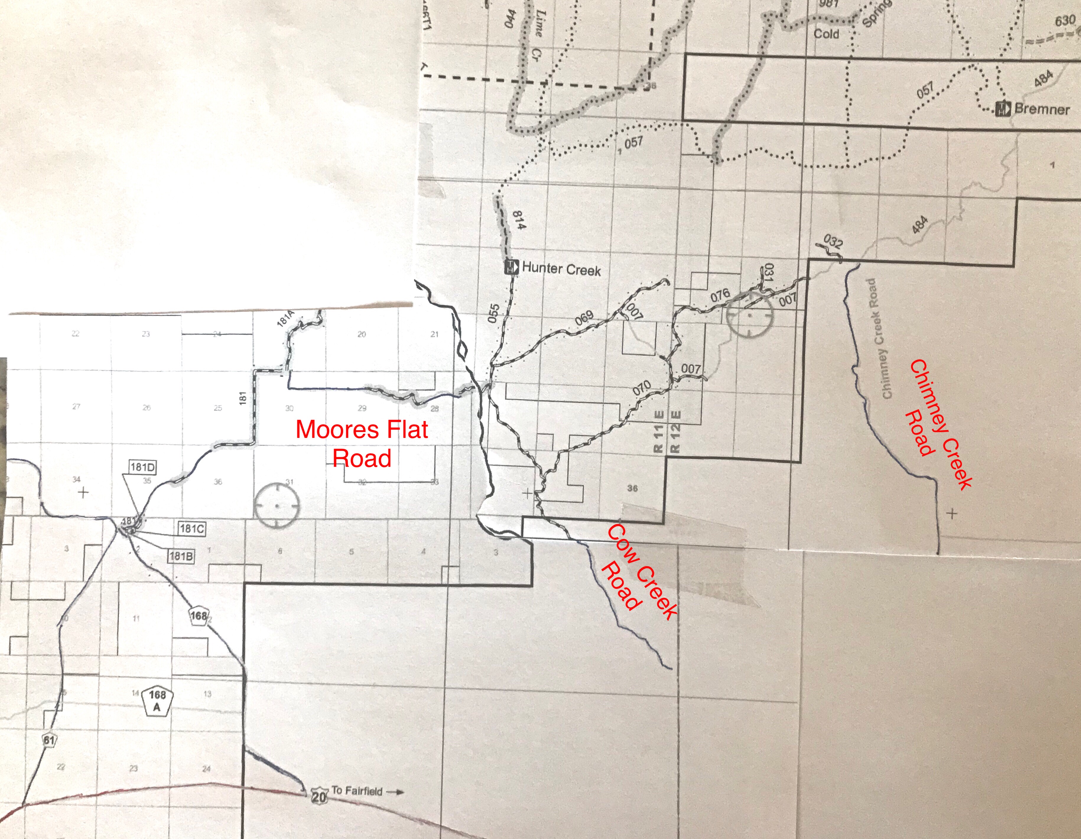
The Boise National Forest maps cover the Moores Flat area. The Sawtooth National Forest maps cover the Cow Creek and Chimney Creek Roads. This composite image was made from 2019 maps. Be aware that access restrictions may change over time.
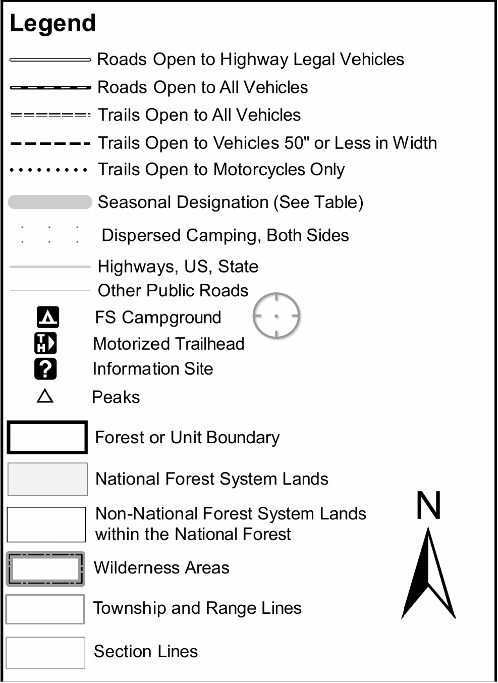
This is the key for the MVUMs.