Elevation: 6,412 ft
Prominence: 472
This peak is not in the book. Livingston Douglas added a new line of descent as he continued on from the summit to climb Peak 6218. Updated November 2022
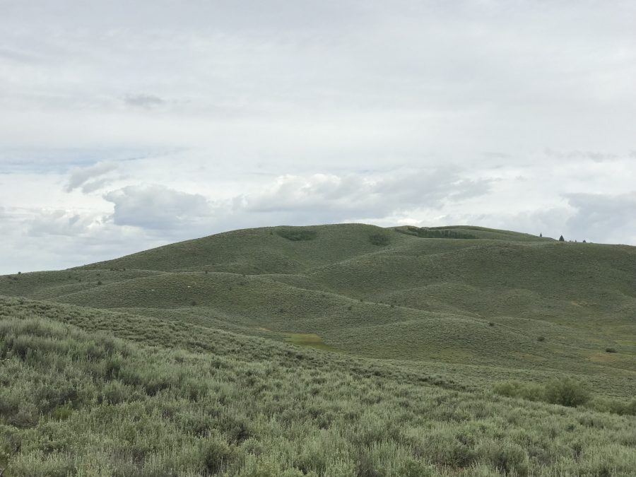
Peak 6412 is located in the center of the southern section of the Soldier Mountains on a north/south trending ridge line that rises between Hunter Creek in the west and Maxfield Creek in the east. The main Soldier Mountains Crest and Deer Mountain provide the stunning backdrop for this summit. USGS Deer Mountain
Peak 6412
Access
FS-058 climbs up Hawks Gulch to the peak’s south ridge at just under 6,000 feet. At this point, FS-058 meets an unnumbered road which follows the peak’s south ridge toward the summit. See the Southern Soldier Mountains Access page for details on reaching FS-058.
South Ridge, Class 1
The unnumbered road leads to the summit in 1.5 miles with 407 feet of elevation gain. The road’s purpose is to service a range fence that parallels the road. While it is passable to 4WDs, it is not clear whether it is open for private vehicle use because the road does not show up on the Forest Service Motor Vehicle Use Map. It any event, it is a short walk to the summit from FS-058.
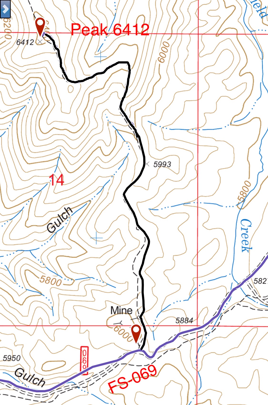
My GPS track
East Shoulder, Class 2 by Livingston Douglas
The Descent
From the summit, return down the 2-track road on the south ridge to the unsigned road junction at a ridge corner (6,220 feet). Go left/north here on a 2-track road (not shown on maps) and follow it to the end of a flat ridge section. Leave the road here and descend a shoulder (of sorts) east then southeast down through thick, steep sagebrush to Maxfield Creek. Maxfield Creek is an ugly sight here. It is nothing but beaver ponds. After some investigation, I moved slightly downstream to an obvious, massive beaver dam (the largest one in this area). Navigate across some grass clumps and brush then cross the beaver dam to reach the east side of Maxfield Creek. This is the low point of the traverse from Peak 6412 to Peak 6218, the next objective of today’s 3-peak adventure.
Additional Resources
Regions: Soldier Mountains->WESTERN IDAHO
Mountain Range: Soldier Mountains
Year Climbed: 2019
Longitude: -125.11379 Latitude: 43.42801