Elevation: 6,540 ft
Prominence: 280
This peak is not in the book. Published January 2023
Peak 6540 is a ridgeline summit that sits on the south side of Cassia Creek, just outside Elba. The easiest access is via Ottley Road (2055S Road) to its north. However, this area is a mix of private and public land but you can remain on BLM land the entire way if you consult a land management map. This is the first leg of a 2-peak adventure that includes Peak 6540 and Peak 6342 to its east. The climb covers 4.0 miles and 1,700 feet of elevation gain round trip. USGS Elba
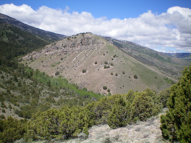
Peak 6540 as viewed from the east. My descent route (east ridge) rises from the lower right up to the center of the photo. Livingston Douglas Photo
Access
From ID-77 in Elba, drive west on [signed] Elba Road (1950S Road) for 0.8 miles to a “T” junction at Elba Park. Turn left/south onto 1125E Road and drive 0.9 miles to a signed junction with Ottley Road (2055S Road). Turn right/west onto Ottley Road and drive 1.8 miles to the base of a jeep road that heads up through a cattle gate. Park at the cattle gate (5,520 feet) if you have landowner permission or drive another 0.3 miles up Ottley Road to reach BLM land. Contrary to what the NFS and USGS maps suggest, Ottley Road is a smooth dirt road suitable for passenger vehicles.
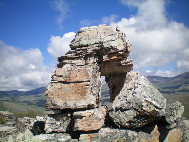
The window rock formation just northwest of the summit block. Livingston Douglas Photo
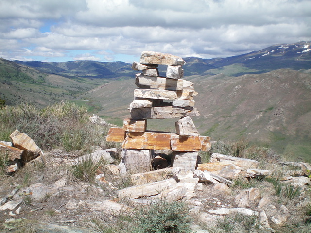
The unique, multi-layered summit cairn atop Peak 6540. Livingston Douglas Photo
North Face, Class 3
The Climb
From the cattle fence at the base of the 2-track road that leads up to the saddle between Peak 6540 and Peak 6342 (see USGS topo map), go through the fence at a fence corner about 100 feet to the west and climb southwest then south up a steep slope of thick-ish sagebrush and other brush to reach the summit ridge of Peak 6540 just at the left/east edge of the thick juniper forest (quite visible from Ottley Road). Scramble right/west along the easy, semi-open ridge crest.
Stay to the left/south of the ridge crest to avoid trees and rocky outcrops. Climb or skirt the first summit block (Class 3), which turns out to be five feet lower than the [higher] west summit. The west summit block (the true summit) is imposing. Bash through thick brush and boulders on its right/north side to get around to the west side of the block then climb Class 3 ledges to reach the top. There was no sign of previous ascent. There is an amazing “window rock” formation just northwest of the summit block.
East Ridge, Class 3
The Descent
From the top of the summit block, descend the Class 3 ledges to the base of the imposing block. Follow the ridge eastward in easy scrub initially. Lower down, the ridge steepens considerably and has thicker scrub and loose rock. Descend into the forest that surrounds the Cross Creek drainage and quickly find a 2-track jeep road. This concludes the first leg of today’s 2-peak journey. Peak 6342 is up next.
Additional Resources
Regions: Albion Range->SOUTHERN IDAHO
Mountain Range: Albion Range
Longitude: -113.6164 Latitude: 42.22309