Elevation: 6,540 ft
Prominence: 280
This peak is not in the book. Published November 2022
Peak 6540 is a minor hump on the south ramparts of Appendicitis Hill. It is most easily climbed from Newman Canyon and should be climbed in combination with nearby Peak 7028. USGS Appendicitis Hill
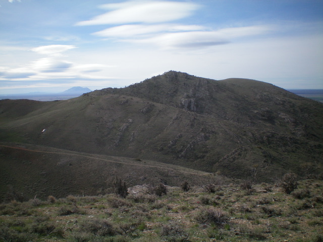
Peak 6540 as viewed from the northwest. Livingston Douglas Photo
Access
Same as for Peak 7028. This is the second leg of a 2-peak adventure.
Northwest Ridge, Class 2
The Climb
From the 6,260-foot connecting ridge with Peak 7028, scramble south to a minor ridge point then drop southeast to a minor saddle. Climb southeast then south to the rock-and-brush summit of Peak 6540. This ridge climb is full of rocky outcrops and rock strata to navigate. While LOJ shows the north summit as the high point (and it is), there are two other summits of equal height (6,520+) according to the USGS topo map. I had to investigate these other summits to see if they are slightly higher or not. Much to my surprise, the other two summits are 55-60 feet LOWER in elevation than the north summit. Clearly, the map contours are incorrect. There are NOT three summits of equal height for Peak 6540. Both the north summit and the [lower] south summit have cairns atop them.
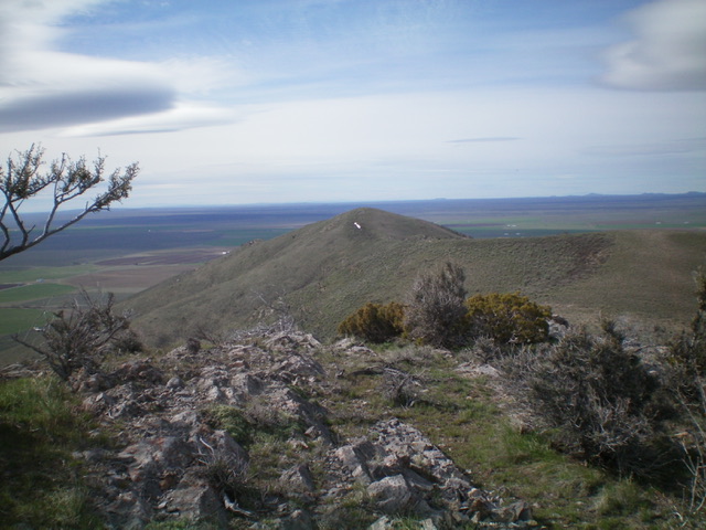
View from the summit of Peak 6540. Livingston Douglas Photo
South Ridge/West Face, Class 2+
The Descent
From the true/north summit, follow the south ridge to reach the [lower] south summit. From the south summit, descend the steep west face/shoulder on large ground boulders, rock strata, and some scrub (Class 2+). Lower down, the slope eases and the descent becomes a relatively easy sagebrush bushwhack. Cross a minor gully then angle up over a ridge to drop west (mostly on a good cattle trail) to reach Newman Creek Road. Follow Newman Creek Road for a short distance down to its base and your parked vehicle. The most direct route to the summit of Peak 6540 is its beautiful southwest ridge, which was my original planned descent route before I decided to investigate the height of the south summit.
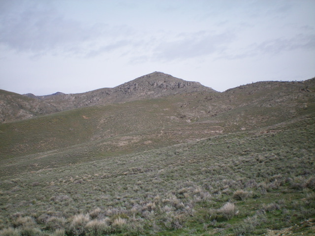
Peak 6540 (dead center) as viewed from the south. Livingston Douglas Photo
Additional Resources
Regions: EASTERN IDAHO->Pioneer Mountains
Mountain Range: Pioneer Mountains
Longitude: -113.42769 Latitude: 43.67379