Elevation: 7,028 ft
Prominence: 408
This peak is not in the book. Published November 2022
Peak 7028 is a bump on the south ramparts of Appendicitis Hill. It is most easily climbed via its south ridge from a county road that runs along the base of the mountains in the Appendicitis Hill area. USGS Appendicitis Hill
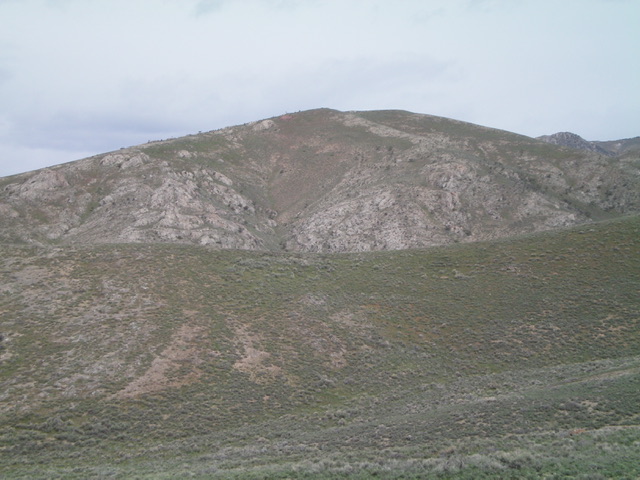
Peak 7028 as viewed from the southeast. Livingston Douglas Photo
Access
From the junction of US-93 and US-20 in Arco, drive northwest on US-93 for about 1/8 mile to a diagonal left/west street at the infamous Atomic Car Wash (radiation is free). This side street is Sunset Drive (W2500N on maps). Drive west on W2500N for 5.7 miles to a 4-way junction. Turn right/north onto 3600W and drive 0.7 miles to an unsigned junction. Turn left/west onto an unsigned county road (a smooth dirt road) and drive 1.8 miles to an unsigned junction with Newman Canyon Road. Park in a large pullout here (5,650 feet). GPS coordinates: 43⁰39’47”N, 113⁰26’40”W. If you wish, you can drive another 0.6 miles up Newman Canyon Road (a 2-track) without much difficulty.
South Ridge, Class 2
The Climb
From the base of Newman Canyon Road, hike about 0.6 miles up the 2-track road to a fork in the canyon and an unsigned road junction (not shown on maps). A side road heads left/northwest up a dry gully all the way to a ridge saddle between Point 6484 and Peak 7028. That ridge saddle is on the southwest spur of Peak 7028 and is an alternative way to climb the south ridge, offering more road hiking than the south ridge route proper. The main road continues straight/northeast up Newman Canyon.
The south ridge of Peak 7028 separates the two forks of Newman Canyon at this road junction. Leave the road here and climb north-northwest then north up the obvious ridge. Avoid another ridge to its right/east since that ridge has a number of ridge breaks due to massive embedded rock strata. Follow the south ridge up through short scrub and rocky outcrops/strata to a false summit. Drop 50 vertical feet to a minor saddle then continue north then northwest to the open, gentle summit hump. There is a summit cairn on top.
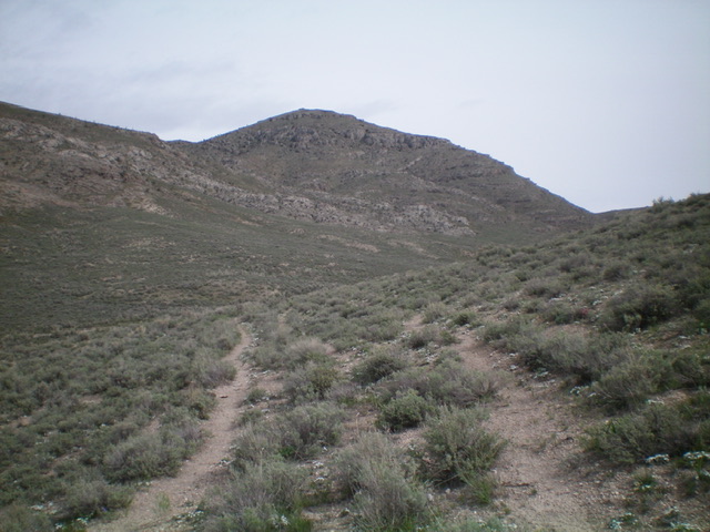
Peak 7028 and its rugged southeast side. This was my ascent route. Livingston Douglas Photo
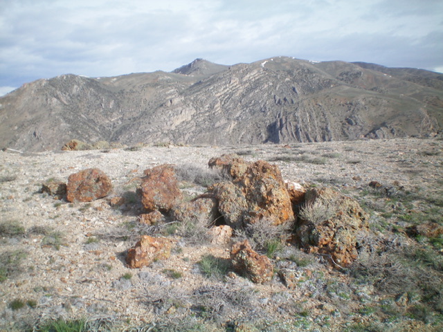
The summit rocks atop Peak 7028 with higher Pioneer Mountains in the distance. Livingston Douglas Photo
East Face, Class 2
The Descent
From the summit, descend southeast through a somewhat steep mix of sagebrush and rock to reach the first of three saddles. Continue southeast up over a minor hump then southeast down to a second saddle. Continue southeast up over a final hump then drop south to the final saddle (6,260 feet). This is the low point of the connecting ridge with Peak 6540 and concludes the first leg of today’s 2-peak journey. Peak 6540 is up next.
Additional Resources
Regions: EASTERN IDAHO->Pioneer Mountains
Mountain Range: Pioneer Mountains
Longitude: -123.44149 Latitude: 43.68549