Elevation: 6,541 ft
Prominence: 361
This peak is not in the book. Published December 2019
Peak 6541 is the gentle, eastern counterpart to rugged Peak 6684. This peak is mostly on private land but there is no signage/fencing/orange paint indicating such. The easiest ascent route is via the south ridge from the East Fork Fish Creek Road. USGS Fish Creek Reservoir
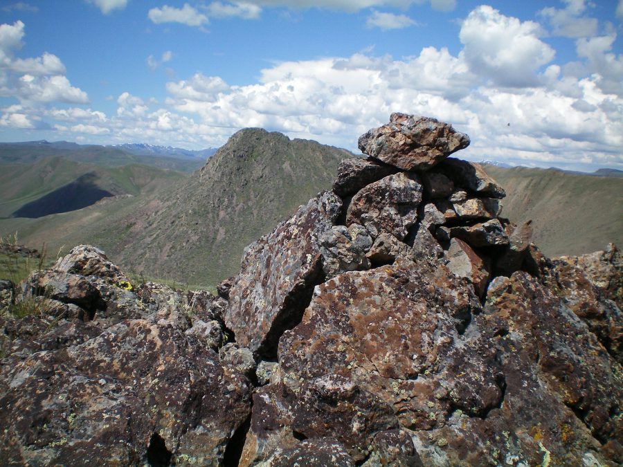
The summit cairn atop Peak 6541. Rugged Peak 6684 is in the background, just left of the cairn. Livingston Douglas Photo
Southwest Face, Class 2
Access
Same as for the southwest ridge of Peak 6884. This route is the final leg of a ridge traverse from Peak 6884 to Peak 6541.
The Climb
From the gully that separates Peak 6884 from Peak 6541, bash your way up the steep scrub slope to reach the scrub-free rock of the upper south ridge. A short, easy scramble around (or over) some ridge rock/outcrops gets you to the rocky summit of Peak 6541. The summit has a large cairn and a magnificent view of the rugged east face (and north ridge) of Peak 6884.
South Ridge, Class 2
Access
Same as for the southwest face. This route is the final leg of a loop route that begins and ends along Fish Creek Road.
The Descent
From the summit, descend the easy, open terrain of the upper south ridge. Lower down, the sagebrush gets a bit taller and thicker, but isn’t too bad. Skirt the left/east side of a rocky ridge buttress as you approach the road. Descend a final steep section of short scrub/grass with a scree base and cross a cattle fence to reach East Fork Fish Creek Road. The south side of the road is fenced and posted. The north side of the road is not posted, with the exception of a short section just west of the base of the south ridge.
Hike west down the East Fork Fish Creek Road for about 1-1/4 miles to its junction with Fish Creek Road. Hike up Fish Creek Road for 0.3 miles to your parked vehicle. Contrary to what the BLM map suggests, the East Fork Fish Creek Road is NOT a rugged 4WD road. It is a relatively smooth, one-lane road.
Additional Resources
Regions: EASTERN IDAHO->Pioneer Mountains
Mountain Range: Pioneer Mountains
Longitude: -113.75959 Latitude: 43.46009