Elevation: 6,684 ft
Prominence: 544
This peak is not in the book. Published December 2019
Peak 6684 separates the East Fork of Fish Creek from the Main Fork of Fish Creek at a pronounced split in the canyon. The sharp southwest ridge is a magnificent sight from Fish Creek Road. There is a lot of private land surrounding this mountain, so choose your route carefully. Most of the west side (and some of the south side) of the mountain is on public land, as is the summit area. Consult the Craters of the Moon BLM Map to stay legal. USGS Fish Creek Reservoir
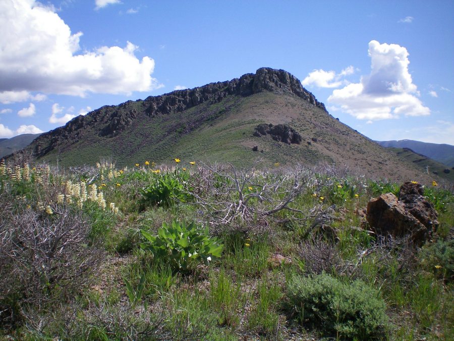
The imposing west face of the summit block of Peak 6684 as viewed from the upper southwest ridge. Livingston Douglas Photo
Southwest Ridge, Class 3
Access
Fish Creek Road is located along US-20. It is 17.2 miles west of the entrance to Craters of the Moon National Monument and 25.4 miles east of the junction of US-20/ID-75. The junction is signed. Reset your odometer at the base of Fish Creek Road at US-20. At 2.9 miles, cross to the right/east side of Fish Creek. At 3.5 miles, reach BLM land (signed). At 6.7 miles, reach an unsigned road junction. Go straight here. At 7.0 miles, park alongside Fish Creek Road at the base of the west face of the southwest ridge. The elevation here is 5,455 feet. The toe of the southwest ridge is on private land so avoid it.
The Climb
From the road, bash your way eastward up through thick sagebrush, weaving to find small open areas of gravel/scree. Stay on the left/north side of a wide gully for easier going, especially higher up. Aim to reach the southwest ridge at a rocky ridge outcrop to the left/north. When you reach the ridge, skirt the right/east side of this obstruction. Remain on the right/east side of the ridge crest to skirt Point 6200. Once past Point 6200, descend 80 vertical feet to a ridge saddle.
From the saddle, scramble northeast up talus/scree to reach the base of the massive, imposing summit block. Move a bit right/east to the south side of the summit block to find a Class 3 chute/slot angling diagonally right and upward. Find a Class 3 gully angling diagonally left to approach the summit. A final scamper right gets you on the small, rocky perch that is the high point of Peak 6684. There is a large cairn on top. There is no Class 2 route to this summit.
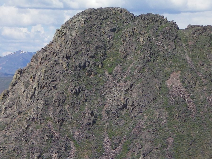
The rugged east face of Peak 6684 as viewed from the south ridge of nearby Peak 6541. Livingston Douglas Photo
East Face, Class 3
Access
Same as for the southwest ridge. This route is the first leg of a traverse from Peak 6684 to Peak 6541.
The Descent
From the summit, you would like to descend north to a ridge saddle at the head of a gully, but you can’t due to Class 5 towers/blocks on the ridge. You must drop right/east below them and skirt them via loose talus/scree gullies and knife-edged aretes. This gets tiresome quickly, so descend northeast then east down the angled face to reach the large, dry gully that separates Peak 6684 from Peak 6541. After you’ve dropped 300 vertical feet from the summit, the terrain gets much easier. The cliffs, aretes, and narrow gullies are GONE. The terrain is all desert scrub now. Sagebrush never looked so good!
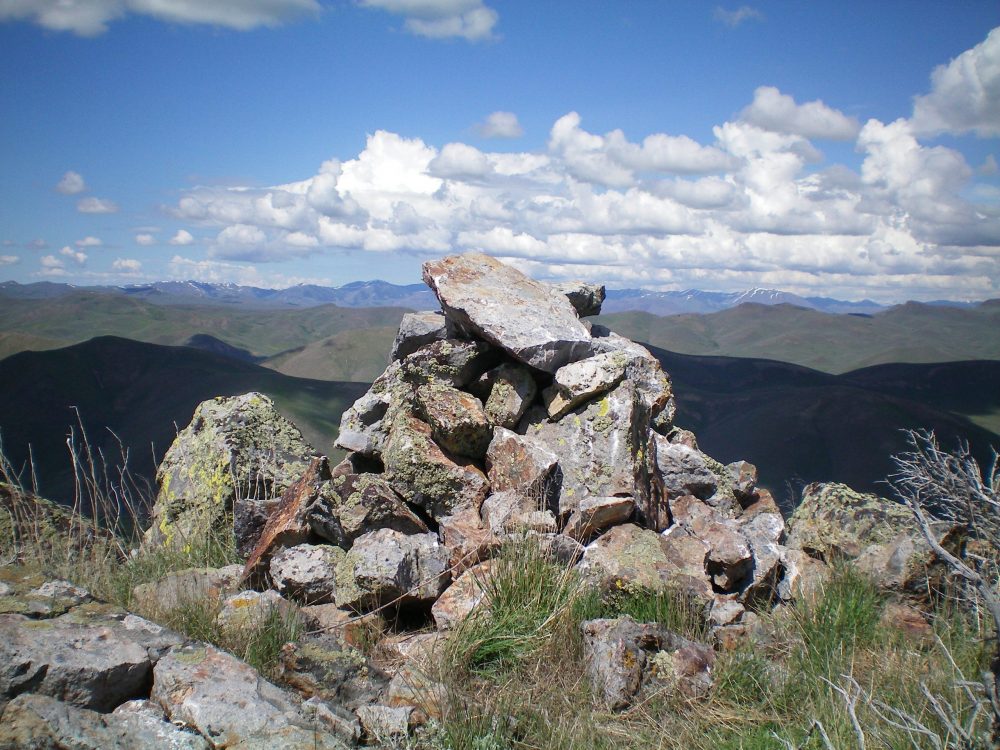
The summit cairn atop Peak 6684. Livingston Douglas Photo
Additional Resources
Regions: EASTERN IDAHO->Pioneer Mountains
Mountain Range: Pioneer Mountains
First Ascent Information:
- Other First Ascent: East Face —Descent
- Year: 2019
- Season: Summer
- Party: Livingston Douglas
Longitude: -113.77259 Latitude: 43.45929