Elevation: 6,544 ft
Prominence: 324
This peak is not in the book. Published November 2020
Peak 6544 is a minor, forested hump that sits above Garden Creek in the Bannock Range. It is overshadowed by its neighbor to the east, Old Tom Mountain (8,733 feet). Peak 6544 can be combined with a climb of nearby Peak 6945 for a more worthwhile endeavor. Please be advised that this area is a patchwork of private and public land so be careful. The landowners in this area are aggressive about posting their property lines. USGS Hawkins
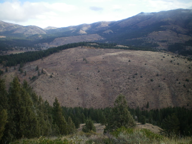
Peak 6544 (mid-ground) as viewed from the southwest. The summit is left of center, next to the forest line. Livingston Douglas Photo
Access
From Exit 40/Arimo on I-15, drive exactly 8.0 miles west on Arimo Road, passing through Garden Creek Gap to reach a [signed] junction with Garden Creek Road. Go right/north on Garden Creek Road and drive 4.8 miles to a 2-track road (on the left/west side of Garden Creek Road) at a saddle. Park here (6,222 feet) or drive a short distance up the side road to a grassy parking area.
East Ridge, Class 2
The Climb
From Garden Creek Road, hike west along the 2-track road to a grassy clearing and find a use trail that heads west up into the forest. Follow this use trail up through a section of pine forest. The use trail leaves the forest to follow the left/south edge of the forest in open sagebrush and brush. Higher up, the trail disappears. Scramble up through brush and some rock to reach the narrow, rocky ridge-crest summit of Peak 6544. The summit has a modest cairn. The summit area itself is open but it borders the nearby pine forest.
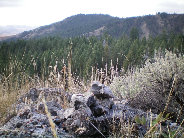
The summit cairn atop Peak 6544 with Peak 6945 in the background to the south. Livingston Douglas Photo
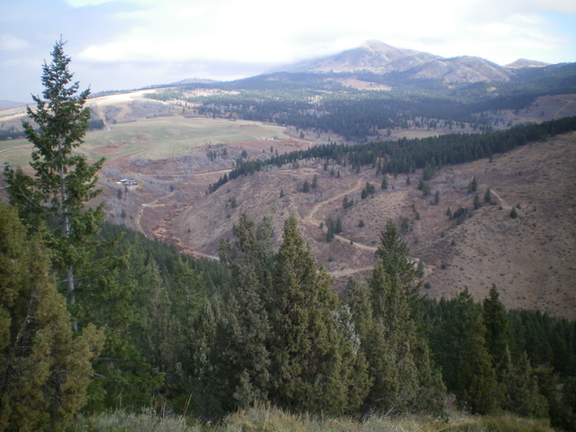
The ranches and old road at the head of Garden Creek, west of Peak 6544. Be careful not to stray too far north in the Garden Creek drainage! Livingston Douglas Photo
Southwest Face, Class 2
The Descent
From the summit, descend southwest and skirt a ridge point. From there, head west across open scrub on the left/south edge of the pine forest. At about 6,400 feet, bend left-ish/southwest and descend easy, open scrub to more directly reach the drainage that separates Peak 6544 from Peak 6945, the next objective of today’s adventure. The final descent to the drainage is quite steep and loose, so be careful. Garden Creek itself is surprisingly pesky and difficult to cross due to the tall field grass that surrounds it and some marshy areas to boot. Find a fallen tree log at the upstream end of an obvious open meadow in order to easily cross Garden Creek. Once you reach the west side of Garden Creek, you are at the low point in the traverse to Peak 6945. This concludes the first leg of today’s journey. Peak 6945 is up next.
Additional Resources
Regions: Bannock Range->SOUTHERN IDAHO
Mountain Range: Bannock Range
Longitude: -112.36901 Latitude: 42.61649