Elevation: 6,550 ft
Prominence: 320
This peak is not in the book. I added a map to Livingston’s narrative. Published November 2021
Peak 6550 is the second-highest peak in the Picabo Hills southwest of Picabo, Idaho. This is the second leg of a 2-peak journey that includes Picabo Hills (6,583 feet) and Peak 6550. An easy ridge traverse (with help from an old 2-track road) connects the two peaks. This is the only route that offers public access to Peak 6550. USGS Gannett
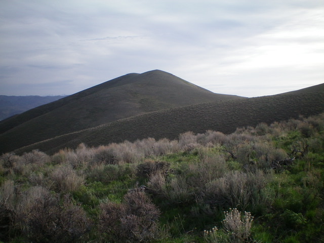
Peak 6550 (dead center) as viewed from the southwest. Livingston Douglas Photo
Access
Same as for Picabo Hills High Point (6,583 feet).
South Ridge, Class 2
The Climb
From the 6,230-foot connecting saddle with the Picabo Hills High Point (6,583 feet), follow an old 2-track road to its end at the northeast hump of the Point 6454 complex. From there, descend north on a ridge to a saddle (6,290 feet) on a mix of talus/scree and short scrub. From the saddle, climb north up the ridge in a mix of scree and short scrub to the cairned summit of Peak 6550.
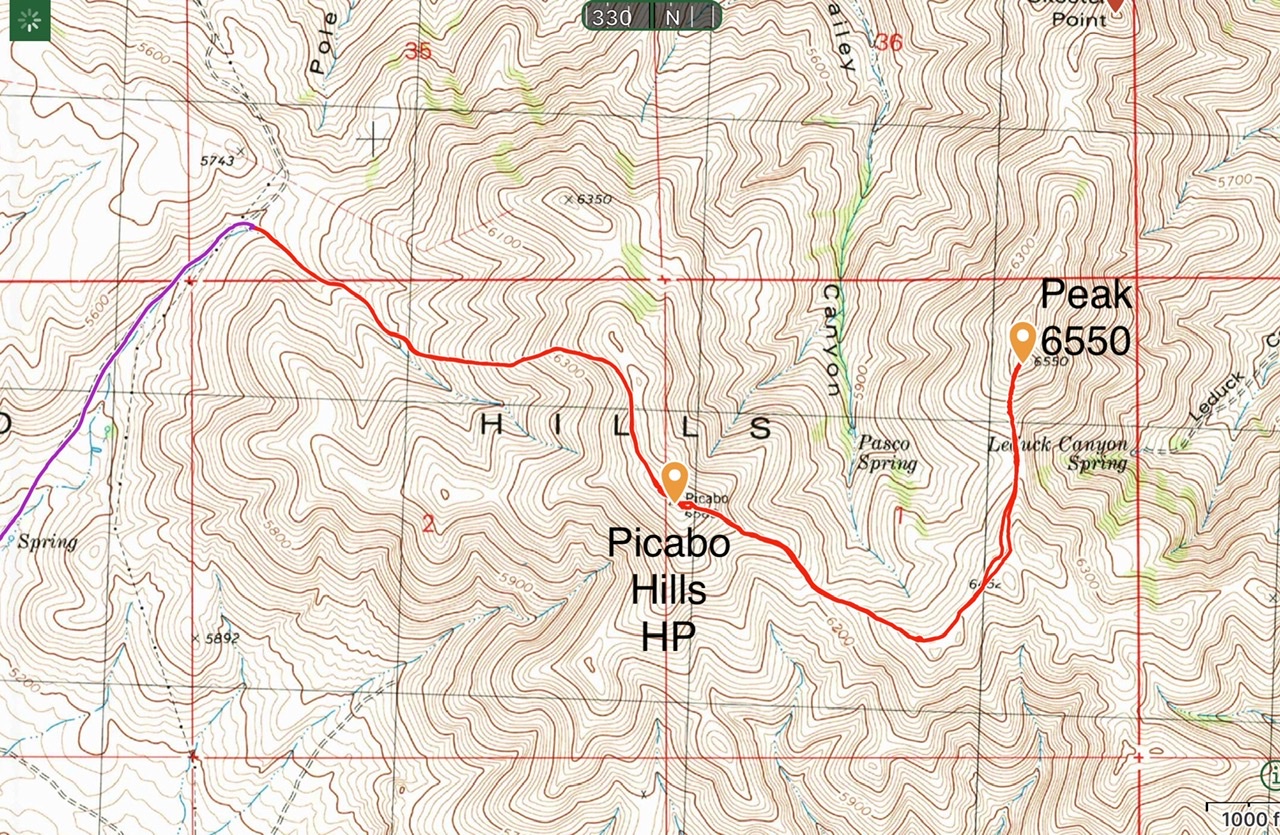
My GPS track covers 5.2 miles round trip with 1,675 of elevation gain for the HP and Peak 6550. It is 1.5 miles with just over a thousand feet of gain to the HP.
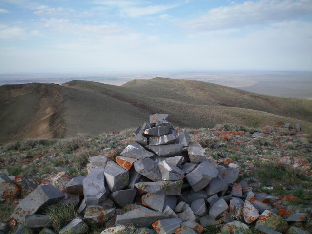
Looking back at the final section of the ridge traverse up to the summit. The Point 6452 massif is an obstruction and is in the left half of the photo. Livingston Douglas Photo
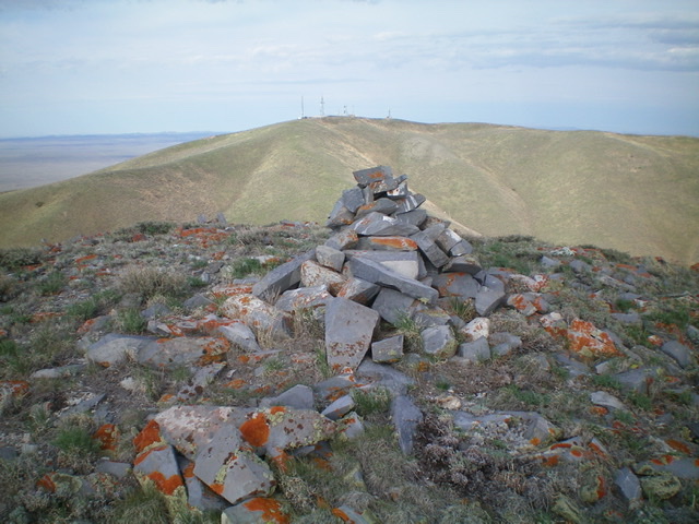
The summit cairn atop Peak 6550 with the antenna-clad high point of Picabo Hills (6,583 feet) in the background. Livingston Douglas Photo
Additional Resources
Regions: Picabo Hills->SNAKE RIVER PLAIN
Mountain Range: Snake River Plain
Year Climbed: 2021
Longitude: -114.14009 Latitude: 43.28469