Elevation: 6,583 ft
Prominence: 1,668
This peak is not in the book. I added two maps to Livingston’s narrative. Published November 2021
Picabo Hills HP (or Picabo Benchmark) is the high point of the Picabo Hills, which are located south of US-20 and southwest of Picabo, Idaho. The only public access is via Picabo Desert Road and a service road to the summit. The antenna-clad summit towers over the surrounding gullies and hills. USGS Gannett
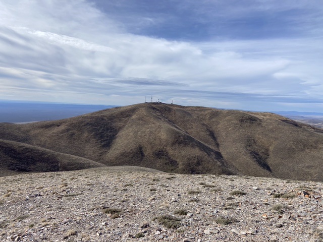
The Picabo Hills HP viewed from Peak 6550.
Access
This is the first leg of a 2-peak journey that includes Picabo Hills HP and Peak 6550.
Spud Patch Road is located along ID-75 exactly 1.2 miles south of the ID-75/US-20 junction. Turn left/east onto [signed] Spud Patch Road and reset your odometer. At 2.2 miles, the road bends right/southeast at an unsigned junction. At 5.8 miles, you reach an unsigned “T” junction (of sorts) with Picabo Desert Road. Go straight/left-ish here onto Picabo Desert Road heading east. Ignore an old 2-track road (not shown on maps) heading left just before this junction. Picabo Desert Road bends left/northeast then left/north then right/northeast as it climbs up into the Picabo Hills.
At 7.5 miles, go straight/north at an unsigned junction. At 7.8 miles, the road crosses a cattle guard/fence onto private land (“Access Yes” sign here). At 10.3 miles, you reach an unsigned junction with the service road (5,550 feet) to the right/east. This service road is not shown on maps. You are now back on public (BLM) land. Hike (or drive) 0.3 miles up the service road to a parking pullout at the base of a very steep section of the service road. While you can drive to the top, you will need a 4WD with good tires and good brakes. I recommend hiking the final mile from the parking pullout to the summit.
Contrary to what is shown on the USGS topo map, the aforementioned roads leading to the parking pullout on the service road are quite good and are mostly smooth. While a 4WD is recommended, the roads are not steep. These roads are nearly impossible to drive when wet.
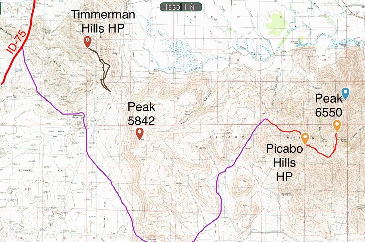
This map provides an overview of access for the Timmerman Hills HP and Picabo Hills HP.
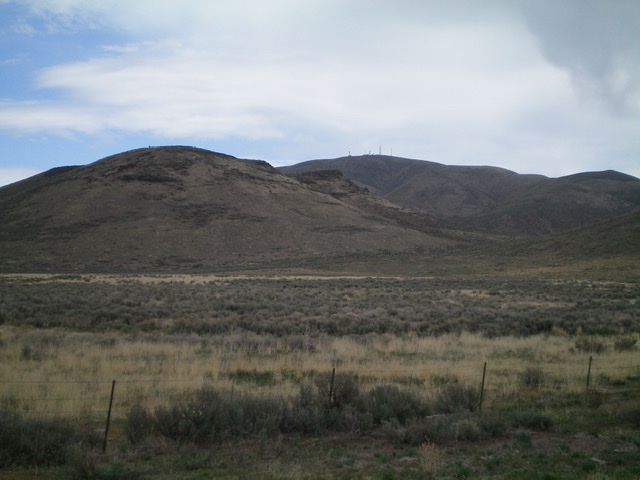
Picabo Hills as viewed from Picabo Desert Road at the BLM/private land boundary. Livingston Douglas Photo
Northwest Gully, Class 1
The Climb (then Descent)
Hike southeast up the steep service road as it follows a sagebrush gully. The road eventually leaves the gully and climbs east up onto the summit ridge. Continue right/southeast up the road on the ridge crest to reach the antenna-clad summit. The service road is so steep that descending it is a bit treacherous due to loose gravel on hard road surface. Be sure to have good treads on your hiking boots.
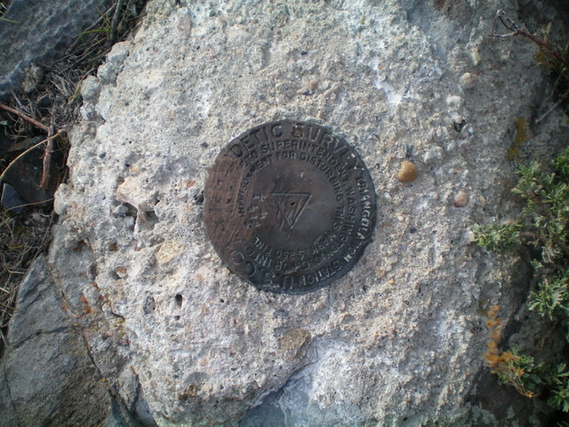
The USGS benchmark atop Picabo Hills. Livingston Douglas Photo
Southeast Ridge, Class 1
The Descent (then Ascent)
From the summit, follow an old 2-track road that follows a fence row southeast along the ridgeline to quickly reach a saddle (6,230 feet). This is the connecting saddle with Peak 6550 and is the terminus of the southeast ridge of Picabo Hills. Peak 6550 is up next.
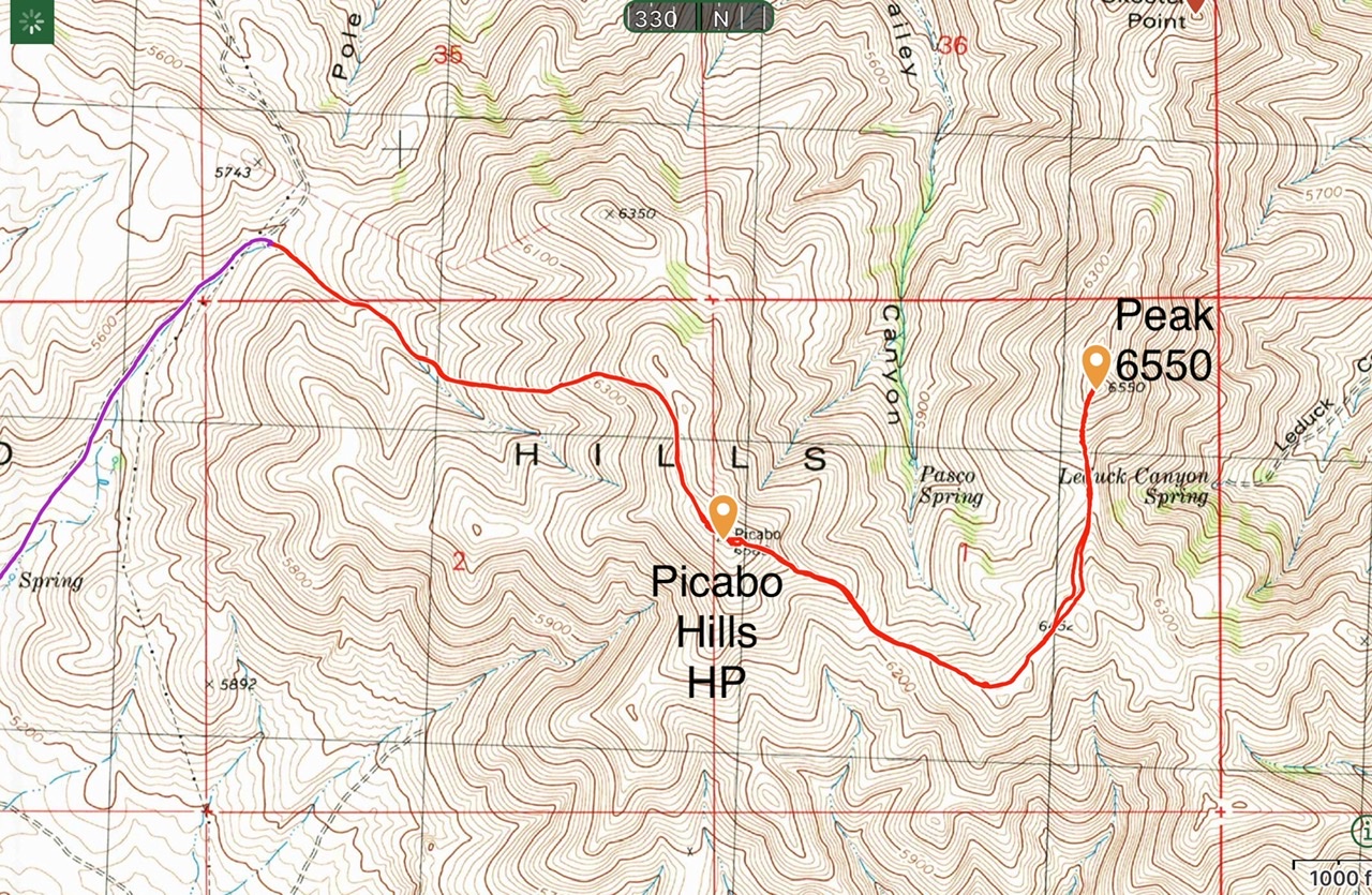
My GPS track covers 5.2 miles round trip with 1,675 of elevation gain for the HP and Peak 6550. It is 1.5 miles with just over a thousand feet of gain to the HP.
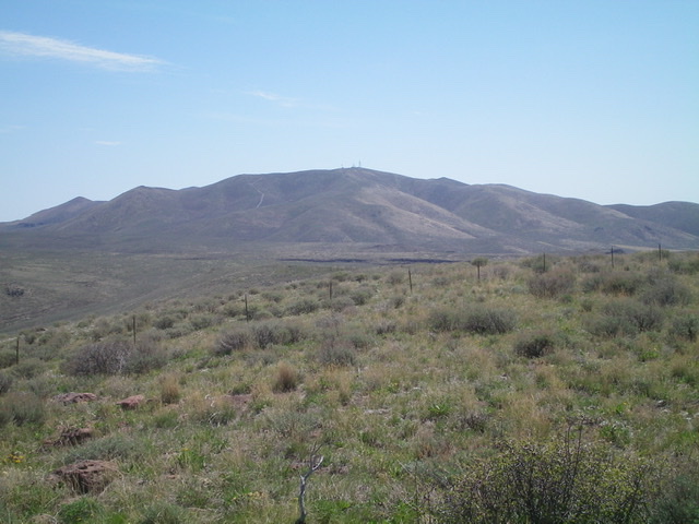
The antenna-clad high point of Picabo Hills as viewed from Peak 5842 to its west. Livingston Douglas Photo
Additional Resources
Regions: Picabo Hills->SNAKE RIVER PLAIN
Mountain Range: Snake River Plain
Year Climbed: 2021
Longitude: -114.15479 Latitude: 43.28039