Elevation: 6,611 ft
Prominence: 406
This peak is not in the book. Published January 2023
Peak 6611 is located between South Heglar Canyon and the Lake Fork drainage in the Sublett Range. It sits above several springs: South Heglar Spring, Upper Lake Fork Spring, and Lake Fork Spring. This is the first leg of a 2-peak adventure that includes Peak 6611 and Peak 6629. This journey covers 6.0 miles with 2,375 feet of elevation gain round trip. USGS North Heglar Canyon
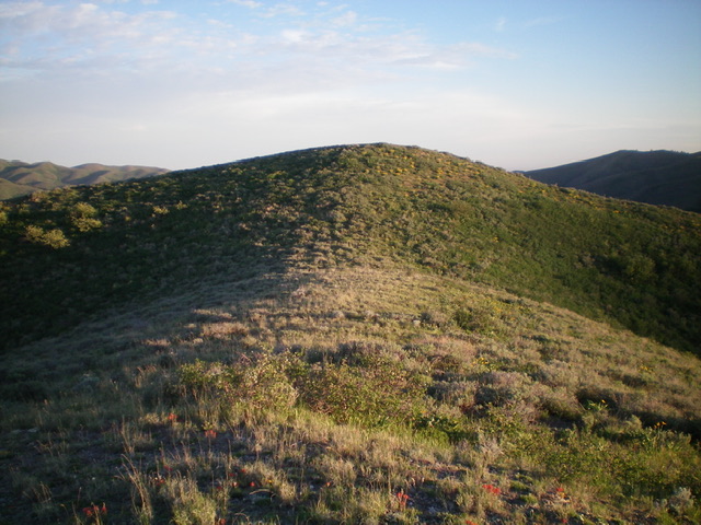
Peak 6611 (dead center) as viewed from the top of the northeast shoulder/spur. The summit hump is trying to hide. Livingston Douglas Photo
Access
From Exit 245 (Malta/Sublett) on I-84, drive southeast on Sublett Road. Continue on the road as it bends east then north and passes the west side of Sublett Reservoir. At 10.0 miles, reach a signed junction with Lake Fork Road/FSR-564 at the northwest end of the reservoir. Drive 4.7 miles north up Lake Fork Road to an unsigned junction with an old 2-track on the left/west side of the road. The 2-track is now closed to motor vehicles (sign). This old 2-track leads southwest to a shaded campsite at Upper Lake Fork Spring (on map). This junction is at 6,055 feet and GPS coordinates: 42⁰23’34”N, 113⁰02’19”W. Park here.
Northeast Ridge, Class 2
The Climb
From the unsigned road junction, follow the weak 2-track road south then southwest to an old campsite are then leave it to scramble left/south up onto a nearby ridge that is just west of Point 6024. Scramble south up through easy pine forest to reach the crest of the open scrub and sagebrush on the ridge. Follow the open ridge southwest to its end at a “T” junction with the north ridge of Peak 6611 and a 2-track road on the ridge crest.
Go left/south onto the 2-track briefly and drop 15 feet to reach a fence corner. From the fence corner, go right/west and follow the fence row up the sagebrush/scrub ridge to the summit of Peak 6611. There is a lower hump (10 vertical feet lower) to the southeast of the summit hump. Ignore it. The bare summit of Peak 6611 has a very small cairn because there is not much loose rock with which to build a decent cairn.
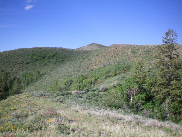
The elusive summit hump of Peak 6611 as viewed from the [lower] southeast summit. Livingston Douglas Photo
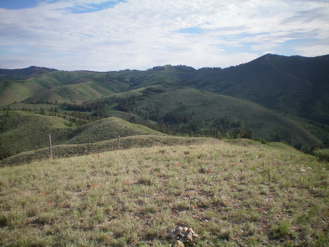
The gentle summit of Peak 6611 with higher Subletts in the distance. Livingston Douglas Photo
West Ridge, Class 2
The Descent
From the summit, begin a rather tedious, up-and-down, weaving ridge traverse in open sagebrush/scrub southwest then northwest to reach Peak 6629. Much of this ridge traverse is along a fence row. It is tedious. The west ridge of Peak 6611 ends at a narrow, 6,180-foot saddle. This saddle concludes the first leg of today’s journey. Peak 6629 is up next.
Additional Resources
Regions: SOUTHERN IDAHO->Sublett Range
Mountain Range: Sublett Range
Longitude: -113.04549 Latitude: 42.38561