Elevation: 6,641 ft
Prominence: 421
This peak is not in the book. Published November 2022
Peak 6641 is the high point of a ridgeline that sits above the north side of Salix Creek in the Soldier Mountains. It separates Hawk Gulch from Salix Creek. Peak 6641 is most easily reached from Salix Creek Road which is a weak, 2-track affair best suited for ATVs. USGS Deer Mountain
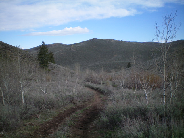
Peak 6641 (dead center) as viewed from the southeast. Livingston Douglas Photo
Access
Same as for Peak 6700. This is the final leg of a 3-peak adventure that includes Peak 6700, Chimney Benchmark, and Peak 6641.
Southeast Face, Class 2
The Climb
From the unsigned road junction on Salix Creek Road at 6,000 feet, head upstream a short distance to find a suitable way to cross Salix Creek, which is a combination of beaver ponds and thick willows. Look for a fence row that crosses the creek. Bushwhack across the small creek just upstream from this fence row in a narrow area of short grass and marsh. Once across Salix Creek, bushwhack west up a thick sagebrush slope to intersect the very dilapidated fence row, which is heading due north (the direction that you want to go). The fence row is steep but it has remnants of a cattle trail that make it an easier go than bushwhacking through the thick sagebrush with no help.
Upon reaching a ridge crossing just east of Point 6430, the fence row turns sharply left/west. Ideally, leave the fence row here and contour northwest to a saddle of sorts. I mistakenly followed the fence row west uphill and soon abandoned it to head down to the aforementioned saddle. From the saddle, bushwhack northwest through unending sagebrush on a ridge of sorts to cross the head of another gully. Once atop the gully, scramble up the southeast face to reach the open summit of Peak 6641. The summit had a torn-down cairn which I rebuilt. The summit offers a nice view of both Chimney Benchmark and Peak 6700.
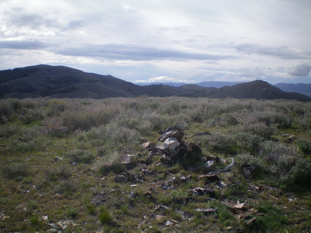
The summit cairn atop Peak 6641 with Chimney Benchmark (left) and Peak 6700 (right) in the distance. Livingston Douglas Photo
South Gully, Class 2
The Descent
From the summit, descend south on a face/shoulder that leads into the wide, obvious south gully. This is a sagebrush bash but it goes pretty quickly thanks to gaps and minor lanes in the sagebrush. Once near the dry gully, stay on its left/east side just above the aspens that are in the drainage proper. When you reach Salix Creek, you must cross the creek to reach Salix Creek Road. Unfortunately, the creek drainage is a mess of massive beaver ponds. Head downstream briefly and find a creek crossing in “easy” marsh just below a massive beaver dam. Once back on Salix Creek Road, follow it southwest then south to the meadow and the unsigned junction from early in today’s multi-peak hike. Follow a 2-track road right/west (then southwest) uphill to return to Cow Creek Road. Hike south down Cow Creek Road to the campsite and your parked vehicle.
Additional Resources
Regions: Soldier Mountains->WESTERN IDAHO
Mountain Range: Soldier Mountains
Longitude: -115.10801 Latitude: 43.40039