Elevation: 6,631 ft
Prominence: 351
This peak is not in the book. Margo Mandella provided the GPS found below. Updated June 2021
Peak 6631 (Antelope Twins South) is one of two humps of nearly identical height located on the southeast side of the Antelope Valley and just south of the bridge crossing of Antelope Creek on Antelope Creek Road. It is best to climb both of these peaks together since they are close neighbors. This area is a mix of public and private land so be careful how you climb these two peaks. USGS Grouse
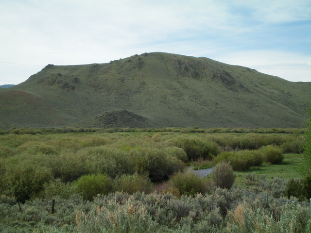
Antelope Twins South as viewed from across Antelope Valley to the north. Livingston Douglas Photo
Access
Same as for Antelope Twins North. This is the second leg of a two-peak journey.
Northeast Face, Class 2
The Climb
From the connecting saddle with Antelope Twins North, scramble southwest up a somewhat tedious, complicated face with rocky outcrops to skirt or navigate to reach the [false] northeast summit. Continue southwest to the higher (by 15 feet) true summit of Antelope Twins South. This peak had a torn-down cairn so I rebuilt it. The sagebrush on the northeast face of Antelope Twins South is thicker and rougher than the easier sagebrush on the southwest face of Antelope Twins North.
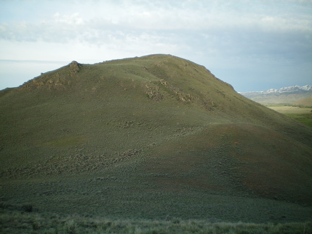
A closer view of the northeast aspects of Antelope Twins South. Livingston Douglas Photo
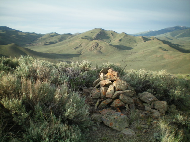
The rebuilt summit cairn atop Antelope Twins South, looking south. Livingston Douglas Photo
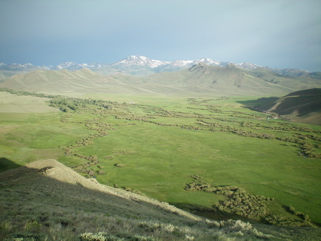
The view from the summit of Antelope Twins South, looking west across the broad Antelope Valley. Waiting for the snow on those higher peaks to melt. Livingston Douglas Photo
The Descent to Antelope Creek Road, Class 2
Descend down the northeast face back to the connecting saddle. From the saddle, follow a good cattle trail northwest down the gully to Antelope Creek Road at the base of the gully.
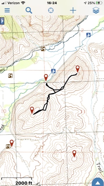
Mandella GPS Track
Additional Resources
Regions: EASTERN IDAHO->Pioneer Mountains
Mountain Range: Pioneer Mountains
Longitude: -113.57749 Latitude: 43.68909