Elevation: 6,667 ft
Prominence: 367

This peak is not in the book. Published November 2023
Peak 6667 is the high point on a lengthy northeast-to-southwest ridgeline that separates the Salmon River from Hot Springs Creek. It is most easily approached from FSR-060/Hot Springs Creek Road which was recently regraded extensively. USGS Pine Creek Rapids
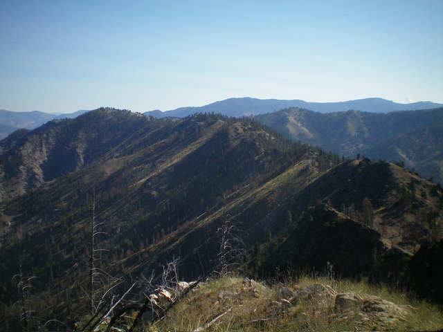
Peak 6667 as viewed from the ridgeline to its south. Livingston Douglas Photo
Access
From US-93 at North Fork, drive 26 miles west on FSR-030/Salmon River Road to a signed junction with FSR-055/Panther Creek Road. Drive 3.9 miles south on Panther Creek Road to a signed junction with FSR-060/Hot Springs Creek Road. Go left/north and drive 4.2 miles up FSR-060 to a road closure gate. Park in a pullout area just below the closure gate (4,550 feet; 45⁰18’49”N, 114⁰19’49”W).
If you plan to only climb Peak 6667, you may be able to drive all the way up FSR-060 to a high ridge saddle (6,340 feet) just southeast of the summit and have a short ridge scramble from there. This is the first leg of a 3-peak adventure that includes Peak 6667, Peak 6514, and Panther Benchmark (6,443 feet). It covers 8.3 miles with 3,750 feet of elevation gain round trip.
Map Errors
The “pack trail” on the high ridge crest (shown on the USGS topo map) is completely gone. The Forest Service Trail from the Hot Springs to the summit of Panther Benchmark (shown on the Salmon National Forest Map) is mostly gone. FSR-060 was recently completely regraded and is in much better shape than the USGS topo map and the Salmon National Forest Map indicate.
Southeast Shoulder/South Ridge, Class 2
The Climb
From the road closure gate, hike about 1-1/2 miles northeast up FSR-060 to a sharp right/south bend where the road crosses the Hot Springs Creek drainage (which is pretty narrow here). Leave the road and climb up an easy, open shoulder of grass/scrub on the left/west side of the drainage. The shoulder is quite steep at first. The ridge heads north but soon bends left-ish/northwest. The brush gets a bit thicker higher up but that doesn’t last for long. There are some scattered ridge pines but not much deadfall to contend with. The shoulder crosses two old, grassy road beds early on (not shown on maps)—ignore them.
It then crosses well-graded FSR-060 twice. Leave the shoulder at the second crossing and hike right/north up FSR-060 for about ¼ mile to a dry gully crossing. Leave the road here (or soon after where it crosses a forested shoulder) and climb up an easy forested shoulder on the right/northeast side of the gully. This shoulder quickly leads up to the south ridge of Peak 6667. Once on the south ridge, scramble right/north then northeast up the easy grass/scrub on the ridge crest to reach the small summit. There were no signs of previous ascent so I built a summit cairn on the high point.
Peak 6667 (the hump left of center) and the connecting ridge to Panther Benchmark as viewed from the summit of Panther Benchmark. Livingston Douglas Photo
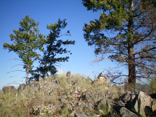
The summit of Peak 6667. Livingston Douglas Photo
Southwest Ridge, Class 2
The Descent
From the summit, follow the ridge crest south then southwest over a few ridge humps. The final ridge hump (Point 6251) is a bit rocky and can be skirted on its left/south side. The ridge terrain is relatively easy and is a mix of scrub with scattered pines but minimal deadfall. From Point 6251, descend to a saddle at 6,180 feet. This is the connecting saddle with Peak 6514. It concludes the first leg of today’s 3-peak adventure. Peak 6514 is up next.
Additional Resources
Mountain Range: Eastern Salmon River Mountains
Longitude: -114.3119 Latitude: 45.3391