Elevation: 6,758 ft
Prominence: 458
This peak is not in the book. Published November 2021
Peak 6758 is the high point of a complex of hills that sit directly above Challis on its northwest side. Nearby Challis Benchmark (6,730 feet) is slightly lower. Due to the preponderance of private property in this area, it is a difficult peak to reach. This entire hike is on BLM land. USGS Pats Creek
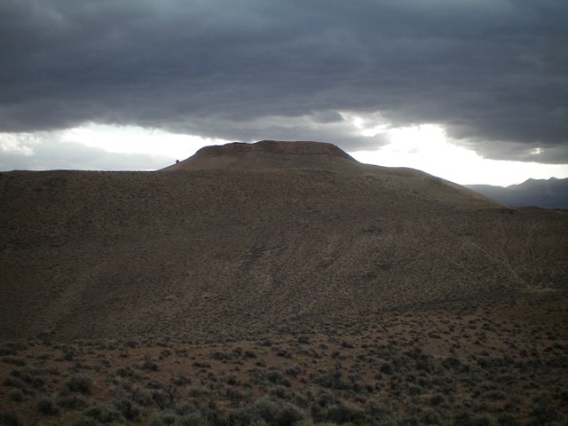
Peak 6758 (the hump just left of center) and Challis Benchmark (the hump that is farther left) as viewed from Peak 6420 to the northwest. Livingston Douglas Photo
Access
Same as for Peak 6420. This is the second leg of a 2-peak adventure that includes Peak 6420 and Peak 6758. It covers 8.0 miles with 2,675 feet of elevation gain round trip.
West Face
The Approach, Class 2
From the 5,980-foot connecting saddle with Peak 6420, follow an old 2-track road (shown on the USGS topo map) southward as it meanders across several gullies and shoulders to reach a shoulder crossing just west of Point 6472. Leave the 2-track and bushwhack southeast down a sagebrush slope to a saddle at the head of a prominent gully.
The Climb, Class 2
From the saddle, scramble east then northeast over a sagebrush hump and descend 85 vertical feet to a minor saddle at the base of the west face. Climb east up a mix of sagebrush and, higher up, boulders/talus to gain the summit ridge. Once on the ridge, head right/south over a rocky ridge outcrop to reach the gentle high point. There was no summit cairn so I built one. The [lower] hump of Challis Benchmark is to the southeast and is obvious.
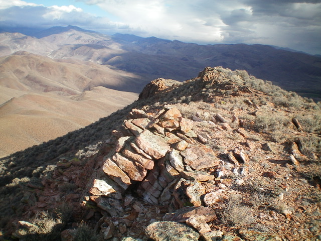
The summit of Peak 6758, looking north. Livingston Douglas Photo
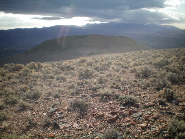
View of Challis Benchmark (the hump in mid-ground) from the summit of Peak 6758. Livingston Douglas Photo
The Descent, Class 2
From the summit, return back to the 5,980-foot connecting saddle with Peak 6420. From the saddle, follow the overgrown, rutted old 2-track road northwest down a gully that leads to the Mill Creek drainage. Due to posted private property, you cannot continue down the 2-track road to the valley floor. You must leave the road and follow a fence row back to your parked vehicle. But the fence row does not extend southward all the way to this 2-track road. You must find it.
Descend the 2-track road past a series of rocky outcrops to reach an area of easy, open sagebrush. Leave the road and contour north (side-hilling) to reach Point 5800+. Cross a final dry gully and climb up onto Point 5800+. The critical fence row is here. Follow the right/east side of the fence row on a cattle trail (of sorts) to reach the fence corner that is close to Mill Creek and your parked vehicle. Go left/west here and follow the fence row quickly down to Mill Creek. Ford the creek and bushwhack a short distance up onto Mill Creek Road. Walk 100 yards downstream to your parked vehicle at the road junction with Jeffs Flats Road.
Additional Resources
Regions: Eastern Salmon River Mountains->Salmon River Mountains->Southeast Corner Peaks->WESTERN IDAHO
Mountain Range: Eastern Salmon River Mountains
Longitude: -114.26929 Latitude: 44.51901