Elevation: 6,774 ft
Prominence: 514
This peak is not in the book. Published November 2020
Peak 6774 is a ranked hump on the north ridge of the North Hansel Mountains HP (6,919 feet). The easiest ascent route is from US-38 via the north ridge. Climb Peak 6774 in combination with the North Hansel Mountains HP (only two miles away) for a magnificent ridge traverse. It also avoids private land issues in the Pocatello Valley (to the east) and a LONG ridge traverse from the south. This two-peak adventure covers 11.0 miles with 3,625 feet of elevation gain round trip. But don’t do it on a windy day. USGS Sheep Creek Spring
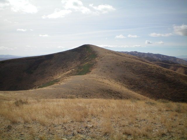
Peak 6774 as viewed from the north along the ridge crest. Livingston Douglas Photo
Access
From the [signed] junction of ID-38 and Arbon Valley Road (a few miles east of Holbrook, ID), drive east on ID-38 for 0.4 miles to an unsigned spur road on the right/south side of the highway. Park near the base of this dirt road (5,020 feet). From here, you can easily access the north ridge of Peak 6774 and remain on BLM land the entire way.
Northwest Spur/North Ridge, Class 2
The Climb
From the base of the spur road, bushwhack southeast through sagebrush to reach the northwest spur of the north ridge. Another option is to bushwhack south directly onto the northwest spur at a lower point. I chose the former for the ascent and the latter for the descent. Just be careful to not wander too far west because there is posted private land nearby. The northwest spur is a bit brushy and is the hardest bushwhack of today’s journey.
Scramble steeply up the rounded northwest spur to reach Point 5807. From there, follow the broad ridge southeast then south to a 5,700-foot saddle on relatively easy, open scrub. Continue south up a brushy face (not too bad) to reach Point 6083. Drop slightly to a minor saddle then follow the ridge southwest on easy, open scrub/grass to reach the top of Point 6664 (large cairn here). The ridge turns south here and drops to another saddle (6,500 feet). Scramble south up the ridge to the summit of Peak 6774. The summit of Peak 6774 has a large cairn and a red fire hydrant (a real one, not a plastic imitation).
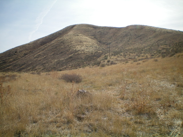
Looking at the scrub shoulder (left of center) that leads up to Point 5807 and the northwest spur of the north ridge of Peak 6774, as viewed from the spur road along ID-38. This is where the adventure begins. Livingston Douglas Photo
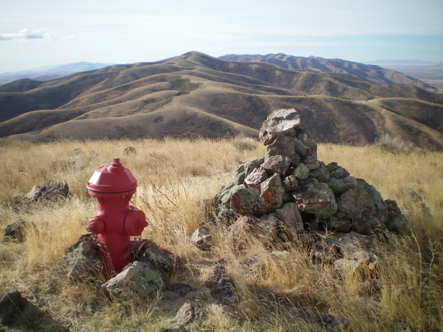
The red fire hydrant (a real one) and summit cairn atop Peak 6774, looking south. North Hansel Mountains HP is the pyramidal-shaped summit in the distance (left of center). Livingston Douglas Photo
Southeast Ridge, Class 2
The Descent
From the summit, the ridge heads east then curls south then south-southwest to reach yet another saddle at 6,260 feet. This is the connecting saddle between Peak 6774 and North Hansel Mountains HP. It is the conclusion of the first leg of today’s two-peak journey. North Hansel Mountains HP is up next.
Additional Resources
Regions: North Hansel Mountains->SOUTHERN IDAHO
Mountain Range: North Hansel Mountains
Longitude: -112.56049 Latitude: 42.13639