Elevation: 6,783 ft
Prominence: 283
This peak is not in the book. Published November 2022
Peak 6783 is a seldom-climbed peak that is located on the south side of FSR-007 in the Soldier Mountains. It sits just west of Chimney Creek and is most easily climbed from FSR-007. It can be climbed in combination with nearby Peak 6885. USGS Deer Mountain
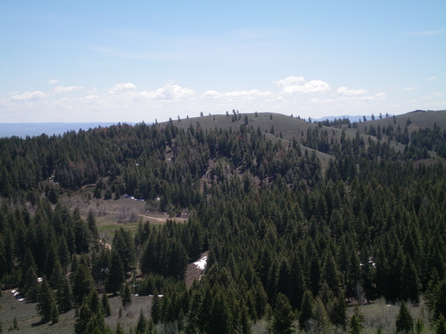
Peak 6783 as viewed from the northwest. Livingston Douglas Photo
Access
From its well-signed “trailhead,” drive up Chimney Creek Road for 4.0 miles to a “T” junction. Turn left/west onto [unsigned] FSR-007 and drive 0.9 miles west to a gated closure. Park here (6,520 feet). GPS coordinates: 43⁰25’28”N, 115⁰02’43”W.
North Gully/North Face, Class 2
The Climb
From the road closure gate, cross the gate and hike west then south on FSR-007 for about 0.3 miles to reach a dry gully on the north side of Peak 6783. Leave the road and bushwhack south up through the thickly-forested gully to quickly reach a saddle in an open area and an old, broken-down corral (what remains of it). There is an old 2-track road that comes up to this corral from FSR-007, so you can avoid the forest bushwhack by walking another 0.1-0.2 miles on FSR-007 to find this 2-track road (not shown on maps) and follow it to the corral. From the corral, bushwhack south up the face in a combination of sagebrush and scattered pines to reach the northeast ridge of Peak 6783 high up. Follow the easy ridge southwest to the rocky outcrop that is the summit. Surprisingly, the summit has a small cairn amidst the rocky boulders on the high point.
Northwest Shoulder/Northwest Face, Class 2
The Descent
From the summit, descend north then northwest on the sagebrush-covered ridge to reach a minor saddle and a road crossing (not shown on maps). Climb northwest up over a minor, lateral forested hump then descend northwest through thick pine forest with copious blowdown to reach the junction of FSR-007 and an unsigned jeep road. This junction is shown on the USGS topo map. From the road junction, follow FSR-007 west then north to reach the east side of open, obvious Peak 6885 and an unsigned road junction (not shown on maps). This concludes the first leg of this 2-peak adventure. Peak 6885 is up next.
Additional Resources
Regions: Soldier Mountains->WESTERN IDAHO
Mountain Range: Soldier Mountains
Longitude: -115.05101 Latitude: 43.41479