Elevation: 6,883 ft
Prominence: 583
This peak is not in the book. Published November 2020
Peak 6883 is an impressive behemoth that towers over Meadow Creek to its south in the Sublett Range. It is best climbed in combination with nearby Peak 6460. Peak 6883 is most easily climbed via its southeast ridge from a road junction along Meadow Creek Road. USGS Sublett Troughs
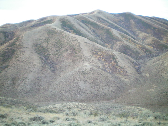
Peak 6883 is a behemoth as viewed from the east. The east ridge is left of center. The summit is the hump just right of center. Livingston Douglas Photo
Access
Same as for Peak 6460. This is the second leg of a two-peak adventure that begins at a road junction along Meadow Creek Road to the south.
Northeast Shoulder/East Ridge, Class 2
The Climb
From the road junction, hike about 100 yards west up a side road (shown on the USGS topo map) to reach the toe of a shoulder. Leave the road and bushwhack west through some thick sagebrush and other brush to reach the crest of the shoulder. Follow the shoulder southwest up easy short grass/scrub to reach the east ridge. Follow the ridge west to the summit on easy, open terrain. There is a game trail on the ridge crest for most of the shoulder and ridge climb. The summit of Peak 6883 has a nice cairn.
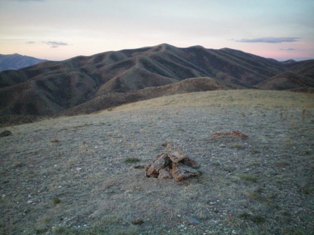
The summit of Peak 6460 with Peak 6883 in the background. Livingston Douglas Photo
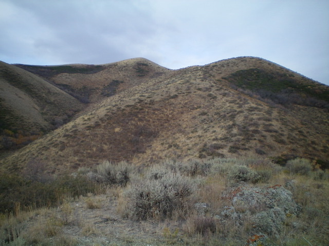
Peak 6883 (summit is the smaller hump left of center) as viewed from high on the southeast ridge. Livingston Douglas Photo
![The summit area of Peak 6883, looking northwest at the [lower] northwest summit (Point 6874). Livingston Douglas Photo](https://www.idahoaclimbingguide.com/wp-content/uploads/4D3B5427-0321-4D23-80A8-568617918B9F.jpeg)
The summit area of Peak 6883, looking northwest at the [lower] northwest summit (Point 6874). Livingston Douglas Photo
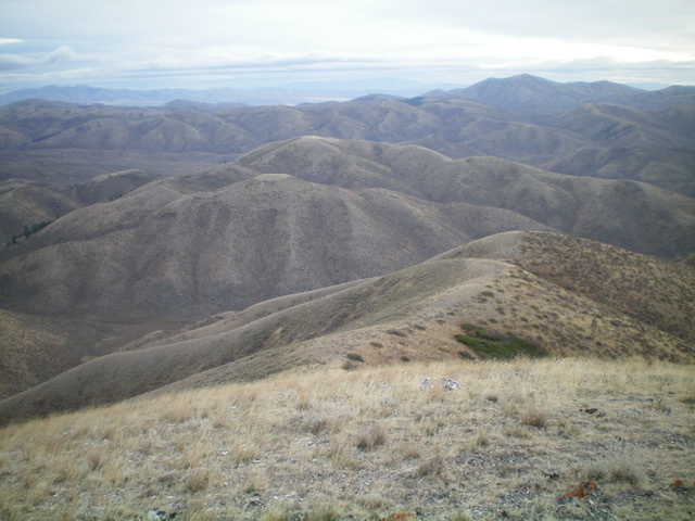
Looking down the east ridge (right of center) from the summit of Peak 6883. Peak 6460 is the second lateral ridge in the distance. Livingston Douglas Photo
Southeast Ridge, Class 2
The Descent
From the summit, descend the east ridge to a junction at 6,600 feet. Descend southeast on a well-defined ridge all the way down to the road junction at Meadow Creek Road and your parked vehicle. This ridge is mostly easy, open scrub/grass but there is a brushy section down low. The ridge weaves a bit and has a few minor humps to go over. Overall, it is a pleasant and straightforward way to return to Meadow Creek Road. There are some game/cattle trails to help in the brushy section near the road.
Additional Resources
Regions: SOUTHERN IDAHO->Sublett Range
Mountain Range: Sublett Range
Longitude: -112.97601 Latitude: 42.25109