Elevation: 6,885 ft
Prominence: 545
This peak is not in the book. Livingston Douglas added the East Face Route found below. Updated November 2022
Peak 6885 is located a little more than a mile west of the point where Chimney Creek Road reaches the Sawtooth National Forest boundary in the southern Soldier Mountains. Chimney Benchmark is the closest named point. Peak 6885 is roughly 2.5 miles south of this peak. USGS Deer Mountain
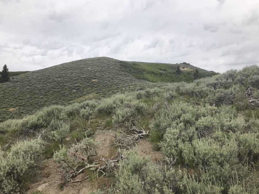
Peak 6885 as viewed from the south
Access
See the Southern Soldier Mountains Access page. From the top of Chimney Creek, follow FS-007 east for roughly a mile, cross through a gate and continue to the right turn southeast of the peak. Follow this road downhill to the first junction. Follow this road, 4WD recommended, to the saddle just south of the peak. Park here.
South Ridge, Class 2
From the saddle, climb the south ridge to the summit. It is 0.7 miles with 293 feet of elevation gain round trip. The only obstacle along the way is thick sagebrush.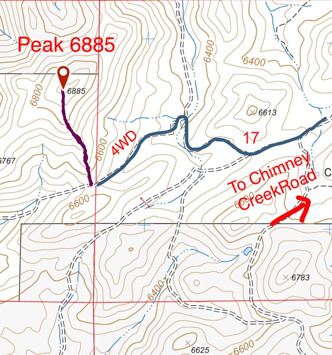
East Face, Class 2 by Livingston Douglas
The Climb
From the unsigned road junction on FSR-007 at the base of the east face, follow a 2-track road west (briefly) then leave it to climb directly west up through the thick sagebrush directly at the summit. Worse yet, there is a thick patch of aspens and willows high up to bash through. Once above that mess, skirt left/south to avoid a final patch of thick willows just below the summit, staying in open sagebrush. Scramble up the Class 2 summit boulders to reach the rocky outcrop that is the obvious high point of Peak 6885. There is a circular cairn inside the summit boulders.
Additional Resources
Regions: Soldier Mountains->WESTERN IDAHO
Mountain Range: Soldier Mountains
Year Climbed: 2019
Longitude: -115.06601 Latitude: 43.42389