Elevation: 6,890 ft
Prominence: 320
This peak is not in the book. Published November 2023
Peak 6890 is one of two rock-and-sagebrush hills located on the northeast side of Mahogany Hill (8,441 feet) in the Pahsimeroi Range. It is a rugged, rocky mountain with three distinct summits. The middle summit is the high point. USGS Mahogany Hill
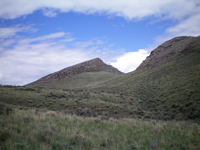
Peak 6890 and its hidden summit finally come into view. The south ridge (my ascent route) is the diagonal ridgeline left of center. Livingston Douglas Photo
Access
Same as for Peak 6558. This is the second leg of a 2-peak adventure that includes Peak 6558 and Peak 6890 which begins at a road junction along Doublespring Road in the Pahsimeroi Range.
Map Errors
Neither the National Forest Map nor the USGS topo map show two critical road segments (and junctions) for this climb.
South Ridge, Class 2
The Climb
From the 6,070-foot connecting saddle with Peak 6558, head west on an unmapped 2-track to its end at the mouth of a dry gully that heads west. Follow a cattle/game trail west then northwest up the left/south side of the gully to a point at which a rocky protrusion (shown on the USGS topo map) reaches the gully on its right/northeast side. The cattle/game trail disappears here but the sagebrush isn’t too bad.
Bushwhack northwest for another ½ mile to reach the base of the south ridge of Peak 6890, which becomes obvious as you approach it. Leave the gully and scramble north up the left/west side of a massive section of ridge slab rock then scramble up talus and boulders to reach the rocky summit. The summit of Peak 6890 has a large cairn. Return back to the 6,070-foot connecting saddle then follow 2-track jeep roads (all shown on the USGS topo map) back to Doublespring Road. This 2-peak journey covers 6.5 miles with 1,700 feet of elevation gain round trip.
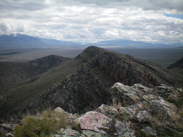
Summit view from atop Peak 6890, looking southeast. Point 6869 is in mid-ground. Livingston Douglas Photo

The large summit cairn atop Peak 6890. Livingston Douglas Photo
Additional Resources
Regions: EASTERN IDAHO->Lost River Range->Pahsimeroi Range
Mountain Range: Lost River Range
Longitude: -113.8502 Latitude: 44.4360