Elevation: 6,906 ft
Prominence: 406

This peak is not in the book. Published May 2020
Phoebe Peak is located southwest of Peak 6820 (Keyhole Mountain) on the massive Log Mountain/Deadwood Divide. USGS Teapot Mountain
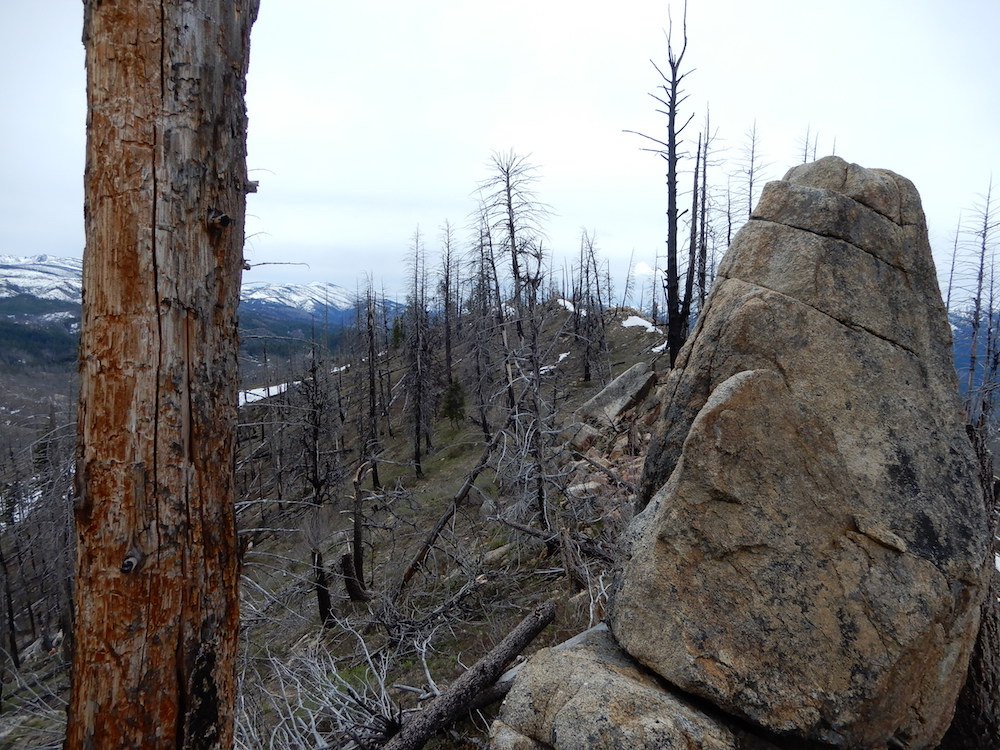
Phoebe Peak. The summit is the snag-covered point in the middle of the photo. John Platt Photo
Access
This peak is accessed via FST-090/Indian Ridge Trail [(C)(1.1)(b) on Page 139]. This well-maintained trail leaves the South Fork Salmon River Road at the Krassel Guard Station which is located 27.0 miles south of the Warm Lake Highway. Hike the trail to the peak’s north ridge in roughly 4.3 miles. Please keep in mind that any hike out of the South Fork Salmon River Canyon requires a massive elevation gain.
North Ridge, Class 2
Leave the trail at the point that it crosses the peak’s north ridge and hike to the top. Use the link below to read John Platt’s trip report for additional details.
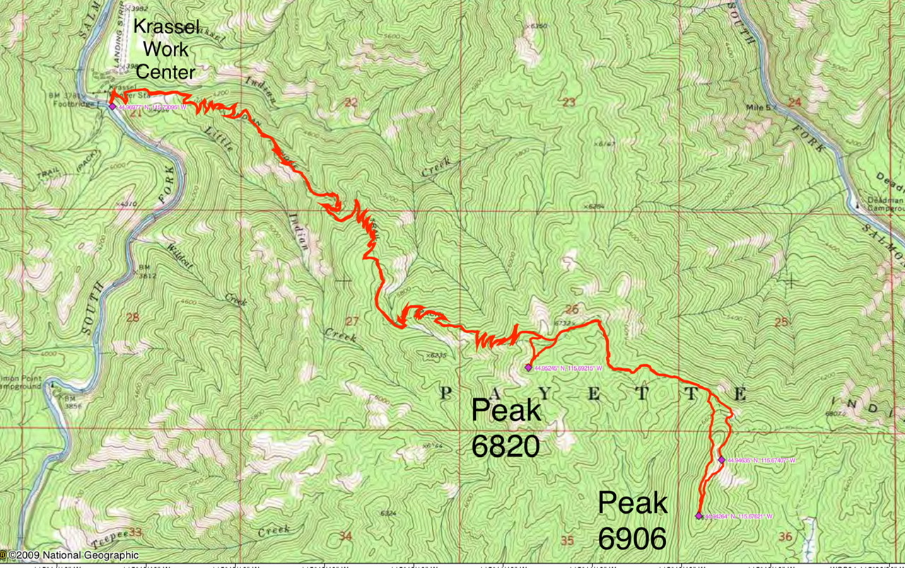
John Platt’s GPS track for Keyhole Mountain and Phoebe Peak. This round-trip route covers 13.9 miles with over 4,800 feet of elevation gain.
Additional Resources
Regions: Central Salmon River Mountains->Log Mountain - Deadwood Divide Peaks->Salmon River Mountains->WESTERN IDAHO
Mountain Range: Central Salmon River Mountains
Longitude: -115.67609 Latitude: 44.94259