Elevation: 6,955 ft
Prominence: 415
This peak is not in the book. Published January 2023
Peak 6955 is sandwiched between Heydlauff Canyon and Sager Canyon deep in the Sublett Range. This is the second leg of a 2-peak adventure that includes Peak 7155 and Peak 6955. The journey covers 6.0 miles with 2,425 feet of elevation gain round trip. USGS Sublett Troughs
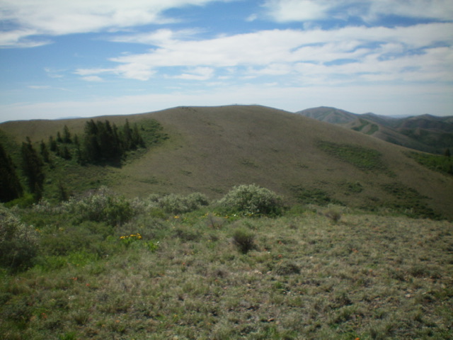
The summit hump of Peak 6955 as viewed from the [lower] northwest summit. Livingston Douglas Photo
Access
Same as for Peak 7155. This is the final leg of a 2-peak journey.
North Ridge—West, Class 2
The Climb
From the crossing of Heydlauff Canyon, bushwhack left/southeast up through the brushy pine forest to reach open scrub higher up. This is a steep face scramble up onto the magnificent, easy scrub/grass of the crest of the north ridge—west of Peak 6955. Yes, Peak 6955 has TWO north ridges. Follow the ridge crest south to the cairned northwest summit. No, this is not the true summit.
The true summit (which is only 15 feet higher) lies to the southeast and requires a 125-foot vertical descent to a brushy saddle to get there. Look for paths/gaps in the sagebrush and other brush to make this ridge descent go easier. Once at the saddle, the climb southeast then south to the true summit of Peak 6955 is quite easy on short scrub and broken scree. The summit has a decent cairn.
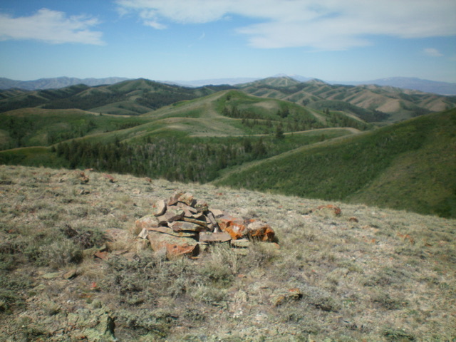
The summit cairn atop Peak 6955. Livingston Douglas Photo
West Ridge/West Gully, Class 2
The Descent
From the summit, return to the northwest summit then head southwest to the west summit. Yes, there is a third summit hump. A thick short patch of aspens makes it difficult to reach its rocky top. If you skirt the north side of the west summit, you still must bash through a patch of thick aspens there. Once atop the west summit, the terrain is much more open and easier. From the west summit, descend northwest on an open scrub ridge then do a diagonal descent west-northwest to drop to a drainage to the west. This dry drainage leads back to FSR-563 and your parked vehicle.
The descent down the drainage/gully is steep and somewhat loose, with scrub that is sometimes a bit tedious. Once you reach the forested gully, descend its forested center (or sidehill on angled scrub to avoid the forest) as it heads north then northwest then west. Alternate between the forested center of the narrow gully and the angled scrub on the steep sides as the terrain dictates. Farther down the gully, find a footpath of sorts to finish off the gully descent. The footpath turns into an old 2-track which leads past a corral and quickly down to FSR-563 and your parked vehicle.
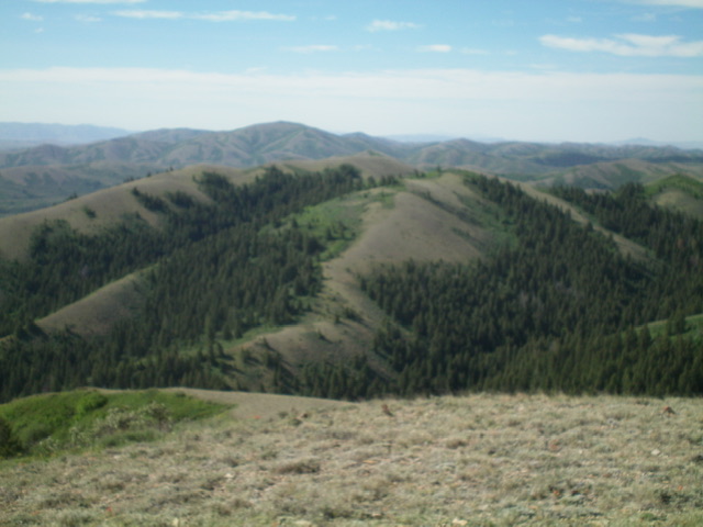
Peak 6955 (mid-ground) with its two north ridges. The north ridge west is dead center (my ascent route). The north ridge east is left of center and rises diagonally rightward in the photo. Livingston Douglas Photo
Additional Resources
Regions: SOUTHERN IDAHO->Sublett Range
Mountain Range: Sublett Range
Longitude: -112.9139 Latitude: 42.31179