Elevation: 7,155 ft
Prominence: 695
This peak is not in the book. Livingston Douglas added two new routes to this entry. His routes are set out farther down the page. Updated January 2023
This peak is located southeast of the abandoned Sublett Guard Station. The name Heydlauff Peak was chosen by Rick Baugher to honor John Heydlauff, an early settler in the Rockland Valley. Rick’s trip report linked below provides the history behind the name. USGS Sublett Troughs
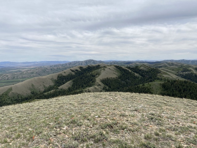
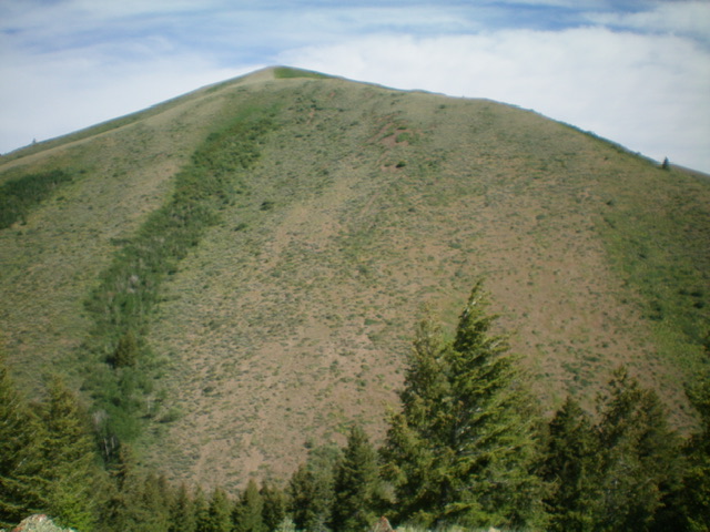
The view from the summit
Access
There is good primary road access to this peak from both the east or west. Google Maps provides good directions to most points in Sawtooth National Forest portion of the Sublett Range.
From the east and ID-37, take Hartley Canyon Road/FSR-578 west to Hartley Pass. From the west, access Hartley Pass from North Heglar Canyon/South Summit Canyon Road/FSR-565. This road is the primary north-south route through the Sublett Range. Both ends of the road are accessed from I-84. To reach it from the north, leave the freeway at Exit 228. Head east on East Yale Road for 8.7 miles and then turn onto North Helgar Canyon Road. This road becomes FSR-565 when it reaches the National Forest Boundary. The southern approach leaves I-84 at Exit 245. From the freeway, turn east and follow the road east/southeast into the mountains for 11.0 miles to Sublett Reservoir. This road becomes FSR-565 when it reaches the National Forest Boundary.
Whichever way you go on FSR-565, follow it to the site of the abandoned Sublett Guard Station. Turn west at the guard station onto FSR-582 and follow it for 3.7 miles to a saddle on the peak’s west slopes. Park here. 
West Face, Class 2
Climb the steep motorcycle trail up the west face to the summit. This short climb covers 0.5 miles with 330 feet of elevation gain.
West Ridge and Southeast Ridge/South Face Routes by Livingston Douglas
Peak 7155 is located at the head of Elbow Canyon in the Sublett Range. This is the first leg of a 2-peak adventure that includes Peak 7155 and Peak 6955. The journey covers 6.0 miles with 2,425 feet of elevation gain round trip.
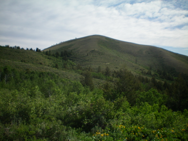
Peak 7155 as viewed from the southwest. Livingston Douglas Photo
Access
From Exit 245 (Malta/Sublett) on I-84, drive southeast on Sublett Road. Continue on the road as it bends east then north and passes the west side of Sublett Reservoir. At 10.0 miles, reach a signed junction with Lake Fork Road/FSR-564 at the northwest end of the reservoir. Turn right/east here onto FSR-565 and reset your odometer. At 2.9 miles, reach a signed junction with FSR-563. Go right onto FSR-563 and drive 3.4 miles to an unsigned junction with a 2-track road heading left/east up a dry gully. Park here (5,910 feet). This side road is not shown on maps and does not go very far up the dry gully.
West Ridge, Class 2
The Climb
From the road junction, hike a short distance east up the 2-track road to a corral. Leave the road and scramble left/north up a steep hillside of grass and sagebrush to reach the crest of the southwest spur of the south ridge of Point 6862. Follow the scrub-covered ridge (a bit thick and tedious early on) east then northeast then north to reach the south ridge of Point 6862. The scrub is short and easy now. Continue north then east to the top of Point 6862, staying in open scrub and avoiding the thick brush and forest to the right/east.
From the open top of Point 6862, follow the ridge crest east on an old cattle trail (then on remnants of an old road) to breeze through thick, tall sagebrush and other brush and quickly reach the saddle (and jeep road crossing) at the base of the open, easy scrub of the west ridge/face of Peak 7155. Hike east up an old 2-track (now just a footpath) to the summit. The summit of Peak 7155 has a decent cairn with a post laying on the ground nearby. I rebuilt the cairn and stuck the post in it.
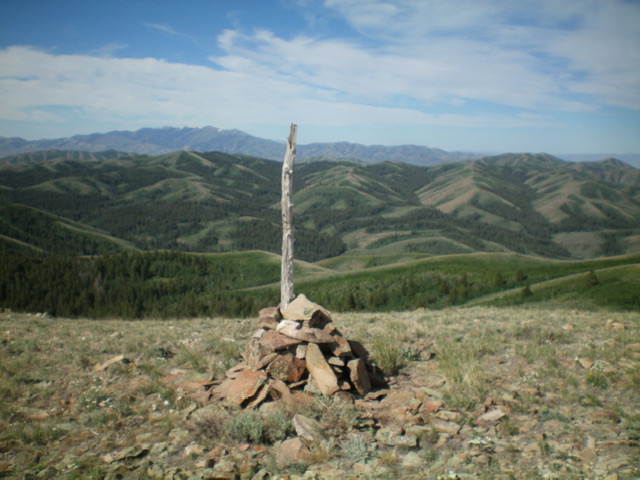
The summit cairn atop Peak 7155 with a sea of Subletts in mid-ground and the Black Pine Mountains in the far distance. Livingston Douglas Photo
Southeast Ridge/South Face, Class 2
The Descent
From the summit, descend southeast down the open scrub ridgeline to a shoulder that drops right/south to Heydlauff Canyon, a prominent drainage with a jeep road passing through it (as shown on maps). The descent down the south face (on the shoulder) is on steep, loose shale and scrub, so proceed slowly. Aim to reach the canyon at the base of a ridge that heads south up to Peak 6955. This canyon crossing is the conclusion of the first leg of today’s 2-peak journey. Peak 6955 is up next.
The steep south face and southeast ridge (right skyline) of Peak 7155. Livingston Douglas Photo
Additional Resources
Regions: SOUTHERN IDAHO->Sublett Range
Mountain Range: Sublett Range
Year Climbed: 2021
Longitude: -112.92409 Latitude: 42.32901