Elevation: 6,984 ft
Prominence: 334
This peak is not in the book. Published December 2020
Peak 6984 is a forested hump located north of Kilgore, ID. Combining this peak with nearby Peak 7496 makes for a good two-peak outing of two ranked Centennial mountains. This area is a mix of private and public land so be careful of the specific line that you take. The summit area of Peak 6984 is on private land but I encountered no fencing, signage, or orange paint. USGS Kilgore
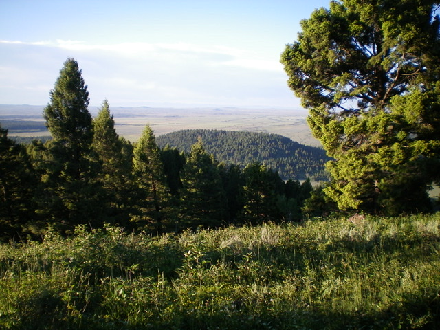
Peak 6984 (forested hump in dead center) as seen from the southeast ridge of Peak 7496. Livingston Douglas Photo
Access
Same as for Peak 7496. This is the final leg of a two-peak journey.
North Face, Class 2
The Climb
From cattle fence row juncture just south of the 6,650-foot connecting saddle with Peak 7496, jump the east-west cattle fence and bushwhack south up an open scrub slope (a bit tedious but short-lived) to reach an open pine forest. Bushwhack up through this easy forest with short veg brushing your feet. Reach the summit ridge at Point 6960+ (the west summit) then cruise east through easy, open pine forest to reach the true summit (6,984 feet). There was nothing on top so I built a small cairn with the few loose rocks that I could find. Summit views are limited but there is a partial view of Button Butte to the north.
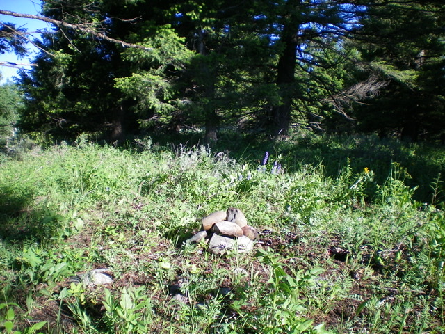
The newly-built summit cairn atop Peak 6984. Livingston Douglas Photo
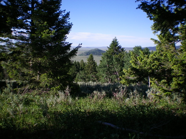
View of Button Butte (forested hump in dead center) from the summit of Peak 6984. Livingston Douglas Photo
Northeast Face, Class 2
The Descent
From the summit, descend northeast through thick brush/blowdown and dense pine forest on a rounded, ill-defined shoulder to reach the sagebrush on the valley floor just west of Cottonwood Creek Road. This forest bushwhack is punishing in contrast to the joyful bushwhack up the north face. You will be relieved to reach the easier sagebrush terrain below. Stay left/west of any fences here because there is private property (and a few homes/ranches) on the west side of Cottonwood Creek Road. If you come out of the forest and reach a jeep road, follow it north until it ends. Then follow a foot path on the left/west side of a cattle fence to reach National Forest land. Bushwhack a short distance right/east to reach Cottonwood Creek Road. Follow the road north about 0.5 miles to the bridge crossing and the parking pullout from whence this journey began.
Additional Resources
Regions: Centennial Range->EASTERN IDAHO
Mountain Range: Centennial Range
Longitude: -111.90320 Latitude: 44.46929