Elevation: 7,042 ft
Prominence: 302
This peak is not in the book. Published November 2020
Peak 7042 is one of two ranked summits located on north side of Kepps Crossing Road above Tex Creek. This peak barely makes it as a ranked summit with only 302 feet of prominence. It is way back in and is not visible from Kepps Crossing Road. This two-peak journey is a 100% bushwhack. The USGS map shows an old jeep road descending a side gully to Tex Creek from the west flanks of Peak 7042. However, this road no longer exists. USGS Point Lookout
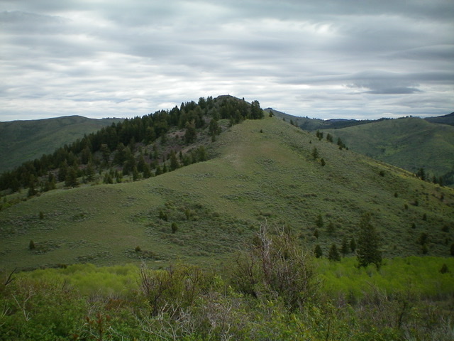
Peak 7042 (dead center) as viewed from Point 6972 to its southwest. The gentle, upper southwest ridge is coming at the camera. Livingston Douglas Photo
Access
Same as for Peak 7283. This is the final leg of a two-peak journey.
Upper Southwest Ridge, Class 2
The Climb
From the connecting saddle with Peak 7283, follow a fence row (only posts remain) northwest up Point 6972 to pick up another fence row (only posts remain) heading right/northeast down to a saddle at the base of the upper southwest ridge of Peak 7042. Be sure to stay above the aspens in the nearby gully to avoid complications. From the final saddle, scramble northeast up short field grass/scrub to the summit. There was a modest torn-down cairn on top so I rebuilt it.
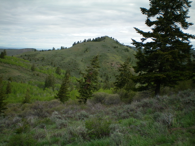
Peak 7042 as viewed from the northwest ridge of Peak 7283 to its south. Livingston Douglas Photo
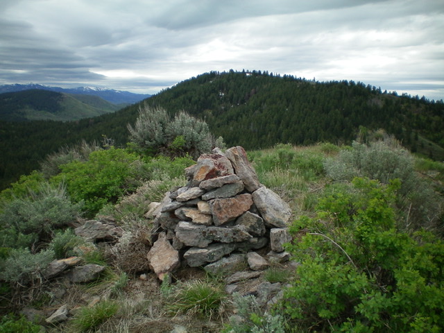
The newly-rebuilt summit cairn atop Peak 7042 with Peak 7283 in the background. Livingston Douglas Photo
Southwest Ridge/Southwest Gully, Class 2
The Descent
Descend southwest to the saddle at the base of the upper southwest ridge. Follow a fence row (only metal posts remain) southwest up the top of Point 6972. Descend a ridge line northwest to just past a nasty gully on the left/west side of the ridge to reach an open shoulder that heads left/southwest on the north side of the aforementioned gully. This shoulder descends to an obvious, wide drainage. This drainage is your ticket back to the Tex Creek drainage.
Follow the right/north side of this drainage on easy field grass down to a narrow gorge of sorts. At this point, cross to the left/south side of the drainage and jump a small creek to follow an old cattle trail that eventually moves back to the right/north side of the small creek below the gorge. As you approach the merger with Tex Creek, the cattle trail moves back to the left/south side of the small creek. Tex Creek is ugly here: it’s not a small creek, it has tall willows all around it, and it has wide, deep pools of water mixed in. Move upstream (south) to quickly find a beaver dam to cross Tex Creek. Thank God for beavers!
Once across Tex Creek, follow an old cattle trail on the right/west side of Tex Creek to the first side gully heading right/southwest. Leave the cattle trail and climb up easy grass/scrub (initially) then thicker brush/sagebrush higher up. The gully ends and you must climb left/south up to a flat, grassy area near Point 6342. From here, descend southward to Kepps Crossing Road and walk a short distance back to the parking pullout at the base of the dry gully from which this adventure began a few hours earlier.
Additional Resources
Regions: Caribou Range->SOUTHERN IDAHO
Mountain Range: Caribou Range
Longitude: -111.59979 Latitude: 43.41609