Elevation: 7,092 ft
Prominence: 568
This peak is not in the book. Published January 2023
Peak 7092 is a ridgeline summit that separates Wood Canyon from Sheep Creek in the Pleasantview Hills. It is easily reached via BLM-611 and an unofficial 2-track road that heads all the way to the open summit area. This area is a mix of private and public land, so be careful. This hike is entirely on BLM land. USGS Sheep Creek Spring
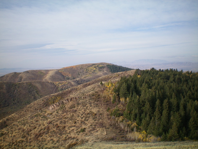
Peak 7092 (dead center in distance) as viewed from Peak 7161 to its northeast. Livingston Douglas Photo
Access
From ID-38 exactly 4.2 miles east of the major highway junction at the west end of Holbrook, drive north on [signed] Arbon Valley Road for 1.9 miles. Turn right/east onto [signed] 1000N which becomes Wood Canyon Road/BLM-610. Reset your odometer here. At 1.5 miles, the smooth road leaves the Curlew National Grassland and enters BLM land. The road is now a narrow, 2-track road that gets progressively worse. It is rocky and badly rutted. At 4.1 miles, reach a signed junction at a corral. Park here (5,740 feet). BLM-611 heads left/north from this junction.
Map Errors
There is no National Forest map for this area. The USGS topo map fails to show many of the old 2-track roads on the ridges in this area, two of which were very helpful in this 3-peak adventure that includes Peak 7092, Peak 7161, and Pleasantview Hills HP (John Evans Mountain).
East Ridge, Class 1
The Climb
From the road junction, hike (or drive) north up BLM-611 for about 1.5 miles to a road crest at Saddle 6524. There is a cattle guard and cattle fence here. Leave BLM-611 here and hike left/southwest then west up an old 2-track road that is now overgrown with tall grass higher up. This old 2-track follows a fence row all the way to the barren, open summit area of Peak 7092. The summit has a tall cairn and offers magnificent views of the surrounding peaks and valleys. From the summit, return to Saddle 6524. This is the connecting saddle with Peak 7161 and concludes the first leg of today’s 3-peak adventure. Peak 7161 is up next.
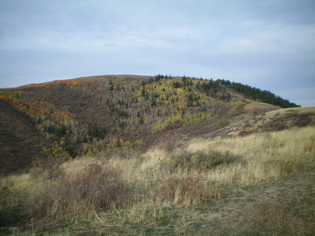
Peak 7092 as viewed from partway up the east ridge. The east ridge is right of center and the summit is in dead center. Livingston Douglas Photo
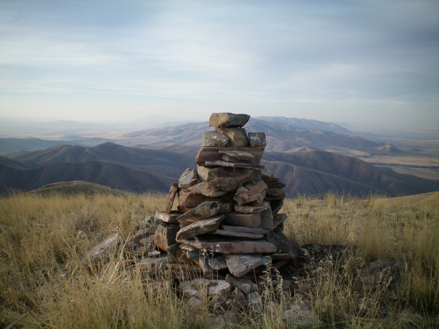
The tall summit cairn atop Peak 7092. Livingston Douglas Photo
Additional Resources
Regions: Pleasantview Hills->SOUTHERN IDAHO
Mountain Range: Pleasantview Hills
Longitude: -112.53579 Latitude: 42.22449