Elevation: 7,100 ft
Prominence: 640
This peak is not in the book. Published November 2023
Peak 7100 is a seldom-climbed, somewhat-remote summit that sits above both Cherry Creek and Spring Gulch in the Eastern Salmon River Mountains southwest of Ellis. It is most easily reached from an old trail in Spring Gulch via its west face and south ridge. USGS Gooseberry Creek
The elusive summit hump of Peak 7100 as viewed from the east summit. Livingston Douglas Photo
Access
Same as for Peak 6179. This is the second leg of a 2-peak adventure that covers Peak 6179 and Peak 7100. It covers 9.5 miles with 3,600 feet of elevation gain round trip and begins at an old bridge crossing of the Salmon River.
East Ridge, Class 2
The Climb
The 5,780-foot connecting saddle with Peak 6179 is the base of the meandering east ridge of Peak 7100. From the saddle, follow the easy ridge of short scrub and stable scree/gravel as it heads southwest. The ridge wiggles a bit and undulates as well to make a final, short right/west push to the top of Point 6737. Point 6737 is at a “T” junction on a high ridge. A 2-track road (weak initially) heads along the ridge crest almost all the way to Peak 7100. It dies out about 100-200 yards below the summit hump.
Follow the old 2-track road until it ends then bushwhack up easy scrub to the summit of Peak 7100. It is a tedious three miles from Point 6737 to Peak 7100. It has endless undulations and false summits. The summit hump of Peak 7100 does not come into view until you scale the [lower] east summit hump. The summit of Peak 7100 had no cairn so I built one.
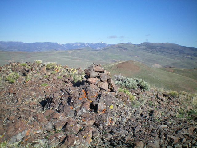
The newly-built summit cairn atop Peak 7100. Livingston Douglas Photo
East Ridge Variation, Class 2
The Descent
From the summit, return east-southeast on the ridge crest to Saddle 6614. From the saddle, angle east up onto a shoulder that heads northeast. Descend this shoulder to about 6,100 feet then bushwhack east to cross a gully and reach the east ridge at a saddle just southwest of Point 6017. Follow the east ridge back to the connecting ridge with Peak 6179. This variation avoids some ups and downs but is probably slightly longer than the standard east ridge route and probably isn’t worth the effort.
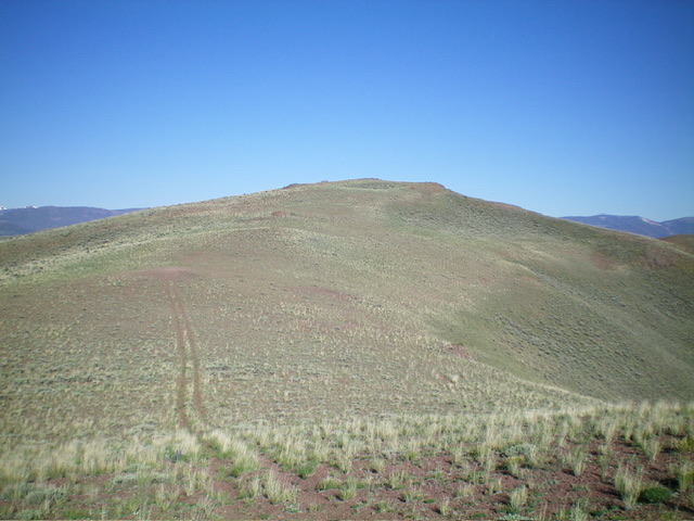
View of Peak 7100 (in dead center) from Peak 6179. The ridge traverse is over three miles and heads from right of center up a ridge going diagonally left then turns right to follow the ridge crest in the distance to reach the [false] east summit hump. The true summit hump is not yet visible. Livingston Douglas Photo
Additional Resources
Regions: Eastern Salmon River Mountains->Salmon River Mountains->Southeast Corner Peaks->WESTERN IDAHO
Mountain Range: Eastern Salmon River Mountains
Longitude: -114.1436 Latitude: 44.6749