Elevation: 7,138 ft
Prominence: 838
This peak is not in the book. Published January 2023
Peak 7138 is located on the north side of Cold Spring Canyon. It is most easily reached from the south via Cold Spring Canyon Road (1825S Road) and a 2-track that heads north up a gully from that road. This is the first leg of a 2-peak adventure that includes Peak 7138 and Peak 7060. This journey covers 5.5 miles with 2,025 feet of elevation gain round trip. USGS Sublett Reservoir
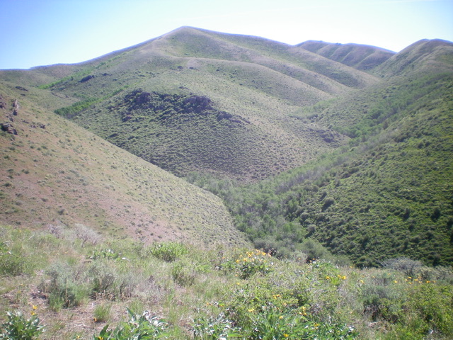
Peak 7138 and its southwest ridge (left of center), my ascent route. Livingston Douglas Photo
Access
From Exit 254 (Sweetzer Road) on I-84, drive 0.1 miles east to the frontage road (signed as Meadow Creek Road). Turn left/north onto Meadow Creek Road and drive 3.3 miles to a signed junction at an underpass. Turn right/east onto 1850S Road and drive 0.3 miles to a signed junction with 1825S Road (Cold Spring Canyon Road). Turn right/east onto Cold Spring Canyon Road and drive 5.4 miles to an unsigned junction and a large water tank (shown on the USGS topo map). Park near the water tank on the right/south side of the road (5,535 feet).
Southwest Ridge, Class 2
The Climb
From the water tank, walk a short distance down Cold Spring Canyon Road to the unsigned road junction. Leave Cold Spring Canyon Road and hike up an overgrown, grassy 2-track road that follows a dry gulch north then northeast for a total of 1.2 miles to its end in a small meadow at a fork in the canyon. Bear right/northeast at an unsigned junction early on. This 2-track road is drivable.
From the end of the 2-track road, bash straight/northeast up through a very thick gully (trees/bushes) to reach an obvious rock-and-scrub shoulder just over 0.1 miles away. Stay up and right of the dense gully on angled sagebrush/scrub that is no picnic either. Reach the base of the steep shoulder at another fork in the canyon. Cross the dry, thick drainage to reach the steep scrub of the shoulder. This shoulder is the base of the southwest ridge of Peak 7138.
The first 200 vertical feet of this ridge (from 6,200 feet to 6,400 feet) is steep and has some boulders and rocky outcrops to navigate (with brush mixed in) but it’s not too bad. Higher up, the ridge terrain becomes a combination of boulders/outcrops and brush but that soon gives way to short scrub and broken scree—absolute BLISS! Follow the easy, open ridge to the gentle, small summit of Peak 7138. The summit has a small cairn and a magnificent view of Sublett Reservoir and Peak 7060 to the west.
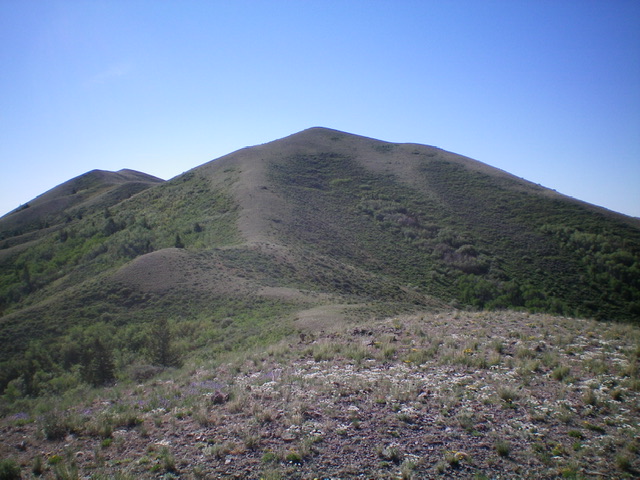
Looking up the west ridge (my descent route) at the summit hump of Peak 7138. Livingston Douglas Photo
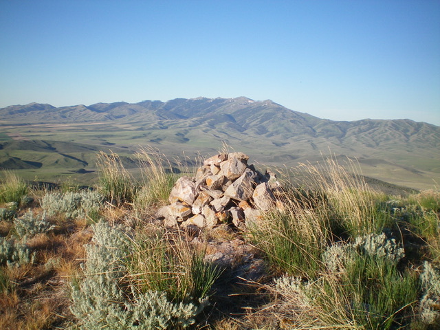
The enlarged cairn atop Peak 7138 with the Black Pine Mountains in the distance. Livingston Douglas Photo
West Ridge, Class 2
The Descent
From the summit, descend west-northwest on the easy scrub and broken scree of the undulating ridge crest to reach the 6,780-foot connecting saddle with Peak 7060. This concludes the first leg of today’s 2-peak journey. Peak 7060 is up next.
Additional Resources
Regions: SOUTHERN IDAHO->Sublett Range
Mountain Range: Sublett Range
Longitude: -113.01701 Latitude: 42.29001