Elevation: 7,342 ft
Prominence: 442
This peak is not in the book. Published November 2023
Peak 7342 is a seldom-climbed summit that is located northeast of Ulysses Mountain (7,649 feet) on a high ridge. It is most easily reached via a ridge road (FSR-005) on its west side. USGS Ulysses Mountain
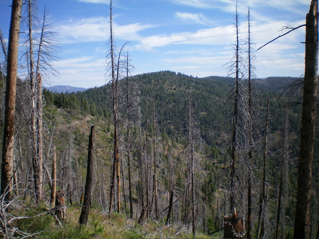
Peak 7342 (in mid-ground) as viewed from the southwest. Livingston Douglas Photo
Access
From US-93 at North Fork, drive west on FSR-030/Salmon River Road for 7.7 miles to an unsigned junction with FSR-005/Sage Creek Road. Turn right/east onto FSR-005 and drive 3.0 miles to a signed junction with FSR-164. Park at this junction on FSR-005 in a large pullout area just up from the junction (5,170 feet).
This is the first leg of a 2-peak adventure that includes Peak 7342 and Ulysses Mountain (7,649 feet). It covers 9.0 miles with 3,075 feet of elevation gain round trip. This route can be significantly shortened if you are able to drive farther up FSR-005/Sage Creek Road. You will need a 4WD vehicle with good tires to navigate the steeper and rockier sections of FSR-005, particularly a rocky/rutted section at 5,800-5,850 feet.
Map Errors
There are numerous old, overgrown logging roads in this area that are not shown on maps. The USGS topo map shows a spurious section of FSR-443 that no longer exists. The USGS topo map incorrectly shows FSR-005 heading up the East Fork Sage Creek from its junction with FSR-164 but no such road exists. The USGS topo map shows two spurious, non-existent roads that go right/north from FSR-005 high up. The Salmon National Forest map does a much better job of showing theroads in this area.
West Face/Southwest Ridge, Class 2
The Climb
From the roadside pullout near the junction of FSR-005 and FSR-164, hike north up FSR-005 (with its many switchbacks and wiggles) for about 3-1/2 miles to reach an unsigned “T” junction on the high ridge crest at a saddle (6,900 feet). FSR-005 continues right/northeast from here. FSR-163/Ulysses Mountain Lookout Road heads left/southwest from here.
Follow FSR-005 northeast then north as it skirts the west face of Peak 7342 and passes two ridge humps along the way. Leave the road about ½ mile from the aforementioned junction where the road begins to descend northward. Bushwhack diagonally right/northeast through a clearcut area on the west face. The terrain here is a mix of cut tree stumps, downed trees/logs, and brush. Cross two or three old logging road beds and wrestle with thick willows that surround them as you head to the crest of the southwest ridge at a saddle (7,180 feet).
From the wide saddle, bushwhack northeast through thick vegetation and lots of deadfall to reach the summit of Peak 7342. As the USGS topo map suggests, the high point is at the west end of the semi-open summit area. There was a small, torn-down cairn on top so I built a nice cairn to replace it. The summit offers some decent views of the surrounding area. Return to FSR-005 and head ½ mile southwest back to the unsigned road junction with FSR-163/Ulysses Mountain Lookout Road. This concludes the first leg of today’s 2-peak adventure. Ulysses Mountain (7,649 feet) is up next.
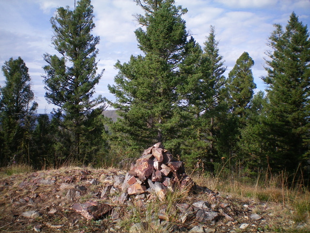
The newly-built summit cairn atop Peak 7342. Livingston Douglas Photo
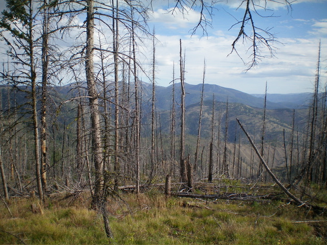
Summit view from atop Peak 7342. Livingston Douglas Photo
Additional Resources
Regions: Bitterroot Mountains->NORTHERN IDAHO
Mountain Range: Bitterroot Mountains
Longitude: -114.0809 Latitude: 45.4499