Elevation: 7,423 ft
Prominence: 283

This peak is not in the book. Published December 2020
Peak 7423 is located in the Western Centennials above Porcupine Pass (7,062 feet). It is one of three humps of similar height that are south or east of the pass and are close to each other: Peak 7496, Point 7388, and Peak 7429. This area is thickly forested and navigation can be an issue so don’t take it lightly even though the peaks are only 7ers. USGS Lookout Point
Peak 7423 (forested hump in center) as viewed from the northeast. Livingston Douglas Photo
Access
Same as for Peak 7496. This is the second leg of a 2-peak journey.
Southwest Face, Class 2
The Climb
From the 7,140-foot connecting saddle (an open meadow), hike east across the grass/sagebrush meadow (weaving as necessary) to enter the forest on a cattle trail. Head southeast then east, using cattle trails as available, in easy, open pine forest to reach the forested (but semi-logged) summit of Peak 7423. There was nothing on top and no rocks with which to build a summit cairn.
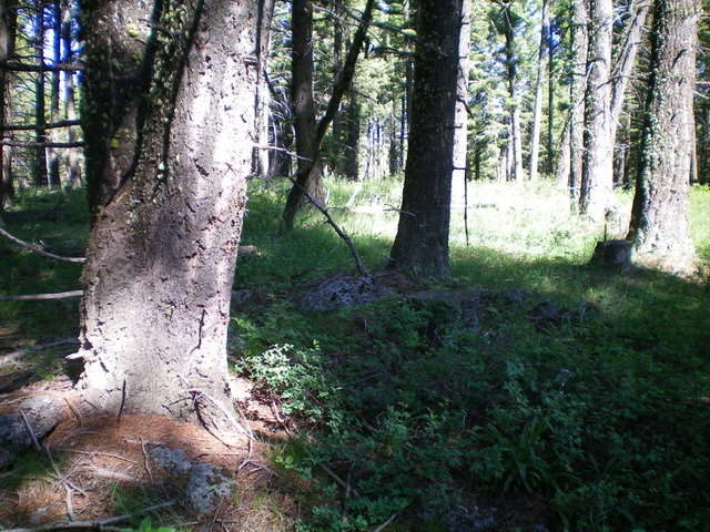
The forested summit of Peak 7423. The large tree at far left is probably the high point. Livingston Douglas Photo
West Face, Class 2
The Descent
From the summit, descend west through a somewhat dense pine forest to reach an old road that drops left/northwest to a dispersed campsite. Go right/northeast here and follow a jeep road northeast, following a drainage. At an unsigned junction, go right/east on a jeep road to leave the drainage area and descend to the valley floor. The road jogs left/northeast to reach a junction with West Camas Creek Road. Hike 2.1 miles west up the road to return to Porcupine Pass and your parked vehicle.
Additional Resources
Regions: Centennial Range->EASTERN IDAHO
Mountain Range: Centennial Range
Longitude: -112.08981 Latitude: 44.47229