Elevation: 7,442 ft
Prominence: 382
This peak is not in the book. Livingston Douglas contributed additional commentary and photos. Updated December 2020
Peak 7442 is the lowest of the seven peaks surrounding the Sage Creek drainage in the Northern Boulder Mountains. The view of the peaks surrounding the Sage Creek drainage (including Jerry Peak) from the summit is a good reason to climb this peak. USGS Jerry Peak
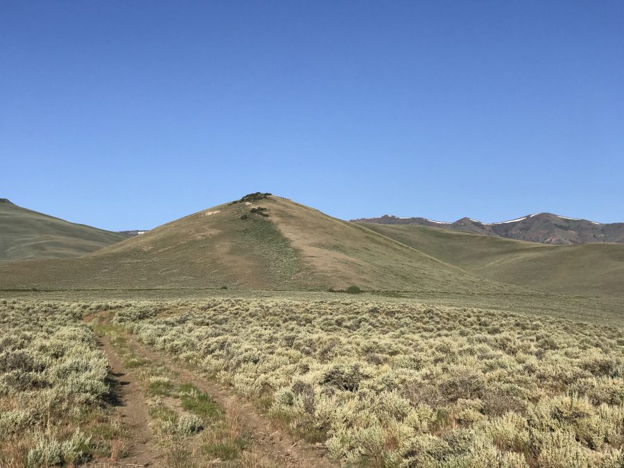
Peak 7442 as viewed from the northeast
Access
A combination of two roads, Dry Gulch Road [(D)(2) on Page 243] and Walker Way, parallel US-93 through the Northern Boulder Mountains. The two roads meet at the crossing of Road Creek at an elevation of 7,530 feet. Walker Way continues west at this point and eventually reaches the East Fork Salmon River. Walker Way leaves Trail Creek Road [(B) on Page 242] 4.7 miles west of US-93. Dry Gulch Road leaves US-93 18.2 miles south of the US-93/ID-75 junction. For Peak 7442, follow this road system until you are east of the peak. Turn west onto a 2-track road and drive as far as you can toward the peak. See map below.
East Slopes, Class 2
A 4WD 2-track leads from Walker Way to an irrigation canal northeast of the summit. From this point, make the easy crossing of the canal and climb southwest to the summit. Round trip stats: 0.7 miles with 488 feet of elevation gain. Livingston Douglas adds the following comments: “I respectfully disagree that the aqueduct is an “easy crossing.” I couldn’t jump it so I had to move left/east to find a clump of willows where it narrowed and I was able to jump it…and then target those willows on the descent to get back across it. I HATE aqueducts. But I didn’t follow the same line that you did. You came up the northeast side of the peak. I came up a bit left/west of your line and had more of a north line.”
Livingston’s northeast shoulder variation: “I stayed in the open scrub (quite visible on the photo) on the right side of the shoulder to cruise to the top.”
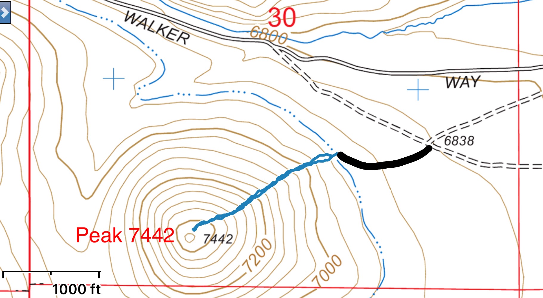
My GPS track in blue. The black line is for a two-track road that I followed from the Walker Way Road to reach my starting point.
Peak 7442 and its magnificent northeast shoulder (left side of photo) as viewed from Walker Way to the north. Livingston Douglas Photo
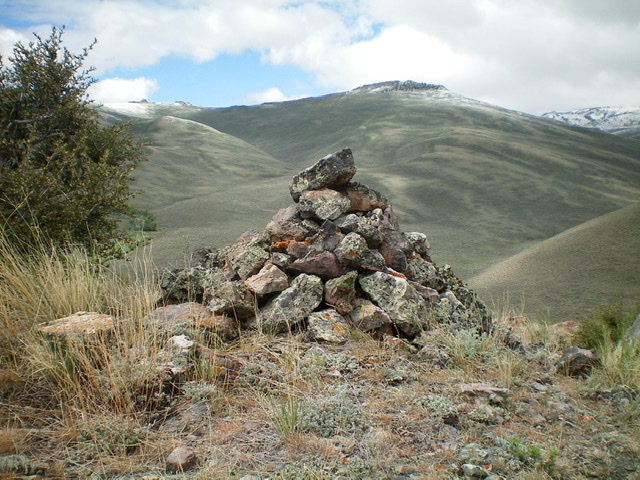
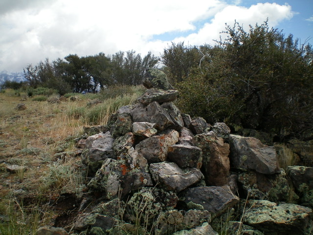
The large summit cairn atop Peak 7442, looking southwest. Livingston Douglas Photo
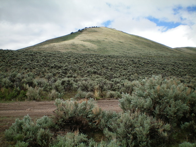
The semi-open summit of Peak 7442. Livingston Douglas Photo
Additional Resources
Regions: Boulder Mountains->EASTERN IDAHO
Mountain Range: Boulder Mountains
Year Climbed: 2019
Longitude: -114.02439 Latitude: 44.07479