Elevation: 7,466 ft
Prominence: 406
This peak is not in the book. Published January 2023
Peak 7466 sits above Mahogany Basin in the Bear River Range. It separates Liberty Creek from Mill Creek. Peak 7466 is most easily climbed via its south ridge from FSR-939. USGS Midnight Mountain
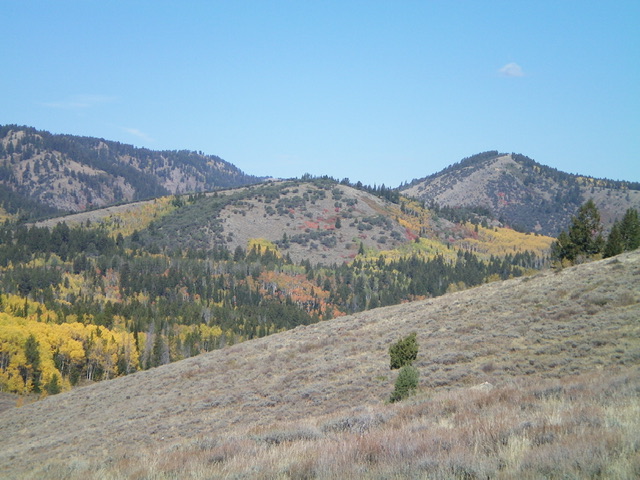
Peak 7466 (the hump in mid-ground) as viewed from Mill Canyon Road to its southeast. Livingston Douglas Photo
Access
Same as for Peak 7924. This is the second leg of a 2-peak adventure that includes Peak 7924 and Peak 7466.
West Face/South Ridge, Class 2
The Climb
The low point in the traverse from Peak 7924 to Peak 7466 is the bridge crossing of Liberty Creek on FST-309. From the bridge crossing, hike south up FST-309 (an ATV trail) through a thick pine forest and cross another footbridge. Just after this second bridge crossing, the trail emerges into open terrain. Leave the trail here and bushwhack east up through reasonable sagebrush to reach a north-south ridge with a 2-track road on its crest.
Follow this 2-track north to about 30 yards from its end. Leave the 2-track and bushwhack right/east through a patch of pine forest to quickly reach, and cross, a dry drainage at a saddle-like area. Scramble east up a steep sagebrush slope to reach the mahogany-studded south ridge. Follow the semi-open ridge north then northeast on scrub and grass to reach the semi-open ridgeline summit of Peak 7466. The summit has a modest cairn hidden near a mountain mahogany tree.
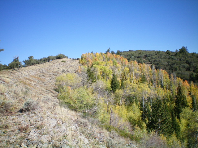
The mahogany-clad south ridge of Peak 7466 (in the distance) as viewed from midway up the west face (my ascent route). Livingston Douglas Photo
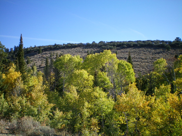
The summit of Peak 7466 is in the distance in dead center but is not visible due to the aspens. Livingston Douglas Photo
South Ridge, Class 2
The Descent
From the summit, descend the ridge in semi-open terrain southwest then south to reach Mahogany Basin and FSR-939. The ridge terrain is semi-open with easy grass/scrub and ridgeline mountain mahogany trees. Once on FSR-939, follow the rugged road back to its junction with Mill Canyon Road and your parked vehicle.
Additional Resources
Regions: Bear River Range->SOUTHERN IDAHO
Mountain Range: Bear River Range
Longitude: -111.5184 Latitude: 42.3169