Elevation: 7,924 ft
Prominence: 304
This peak is not in the book. Published January 2023
Peak 7924 is a minor hump that is nestled between Wills Canyon and Liberty Creek on the east side of Copenhagen Basin in the Bear River Range. It is most easily climbed from FSR-939 and FST-309 to its southeast. USGS Midnight Mountain
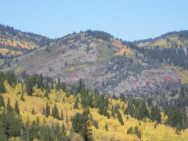
Peak 7924 (dead center) as viewed from Mill Canyon Road to its southeast. Livingston Douglas Photo
Access
From the junction of US-89 and ID-36 in Ovid, drive south on US-89 for about 0.5 miles to an unsigned junction with a gravel road heading right/west. Turn onto this road and drive 1.5 miles west to an unsigned “T” junction with Lanark Road. Turn right/north onto Lanark Road and drive 1.4 miles to a signed junction with Mill Canyon Road (mislabeled as “Mill Farm Road” on the USGS topo map). Reset your odometer here. At 3.1 miles, reach the Cache National Forest boundary. At 4.2 miles, reach a signed junction with FSR-939 in [signed] Danish Flat. Park at this junction (7,029 feet).
Map Errors
The USGS topo map shows a “pack trail” where ATV trail FST-309 actually is. And the positioning of the trail is incorrect. FST-309 actually briefly heads up Liberty Creek after crossing the creek on a good footbridge. It then switchbacks east and then turns north to cross the southeast ridge of Peak 7924. The Caribou-Targhee National Forest map also mispositions this section of FST-309.
Southeast Ridge, Class 3
The Climb
FSR-939 gets quite rough after the first ½ mile and pullouts are scarce. There is a lot of serious rock/boulders, ruts, and mudholes on this road. It is only suitable for ATV, foot, and horse travel. From the road junction, hike north then northwest up rugged FSR-939 to Mahogany Basin Spring where it becomes an ATV trail (FST-309). Follow FST-309 as it descends through a forested area to cross Liberty Creek. Follow FST-309 as it does a few switchbacks then crosses the southeast ridge of Peak 7924.
Leave the ATV trail just before it crosses the ridge and scramble north up through thick sagebrush to reach the crest of the ridge. The southeast ridge is a mess of aspens/pines, brush, willows, and blowdown. It is a difficult bushwhack. There is a short, Class 3 headwall to climb at about 7,350 feet. The final push to the top is in easy, open scrub on the left/west side of the ridge crest. The summit of Peak 7924 had a small, torn-down cairn which I rebuilt and enlarged. The summit offers nice open views of higher peaks to the west.
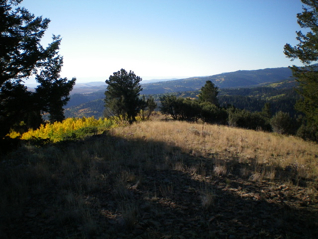
The semi-open summit of Peak 7924, looking southeast. Livingston Douglas Photo
Southeast Shoulder/South Face, Class 2
The Descent
From the summit, descend south then southeast on an open shoulder of scrub. At a steep section, drop left/east to cross a minor dry gully (a bit brushy with some willows too) to reach an open shoulder on the south face with scattered mountain mahogany. This shoulder leads down to Liberty Creek upstream and west of the FST-309. There is a magnificent cattle/use trail on this shoulder that then turns left/east to parallel the creek drainage and intercept the ATV trail at a switchback. From that turn, follow FST-309 back to the bridge crossing of Liberty Creek. This is the low point between Peak 7924 and Peak 7466. It concludes the first leg of today’s 2-peak adventure. Peak 7466 is up next.
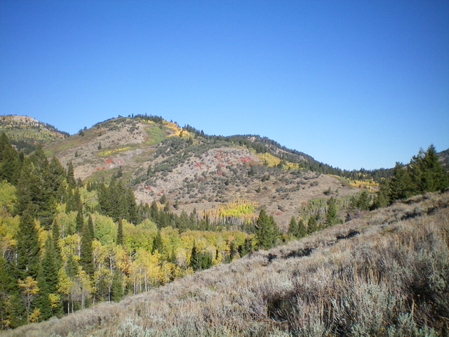
Peak 7924 is the hump left of center but not at far left. Its southeast ridge is the skyline right of center and its south face is in the center of the photo. Livingston Douglas Photo
Additional Resources
Regions: Bear River Range->SOUTHERN IDAHO
Mountain Range: Bear River Range
Longitude: -111.5364 Latitude: 42.3239