Elevation: 7,568 ft
Prominence: 878
This peak is not in the book. Published November 2023
Peak 7568 sits atop magnificent Schmid Ridge. It is one of several ranked summits on this lengthy ridge on the east side of the Slug Creek Valley. Peak 7568 is most easily climbed via its south ridge from FSR-198 at Pass 6918. USGS Dry Valley
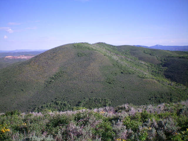
Peak 7568 as viewed from the south-southeast. The summit is in dead center, just right of a lower ridge point. Livingston Douglas Photo
Access
FSR-198 (unsigned) begins as a BLM road along Slug Creek Road/CR-1095. The unsigned junction for FSR-198 is 1.2 miles southeast of the signed junction of South Trail [Canyon] Road and Slug Creek Road. The junction with FSR-198 is at 6,370 feet and 42⁰41’48”N, 111⁰21’08”W. There is a wire cattle gate at the base of FSR-198. Park just outside the gate.
FSR-198 is drivable all the way to the pass at 6,918 feet with a 4WD vehicle, good clearance, and good tires. It is NOT just a cattle trail as Baugher indicates. This would significantly shorten and ease the climbing required to reach Peak 7568 (to the north) and Peak 7550 (to the south). This area is a mix of private and public land, so be careful. This climb is entirely on BLM land. This is the first leg of a 2-peak adventure that includes Peak 7568 and Peak 7550. It covers 6.5 miles with 1,975 feet of elevation gain.
Map Errors
The USGS topo map shows a BLM road heading northeast from Slug Creek Road to reach the critical road junction early on. In fact, that road no longer exists but a BLM road (not shown on maps) does head east from Slug Creek Road along the south edge of the BLM property line to intercept the aforementioned road junction.
West Ridge, Class 2
The Climb
From the road junction, cross the cattle gate and hike east up the steep, rutted (then rocky) 2-track road for about 0.2 miles to an unsigned junction with a weaker, overgrown 2-track road heading left/north. This northbound road is shown on maps. Go left/north onto the weaker road and follow it all the way to a crest in the road, where it crosses the west ridge of Peak 7568 at 6,904 feet (map). Leave the 2-track road here and bushwhack east then northeast up through the thick sagebrush and other brush on the ridge, using a game trail to assist.
Stay right/south of a patch of aspens and quickly reach the primary north-south ridge crest just north of the summit hump. Scramble south-southeast on the ridge crest in easy scrub to reach the open summit of Peak 7568. A game trail on the ridge will help you get there. I built a modest cairn around the piece of rebar protruding from the ground.
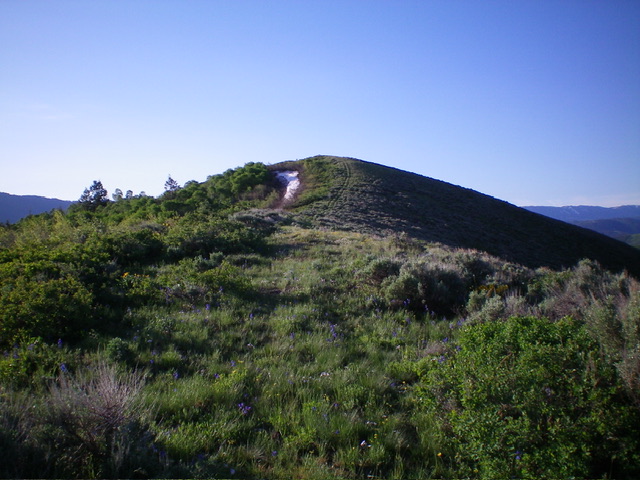
The summit hump of Peak 7568 as viewed from high on the north ridge. Livingston Douglas Photo
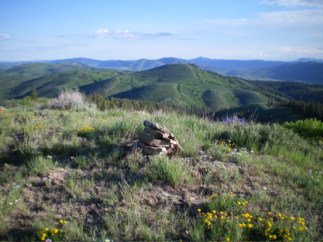
The newly-built summit cairn atop Peak 7568 with Peak 7493 in the distance. Livingston Douglas Photo
South Ridge/Southeast Spur, Class 2
The Descent
From the summit, follow the ridge south through thick sagebrush and other brush to reach a narrow saddle. Continue southward and climb 30 feet up over a ridge hump. From that hump, head south to the top of the steep south face and southeast spur. Descend the southeast spur in thick, tall brush to reach Pass 6918 and a road crossing. This concludes the first leg of today’s 2-peak journey. Peak 7550 is up next.
Additional Resources
Regions: Peale Mountains->Schmid Ridge->SOUTHERN IDAHO
Mountain Range: Peale Mountains
Longitude: -111.3321 Latitude: 42.7085