Elevation: 7,575 ft
Prominence: 555
This peak is not in the book. Published November 2022
Peak 7575 is a gentle giant that sits due west of its higher and more popular neighbor, Timbered Dome (8,356 feet). It sits at the head of both Champagne Creek to its south and Chicken Canyon to its north. Peak 7575 is most easily reached from Champagne Creek Road via its southeast ridge. This area is a mix of private and public land, so be careful. This hike is entirely on BLM land. USGS Champagne Creek
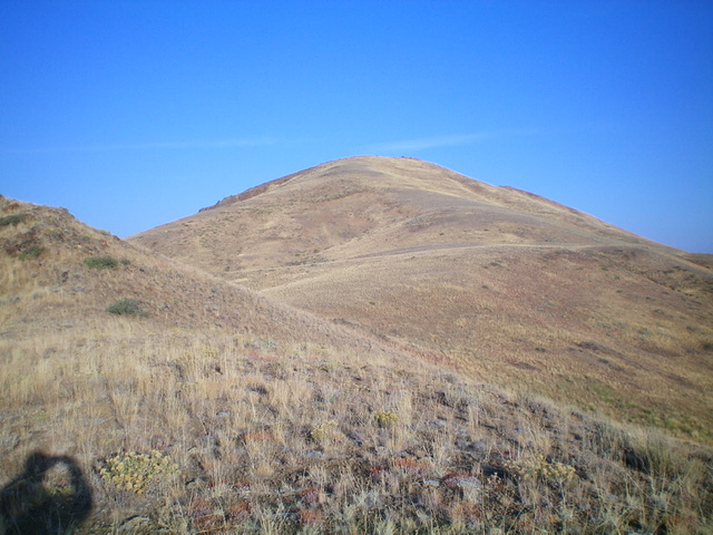
The summit hump of Peak 7575 as viewed from the southeast ridge. This was my ascent route. Livingston Douglas Photo
Access
From the junction of US-20 and US-93 in downtown Arco, drive west on US-20/US-93 for 5.1 miles to an unsigned junction with a well-graded dirt/gravel road heading diagonally right/west. This is Blizzard Mountain Road. Drive west then southwest then south on Blizzard Mountain Road for 8.7 miles to a poorly-signed junction with Champagne Creek Road (simple street sign “Champagne”). Turn right/east onto Champagne Creek Road and reset your odometer. At 3.6 miles, reach BLM land. At 4.5 miles, go right at an unsigned road junction. At 5.3 miles, reach an unsigned road junction and a large, grassy parking area. Park here (6,305 feet). GPS coordinates: 43⁰36’03”N, 113⁰34’22”W.
Southeast Ridge, Class 2
The Climb
From the parking area, hike (or drive) 0.2 miles north up a steep-ish, narrow, rocky 2-track road to reach its end on a bluff. From the bluff, follow the remnants of an old 2-track (quite overgrown and hard to follow in sections) as it drops 55 vertical feet into a dry gulch. Continue along the old 2-track north up the Champagne Creek drainage to its unceremonious end, where a cattle trail continues briefly then ends. Leave the dry gulch/drainage soon after the end of the cattle trail, just after passing a side gulch on the left.
Scramble left/west up a steep sagebrush shoulder with loose underlying dirt/gravel. This shoulder gains definition as you move higher and becomes the southeast ridge. Higher up, the slope eases and the ridge scramble is on easy, short scrub. Reach the top of a rocky ridge hump (Point 7200+). Head northwest and drop 45 feet to a minor saddle. Continue up the broad, rounded ridge to the summit of Peak 7575. The summit has a large cairn atop a rocky outcrop but a nearby boulder to the north may actually be the high point.
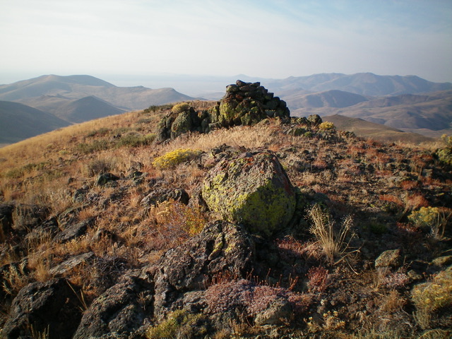
The summit boulders and large summit cairn atop Peak 7575. Livingston Douglas Photo
East Face, Class 2
The Descent
From the summit, descend northeast and skirt a ridge hump on its right/south side. Then head east in easy scrub over a minor hump (Point 7200+) to reach a major saddle at the head of the Champagne Creek drainage. This 7,020-foot saddle is the connecting saddle between Peak 7575 and Timbered Dome. It concludes the first leg of today’s 2-peak adventure. Timbered Dome (8,356 feet) is up next.
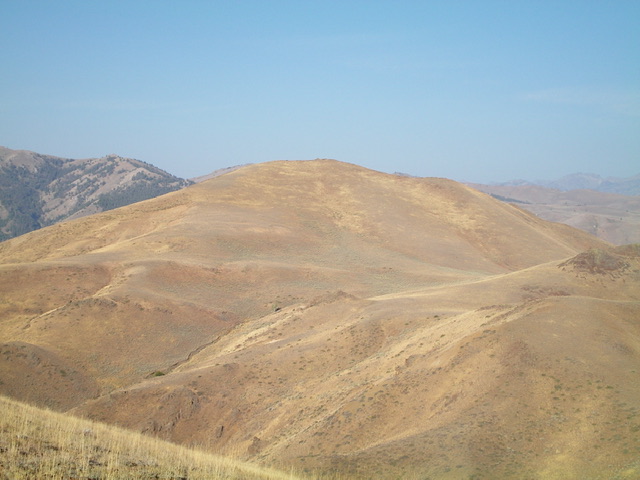
Peak 7575 (in mid-ground) as viewed from the east. Livingston Douglas Photo
Additional Resources
Regions: EASTERN IDAHO->Pioneer Mountains
Mountain Range: Pioneer Mountains
Longitude: -113.58291 Latitude: 43.61751