Elevation: 8,356 ft
Prominence: 1,376
This peak is not in the book. Livingston Douglas provides the definitive upgrade to this page. Updated November 2022
Timbered Dome is the southeasternmost named Pioneer Mountains summit. It is located west-northwest of Arco, Idaho. Timbered Dome is an icon in this area of the Pioneer Mountains. It stands out because of its height, its prominence (1,376 feet), and the pine forest that covers its summit area. The peak can be seen for miles away and is often visible from other open scrub humps in the area. Timbered Dome can be climbed from the southwest via Champagne Creek Road or from the north via Latham Hollow Road. This area is a mix of private and public land, so be careful. This climb is entirely on BLM land. USGS Champagne Creek
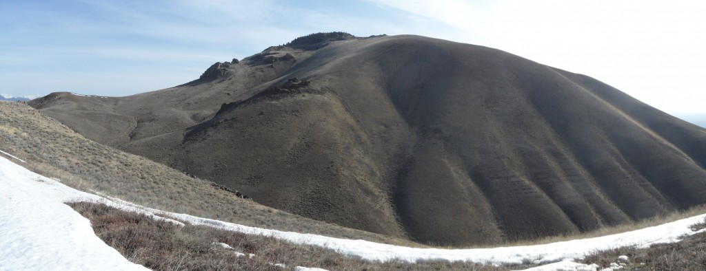
Timbered Dome as viewed from Peak 7248 to its northeast. Livingston Douglas Photo
Access
Same as for Peak 7575. This is the second leg of a 2-peak adventure that includes Peak 7575 and Timbered Dome.
West Ridge, Class 3
The Climb
From the 7,020-foot connecting saddle with Peak 7575, scramble due east up a sagebrush shoulder/face to reach a ridge saddle just north of Point 7410. From the saddle, contour south across a sagebrush face then descend southeast to a 7,140-foot saddle at the base of the west ridge of Timbered Dome. The final section of this descent is on an old 2-track road (not shown on maps). The saddle has a fence row heading east with an old 2-track road alongside it.
Follow the fence row east until just before it ends at the base of a massive rocky buttress on the west ridge. Skirt the left/west side of this buttress in open sagebrush then return to the ridge just above the buttress via a steep-ish bushwhack through more sagebrush. Once on the ridge crest, follow the open scrub on the ridge, which soon gets rockier with talus and boulders mixed in with the scrub. The ridge steepens and reaches a final steep section that is a mix of large boulders and pine forest. Scramble up through this mess (Class 3) to reach the flat summit area. Work across a section of flat boulders, scrub, and scattered pines to reach the rocky boulders that are the summit of Timbered Dome.
The summit has no obvious benchmark but does have some triangulation wreckage and wiring near the highest boulders. The highest boulder had a small cairn, so I found some loose pieces of talus to enhance its girth. Contrary to what the USGS topo map implies, there is no super-steep, forested terrain blocking access to the summit from the peak’s west side. I was pleasantly surprised to find this out. The southwest side of the summit area does have some strange, steep sections, as per the USGS topo map.
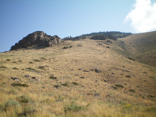
Looking up the steep west face of Timbered Dome. My ascent route is left of center (the west ridge). My descent route is right of center (the west face). Livingston Douglas Photo
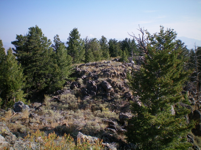
The summit area of Timbered Dome is a mix of pines and boulders. Livingston Douglas Photo
West Face/West Gully, Class 2+
The Descent
From the summit, descend southwest through a very rocky area with scattered pines. This area is Class 2+ due to cliff bands and boulders that require downclimbing. Once below the rocky summit cap, descend briefly down the open scrub of the south ridge to near a narrow, rocky ridge outcrop at 8,020 feet. Leave the south ridge here and descend northwest down a sagebrush face that is initially steep and loose (underlying scree/gravel). The slope eases and is a bit tedious but you soon reach the large, dry gully that cuts the west face of Timbered Dome. This gully sits just below, and south of, the prominent rocky buttress on the west ridge. Bushwhack west down through the somewhat thick sagebrush (and other brush) in the dry gully.
Leave the gully to contour diagonally right/northwest and cross the head of the Hammond Spring Creek drainage to reach an old 2-track road (visible from high up). This 2-track leads to a saddle (of sorts) at the head of a dry gully that drops west to the Champagne Creek drainage. Follow this dry gully west then southwest down to the Champagne Creek drainage and the old 2-track road. The gully has an old cattle trail for much of its mid and lower sections. The gully terrain is mostly easy grass/scrub without too much underlying rock. Once on the 2-track road, follow it south to the parking area at the top of Champagne Creek Road and your awaiting vehicle.
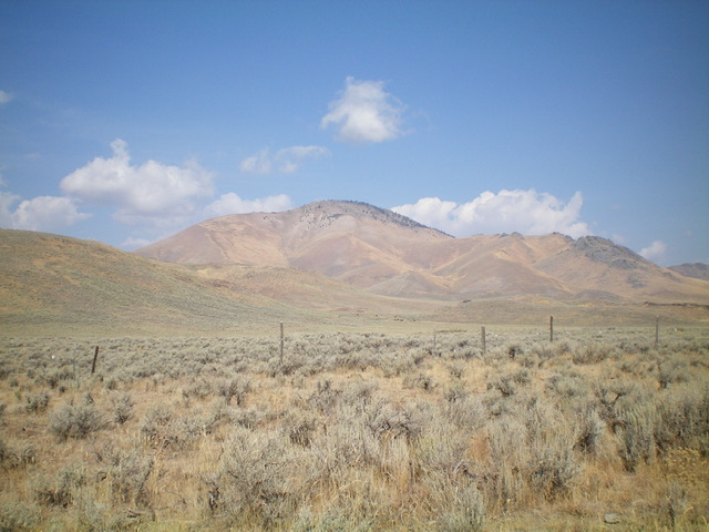
Timbered Dome (dead center) as viewed from Blizzard Mountain Road to its south. Livingston Douglas Photo
Timbered Dome. John Platt Photo
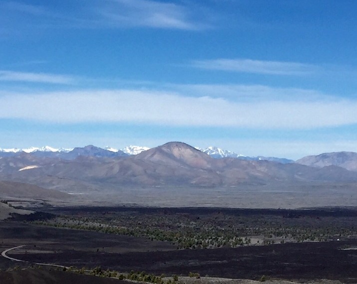
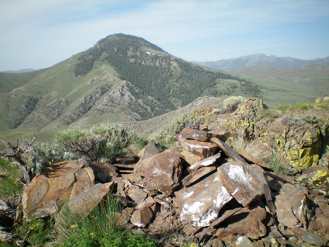
Timbered Dome as viewed from Big Cinder Butte in Craters of the Moon National Monument. The Lost River Range is in the background. Sheep Mountain (White Knob Mountains) is to its left.
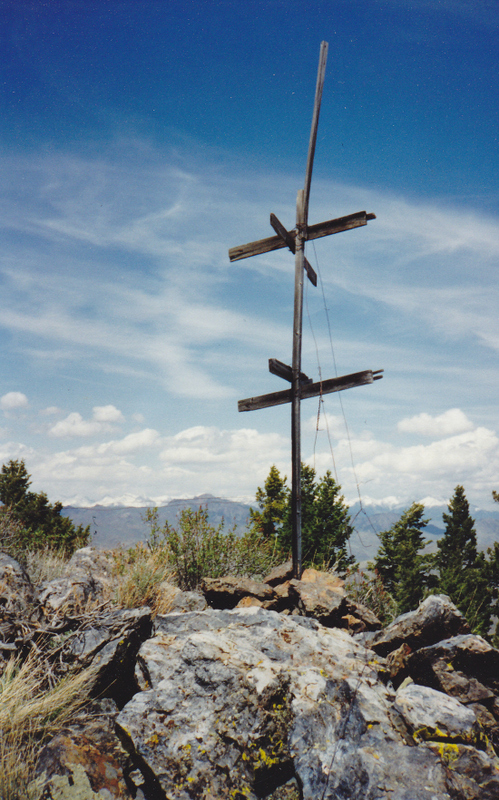
The USGS triangulation remnants atop Timbered Dome, looking north to the Lost River Range (5/22/94). Rick Baugher Photo
Additional Resources
Regions: EASTERN IDAHO->Pioneer Mountains
Mountain Range: Pioneer Mountains
Longitude: -113.54279 Latitude: 43.61349