Elevation: 7,682 ft
Prominence: 713
This peak is not in the book. Published November 2022
Peak 7682 sits above Litz Basin and separates Sugar Creek from Foster Creek. It is a mix of thick forest on its north side and open scrub on its south side. USGS Mapleton
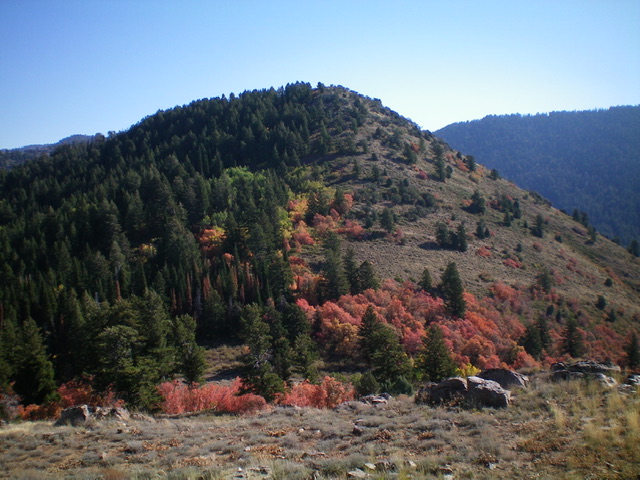
Peak 7682 as viewed from the northwest. Livingston Douglas Photo
Access
Same as for Self Help Peak. This is the final leg of a 3-peak adventure that includes Self Help Peak (6,964 feet), Peak 6990, and Peak 7682.
Map Errors
The USGS topo map shows two trails in the Litz Creek area that no longer exist. The trail junction at 6,056 feet (map) is unsigned but has flagging tape on the nearby field grass/scrub. This junction is critical and should be signed since it is the junction for FST-108 and FST-315. A wrong turn here would be catastrophic.
North Ridge, Class 2
The Climb
From the dry gully that separates Peak 6990 from Peak 7682, bushwhack through a short patch of forest to reach open grass on the right/west side of a ridge hump that is positioned north of Peak 7682. Contour diagonally upward and right (southeast) to reach a forested saddle at the base of the north ridge of Peak 7682. Skirt the left/west side of the dense forest/brush of the saddle until the open terrain runs out.
Bushwhack east up a miserable slope of dense forest, brush, and blowdown. Battle your way up to the rounded crest of the north ridge, only to find that it, too, is a mess of thick brush, blowdown, and scattered pines. Head southeast then south up the miserable ridge to reach rockier terrain above that has much less scrub to contend with. The final push to the summit is in open terrain on easy rock/scrub then short field grass. The summit of Peak 7682 is an open ridgeline on one side with dense forest on the other side. The high point has a very tall, nicely-constructed summit cairn.
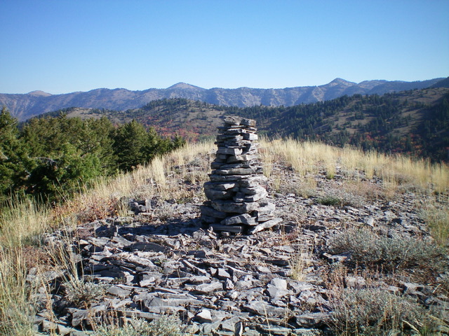
The tall cairn atop Peak 7682, looking northeast. Livingston Douglas Photo
West Ridge/Northwest Spur, Class 3
The Descent
From the summit, descend west to a saddle. Descend left/south of the forest line in open scrub. From the saddle, bushwhack through a short patch of aspens to reach open terrain. Scramble west to the open summit of Point 7350 on a combination of ground boulders and field grass. Descend west from Point 7350 and downclimb some high, hidden cliff bands (Class 3), staying left/south of the forested terrain. These cliff bands have thick brush mixed in, so they are difficult to get through. Once below the cliff bands, descend an open, grassy, rounded shoulder northwest down to a flat, rocky outcrop.
The shoulder forks at this outcrop. Go left/west-northwest and descend a steeper, more tedious mix of ground boulders, grass, and taller scrub to reach easier field grass below. Stay in open terrain (grass) and descend until it runs out and you must drop to the brushy, thickly-forested Foster Creek drainage. Find a cattle trail that descends diagonally right/northeast to make the forest bushwhack short and easy. Cross the dry drainage and quickly reach open scrub terrain. Angle diagonally right/northwest to intersect FST-315, a rather weak footpath in the field grass. Follow FST-315 west to a trail junction that is marked with flagging tape. Go hard right/north at this junction and follow FST-108 north all the way back to the Albert Moser Campground, crossing Self Help Hollow on the way. The trail is narrow and has tall, thick foliage on both sides in its final mile. It makes you very wary about bushwhacking in this area, even in open terrain.
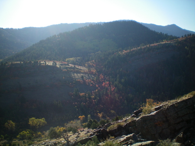
Peak 7682 (thickly forested ridge/hump in mid-ground) as viewed from Point 7350 to its west. Livingston Douglas Photo
Additional Resources
Regions: Bear River Range->SOUTHERN IDAHO
Mountain Range: Bear River Range
Longitude: -111.66239 Latitude: 42.10579